Castellgalí
Castellgalí | |
|---|---|
 | |
 Coat of arms | |
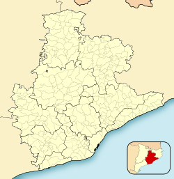 Castellgalí Location in Catalonia | |
| Coordinates: 41°40′23″N 1°50′17″E / 41.673°N 1.838°ECoordinates: 41°40′23″N 1°50′17″E / 41.673°N 1.838°E | |
| Country | |
| Community | |
| Province | Barcelona |
| Comarca | Bages |
| Government | |
| • Mayor | Cristòfol Gimeno Iglesias (2015)[1] |
| Area | |
| • Total | 17.2 km2 (6.6 sq mi) |
| Elevation | 266 m (873 ft) |
| Population (2018)[3] | |
| • Total | 2,053 |
| • Density | 120/km2 (310/sq mi) |
| Demonym(s) | Castellgalí, castellgalina |
| Website | www |


Castellgalí is a municipality in the comarca of the Bages in Catalonia, Spain. It is situated at the confluence of the Llobregat River and the Cardener River. The railway station serves both the FGC line R5 between Barcelona and Manresa and the RENFE line between Barcelona and Zaragoza.
The ruins of a Roman tomb (third century, known locally as la Torre del Breny or "The Devil's Tower") are visible.
Demography[]
| 1900 | 1930 | 1950 | 1970 | 1986 | 2007 |
|---|---|---|---|---|---|
| 775 | 1009 | 887 | 1033 | 705 | 1611 |
References[]
- ^ "Ajuntament de Castellgalí". Generalitat of Catalonia. Retrieved 2015-11-13.
- ^ "El municipi en xifres: Castellgalí". Statistical Institute of Catalonia. Retrieved 2015-11-23.
- ^ Municipal Register of Spain 2018. National Statistics Institute.
- Panareda Clopés, Josep Maria; Rios Calvet, Jaume; Rabella Vives, Josep Maria (1989). Guia de Catalunya, Barcelona: Caixa de Catalunya. ISBN 84-87135-01-3 (Spanish). ISBN 84-87135-02-1 (Catalan).
External links[]
- Official website (in Catalan)
- Government data pages (in Catalan)
| show Places adjacent to Castellgalí |
|---|
| Wikimedia Commons has media related to Castellgalí. |
| show Municipalities of Bages |
|---|
| show Municipalities in the province of Barcelona |
|---|

| Authority control |
|
|---|
This Province of Barcelona location article is a stub. You can help Wikipedia by . |
Categories:
- Municipalities in Bages
- Province of Barcelona geography stubs