Cercs
Cercs | |
|---|---|
 Pedret bridge | |
 Flag  Coat of arms | |
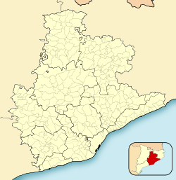 Cercs Location in Catalonia | |
| Coordinates: 42°8′53″N 1°51′43″E / 42.14806°N 1.86194°ECoordinates: 42°8′53″N 1°51′43″E / 42.14806°N 1.86194°E | |
| Country | |
| Community | |
| Province | Barcelona |
| Comarca | Berguedà |
| Government | |
| • Mayor | Jesus Calderer Palau (2015)[1] (CiU) |
| Area | |
| • Total | 47.4 km2 (18.3 sq mi) |
| Elevation | 650 m (2,130 ft) |
| Population (2018)[3] | |
| • Total | 1,152 |
| • Density | 24/km2 (63/sq mi) |
| Demonym(s) | Cercorí, cercorina |
| Website | www |


Cercs is a municipality in the comarca of Berguedà in Catalonia. It is situated on the right bank of the Llobregat river above the Baells reservoir. It is the site of an important power station which burns the lignite extracted at Fígols and Saldes. The town is served by the C-1411 road between Berga and the Cadí tunnel.
The Pre-Romanesque church of Sant Quirze de Pedret is the source of two painted conjunts, which are now displayed at the diocesan museum in Solsona and in the Museu Nacional d'Art de Catalunya in Barcelona. The remains of the monastery of Sant Salvador de la Vedella are visible on a hill now in the middle of the Baells reservoir. The Cercs Mine Museum is located in the Sant Corneli colony, in the Cercs municipal area.
Demography[]
| 1900 | 1930 | 1950 | 1970 | 1986 | 2007 |
|---|---|---|---|---|---|
| 965 | 1365 | 863 | 597 | 1827 | 1331 |
References[]
- ^ "Ajuntament de Cercs". Generalitat of Catalonia. Retrieved 2015-11-13.
- ^ "El municipi en xifres: Cercs". Statistical Institute of Catalonia. Retrieved 2015-11-23.
- ^ Municipal Register of Spain 2018. National Statistics Institute.
- Panareda Clopés, Josep Maria; Rios Calvet, Jaume; Rabella Vives, Josep Maria (1989). Guia de Catalunya, Barcelona: Caixa de Catalunya. ISBN 84-87135-01-3 (Spanish). ISBN 84-87135-02-1 (Catalan).
External links[]
- Official website (in Catalan)
- Government data pages (in Catalan)
| show Places adjacent to Cercs |
|---|
| show Municipalities in the province of Barcelona |
|---|

| show Authority control |
|---|
This Province of Barcelona location article is a stub. You can help Wikipedia by . |
- Municipalities in Berguedà
- Province of Barcelona geography stubs