Cedar, Iowa
Cedar, Iowa | |
|---|---|
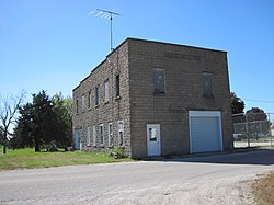 Cedar Hall | |
 Cedar, Iowa | |
| Coordinates: 41°12′44″N 92°31′33″W / 41.21222°N 92.52583°WCoordinates: 41°12′44″N 92°31′33″W / 41.21222°N 92.52583°W | |
| Country | United States |
| State | Iowa |
| County | Mahaska |
| Elevation | 814 ft (248 m) |
| Time zone | UTC-6 (Central (CST)) |
| • Summer (DST) | UTC-5 (CDT) |
| Area code(s) | 641 |
| GNIS feature ID | 455220[1] |

Cedar is an unincorporated community in southeastern Mahaska County, Iowa, United States. It lies along Iowa Highway 23 southeast of the city of Oskaloosa, the county seat of Mahaska County.[2]
Cedar has a Methodist church, Christian Reformed church, and a grain elevator.
History[]
A post office opened in 1874.[3]
The Burlington and Western Railway arrived in Cedar in late 1882. This was a narrow gauge line, widened to standard gauge in 1902 and taken over by the Chicago, Burlington and Quincy. the Burlington line was abandoned in 1934.[4]
Cedar's population was 53 in 1925.[5]
References[]
- ^ U.S. Geological Survey Geographic Names Information System: Cedar, Iowa
- ^ Rand McNally. The Road Atlas '08. Chicago: Rand McNally, 2008, p. 39.
- ^ U.S. Geological Survey Geographic Names Information System: Cedar Post Office
- ^ David Lotz and Charles Franzen, 'Rails to a County Seat', The Print Shop, Washington Iowa, 1989; pages 37, 47-52.
- ^ Company, Rand McNally and (1925). Premier Atlas of the World: Containing Maps of All Countries of the World, with the Most Recent Boundary Decisions, and Maps of All the States,territories, and Possessions of the United States with Population Figures from the Latest Official Census Reports, Also Data of Interest Concerning International and Domestic Political Questions. Rand McNally & Company. p. 190.
| show Municipalities and communities of Mahaska County, Iowa, United States |
|---|
| show Authority control |
|---|
This article about the geography of Mahaska County, Iowa is a stub. You can help Wikipedia by . |
Categories:
- Unincorporated communities in Mahaska County, Iowa
- Unincorporated communities in Iowa
- 1874 establishments in Iowa
- Populated places established in 1874
- South Iowa geography stubs