Cedar River (Gladwin County, Michigan)
| Cedar River | |
|---|---|
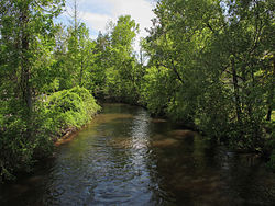 The Cedar River in Gladwin | |
| Location | |
| Country | United States |
| Physical characteristics | |
| Source | |
| • location | Hamilton Township, Clare County |
| Mouth | |
• location | Tobacco River |
• elevation | 712 ft (217 m)[1] |
| Basin features | |
| River system | Saginaw River |
The Cedar River is a 29.0-mile-long (46.7 km)[2] river in the U.S. state of Michigan, flowing through Clare County and Gladwin County.
The main branch of the river is formed by the confluence of Cranberry Creek and the West Branch Cedar River at 44°02′20″N 84°39′56″W / 44.03889°N 84.66556°W[1] in Hamilton Township, Clare County. It flows into the Tobacco River at 43°53′17″N 84°29′14″W / 43.88806°N 84.48722°W[1] in Beaverton.
 WikiMiniAtlas
The North Branch Cedar River rises at 44°08′54″N 84°30′58″W / 44.14833°N 84.51611°W[3] in northwest Gladwin County in Sherman Township east of Meredith near the border with Roscommon County, and joins the main branch at 44°01′38″N 84°34′35″W / 44.02722°N 84.57639°W[3] a few miles northwest of Wiggins Lake.
The Middle Branch Cedar River rises at 44°06′47″N 84°37′23″W / 44.11306°N 84.62306°W[4] in northeast Clare County in Franklin Township just west of Meredith. It flows mostly south and joins with the West Branch at 44°02′40″N 84°37′54″W / 44.04444°N 84.63167°W[4] in Hamilton Township, near the Gladwin County border.
The West Branch Cedar River rises at 44°06′49″N 84°39′08″W / 44.11361°N 84.65222°W[5] in Franklin Township, a few miles southwest of Meredith. Another tributary, Cranberry Creek rises in Arnold and Cranberry lakes a few miles northeast of Harrison.
The Little Cedar River is not a tributary of the Cedar River, but flows into the Tobacco River approximately 5 miles (8 km) downstream from Beaverton.[6]
Tributaries and features[]
From the mouth:
- (left) Doone Creek[7]
- (left) Farm Drain[8]
- (right) Canham Drain[9]
- (left) Lucas Drain[10]
- (left) Swan Lake (also known as Slaughterhouse Lake)[11]
- City of Gladwin
- Bendle Drain[12]
- Silver Creek[13]
- Chappel Dam[14]
- Wiggins Lake (also known as Chappel Pond)[15]
- (left) Smith Creek[19]
- (right) Lake Contos[20]
- (right) North Branch Cedar River[3]
- (right) Middle Branch Cedar River[4]
- (left) Decker Lake[37]
- (right) West Branch Cedar River[5]
- (left) Popple Creek[38]
- (left) Cranberry Creek[39]
Drainage basin[]
The Cedar River drains portions of the following:
References[]
- ^ a b c "Cedar River". Geographic Names Information System. United States Geological Survey.
- ^ U.S. Geological Survey. National Hydrography Dataset high-resolution flowline data. The National Map Archived 2012-04-05 at WebCite, accessed November 7, 2011
- ^ a b c "North Branch Cedar River". Geographic Names Information System. United States Geological Survey.
- ^ a b c "Middle Branch Cedar River". Geographic Names Information System. United States Geological Survey.
- ^ a b "West Branch Cedar River". Geographic Names Information System. United States Geological Survey.
- ^ "Little Cedar River". Geographic Names Information System. United States Geological Survey.
- ^ "Doone Creek". Geographic Names Information System. United States Geological Survey.
- ^ "Farm Drain". Geographic Names Information System. United States Geological Survey.
- ^ "Canham Drain". Geographic Names Information System. United States Geological Survey.
- ^ "Lucas Drain". Geographic Names Information System. United States Geological Survey.
- ^ "Swan Lake". Geographic Names Information System. United States Geological Survey.
- ^ "Bendle Drain". Geographic Names Information System. United States Geological Survey.
- ^ "Silver Creek". Geographic Names Information System. United States Geological Survey.
- ^ "Chappel Dam". Geographic Names Information System. United States Geological Survey.
- ^ "Wiggins Lake". Geographic Names Information System. United States Geological Survey.
- ^ "Howland Creek". Geographic Names Information System. United States Geological Survey.
- ^ "Howland Lake". Geographic Names Information System. United States Geological Survey.
- ^ "Frost Lake". Geographic Names Information System. United States Geological Survey.
- ^ "Smith Creek". Geographic Names Information System. United States Geological Survey.
- ^ "Lake Contos". Geographic Names Information System. United States Geological Survey.
- ^ "Puro Lake". Geographic Names Information System. United States Geological Survey.
- ^ "Mud Lake". Geographic Names Information System. United States Geological Survey.
- ^ "Pratt Lake". Geographic Names Information System. United States Geological Survey.
- ^ "Peach Lake". Geographic Names Information System. United States Geological Survey.
- ^ "McGilvery Lake". Geographic Names Information System. United States Geological Survey.
- ^ "Schoolhouse Lake". Geographic Names Information System. United States Geological Survey.
- ^ "Greasy Jim Lake". Geographic Names Information System. United States Geological Survey.
- ^ "Blue Lake". Geographic Names Information System. United States Geological Survey.
- ^ "Island Lake". Geographic Names Information System. United States Geological Survey.
- ^ "Streaked Lake". Geographic Names Information System. United States Geological Survey.
- ^ "Trout Lake (Gladwin County)". Geographic Names Information System. United States Geological Survey.
- ^ "House Lake". Geographic Names Information System. United States Geological Survey.
- ^ "Hoister Lake". Geographic Names Information System. United States Geological Survey.
- ^ "Lindy Lake". Geographic Names Information System. United States Geological Survey.
- ^ "Lake Little George". Geographic Names Information System. United States Geological Survey.
- ^ "Trout Lake (Clare County)". Geographic Names Information System. United States Geological Survey.
- ^ "Decker Lake". Geographic Names Information System. United States Geological Survey.
- ^ "Popple Creek". Geographic Names Information System. United States Geological Survey.
- ^ "Cranberry Creek". Geographic Names Information System. United States Geological Survey.
- ^ "Cranberry Lake". Geographic Names Information System. United States Geological Survey.
- ^ "Arnold Lake". Geographic Names Information System. United States Geological Survey.
- Rivers of Michigan
- Rivers of Gladwin County, Michigan
- Rivers of Clare County, Michigan
- Tributaries of Lake Huron