Hayes Township, Clare County, Michigan
Hayes Township, Michigan | |
|---|---|
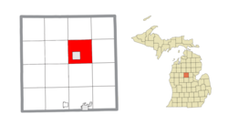 Location within Clare County | |
 Hayes Township Location within the state of Michigan | |
| Coordinates: 44°01′49″N 84°47′12″W / 44.03028°N 84.78667°WCoordinates: 44°01′49″N 84°47′12″W / 44.03028°N 84.78667°W | |
| Country | United States |
| State | Michigan |
| County | Clare |
| Established | 1877 |
| Government | |
| • Supervisor | Terry Acton |
| Area | |
| • Total | 32.2 sq mi (83.3 km2) |
| • Land | 31.3 sq mi (81.0 km2) |
| • Water | 0.9 sq mi (2.3 km2) |
| Elevation | 1,152 ft (351 m) |
| Population (2010) | |
| • Total | 4,675 |
| • Density | 149/sq mi (57.7/km2) |
| Time zone | UTC-5 (Eastern (EST)) |
| • Summer (DST) | UTC-4 (EDT) |
| ZIP code(s) | 48625 (Harrison) |
| Area code(s) | 989 |
| FIPS code | 26-37340[1] |
| GNIS feature ID | 1626454[2] |
| Website | Official website |


Hayes Township is a civil township of Clare County in the U.S. state of Michigan. The population was 4,642 at the 2020 census.
Communities[]
- Airport Forest is an unincorporated housing development east of Clare County Airport in the northwest part of the township at 44°03′23″N 84°48′06″W / 44.05639°N 84.80167°W[3]
- Allendale is an unincorporated housing development next to the southeast corner of Harrison at 44°00′19″N 84°47′05″W / 44.00528°N 84.78472°W[4]
- Ash Acres is an unincorporated housing development just north of Harrison at 44°02′16″N 84°48′43″W / 44.03778°N 84.81194°W[5]
- Piney Woods is an unincorporated housing development near the northern boundary of the township at 44°04′24″N 84°48′30″W / 44.07333°N 84.80833°W[6]
- The city of Harrison is within the township, but is administratively autonomous. The Harrison ZIP code 48625 serves all of Hayes Township.[7]
| subdiv. code | subdiv. Name | year platted | Area |
|---|---|---|---|
| 100 | Airport Forest | 1945 | Oak Flats |
| 105 | Airport Forest #1 | 1946 | Piney Woods |
| 110 | Airport Forest #2 | 1946 | Piney Woods |
| 115 | Allendale | 1951 | Allendale |
| 120 | Allendale 1st Addition | 1954 | Allendale |
| 125 | Allendale 2nd Addition | 1957 | Allendale |
| 126 | Allendale 3rd Addition | 1979 | Allendale |
| 130 | Amy the Pines #2 | 1971 | Piney Woods |
| 135 | Amy's Pine-De-Rosa | 1968 | Airport Area |
| 140 | Amy's Pine-De-Rosa #2 | 1970 | Airport Area |
| 145 | Ash Acres | 1953 | Ash Acres |
| 150 | Ash Acres #2 | 1956 | Ash Acres |
| 155 | Ash Acres #3 | 1958 | Ash Acres |
| 160 | Ash Acres #4 | 1961 | Ash Acres |
| 165 | Ash Acres #5 | 1966 | Ash Acres |
| 170 | Ash Acres #6 | 1967 | Ash Acres |
| 175 | Ash Acres #7 | 1968 | Ash Acres |
| 180 | Campbell's | 1948 | Budd Lake |
| 182 | Cedar Shores Campground | 1974 | Dodge Lake |
| 185 | Clinton P Bailey | 1958 | Business-127 |
| 190 | Cranberry Heights | 1964 | Cranberry Lake South |
| 195 | Cranberry Hills #1 | 1967 | Cranberry Hills |
| 200 | Cranberry Hills #2 | 1967 | Cranberry Hills |
| 202 | Cranberry Hills #3 | 1973 | Cranberry Hills |
| 205 | Cranberry Lake | 1946 | Cranberry Lake South |
| 210 | Cranberry Lake #1 | 1961 | Cranberry Lake North |
| 215 | Cranberry Lake #2 | 1962 | Cranberry Lake North |
| 220 | Dancers | 1965 | Grant |
| 221 | Dancers #2 | 1973 | Grant |
| 223 | Deer Lake Estates | 1973 | Deer Lake |
| 225 | EZ Acres | 1961 | West |
| 230 | EZ Acres #2 | 1965 | West |
| 235 | EZ Acres #3 | 1967 | West |
| 240 | Echo Estates | 1970 | County Farm |
| 245 | Forest Edge | 1971 | Piney Woods |
| 246 | Forest Edge #2 | 1978 | Piney Woods |
| 250 | God's Little Acre | 1969 | Townline |
| 255 | God's Little Acre #2 | 1970 | Townline |
| 260 | God's Little Acre #3 | 1970 | Townline |
| 265 | Hampton Woods | 1954 | Ash Acres |
| 270 | Handy Forest | 1953 | Oak Flats |
| 275 | Harrison Woods | 1954 | Harrison Woods |
| 277 | Harrison Industrial Park | 1977 | Business-127 |
| 280 | Hayes Acres | 1951 | South |
| 282 | Hayes No. 1 | 1975 | Budd Lake |
| 290 | Jar Mar #1 | 1967 | Arnold Lake |
| 285 | Hughes South Shore | 1970 | Arnold Lake |
| 295 | Jay Mar #2 | 1967 | Arnold Lake |
| 300 | Jay Mar #3 | 1967 | Arnold Lake |
| 305 | Jay Woods | 1956 | Arnold Lake |
| 310 | Koch's | 1962 | Arnold Lake |
| 315 | Keneva Hills | 1962 | Cranberry Lake South |
| 320 | Lakepoint | 1969 | Woodstock/Lakepoint |
| 325 | Little Long Lake #1 | 1954 | Little Long Lake |
| 330 | Little Long Lake #2 | 1961 | Grant |
| 335 | Little Long Lake #3 | 1965 | Sutherland Lake |
| 340 | Little Long Lake #4 | 1967 | Grant |
| 345 | Little Long Lake #5 | 1968 | Grant |
| 350 | Mobile Home Village | 1965 | Airport Area |
| 352 | Mobile Home Village #2 | 1973 | Airport Area |
| 355 | Northland Acres | 1953 | Cranberry Hills |
| 360 | Northland Acres 1st Addition | 1959 | Cranberry Hills |
| 365 | Northwood Hills | 1947 | Piney Woods |
| 370 | Oak Beach | 1964 | Cranberry Lake South |
| 375 | Oak Flats | 1959 | Oak Flats |
| 380 | Oak Flats #1 | 1964 | Oak Flats |
| 385 | Oak Flats #2 | 1966 | Oak Flats |
| 390 | Oak Leaf | 1961 | Ash Acres |
| 395 | Oak Leaf #1 | 1963 | Ash Acres |
| 400 | Oak Park | 1955 | Oak Flats |
| 405 | Oak Park #2 | 1956 | Oak Flats |
| 410 | Oak Park #3 | 1965 | Oak Flats |
| 415 | Oak Park #4 | 1966 | Oak Flats |
| 418 | Oak Ridge Resort #1 | unknown | Oak Ridge |
| 419 | Oak Ridge Resort #2 | unknown | Oak Ridge |
| 420 | Oak Shores | 1962 | Cranberry Lake South |
| 425 | Open Range Resort | 1937 | Open Range Resort |
| 430 | Open Range Resort 1st Addition | 1940 | Open Range Resort |
| 435 | Park-View | 1957 | Ash Acres |
| 440 | Pine Manor Estates | 1967 | Piney Woods |
| 445 | Pine Manor Estates #2 | 1968 | Piney Woods |
| 450 | Pine Manor Estates #3 | 1972 | Piney Woods |
| 455 | Scenic Hill | 1966 | Townline |
| 460 | SE 1/4 or the SE 1/4, Section 5 | 1946 | Piney Woods |
| 465 | Sutherland Lake | 1952 | Sutherland Lake |
| 470 | Sutherland Lake 1st Addition | 1954 | Sutherland Lake |
| 472 | Timber Lane Trails | 1976 | Timberland |
| 475 | Townline Wilds #2 | 1954 | Dodge Lake |
| 477 | Trowbridge Oaks | 1995 | West |
| 480 | Unspoiled Little Long Lake | 1940 | Little Long Lake |
| 485 | Wild Life Park | 1952 | Sutherland Lake |
| 490 | Wild Life Park 1st Addition | 1956 | Sutherland Lake |
| 495 | Woodshaw Estates | 1971 | Arnold Lake |
| 500 | Woodstock | 1965 | Woodstock/Lakepoint |
| 505 | Woodstock #2 | 1967 | Woodstock/Lakepoint |
Geography[]
Hayes Township is located northeast of the center of Clare County and surrounds the city of Harrison, the county seat. U.S. Highway 127 crosses the township from north to south, with access from Exits 176 and 170.
According to the United States Census Bureau, the township has a total area of 32.2 square miles (83.3 km2), of which 31.3 square miles (81.0 km2) is land and 0.89 square miles (2.3 km2), or 2.75%, is water.[8]
Demographics[]
As of the census[1] of 2000, there were 4,916 people, 2,014 households, and 1,391 families residing in the township. The population density was 156.3 per square mile (60.4/km2). There were 3,898 housing units at an average density of 123.9 per square mile (47.9/km2). The racial makeup of the township was 97.36% White, 0.12% African American, 0.79% Native American, 0.18% Asian, 0.02% Pacific Islander, 0.53% from other races, and 1.00% from two or more races. Hispanic or Latino of any race were 1.40% of the population.
There were 2,014 households, out of which 28.7% had children under the age of 18 living with them, 53.7% were married couples living together, 10.9% had a female householder with no husband present, and 30.9% were non-families. 25.4% of all households were made up of individuals, and 11.0% had someone living alone who was 65 years of age or older. The average household size was 2.44 and the average family size was 2.87.
In the township the population was spread out, with 25.5% under the age of 18, 6.2% from 18 to 24, 25.8% from 25 to 44, 26.1% from 45 to 64, and 16.3% who were 65 years of age or older. The median age was 39 years. For every 100 females, there were 99.3 males. For every 100 females age 18 and over, there were 97.5 males.
The median income for a household in the township was $26,495, and the median income for a family was $31,343. Males had a median income of $29,755 versus $20,698 for females. The per capita income for the township was $14,394. About 16.7% of families and 20.3% of the population were below the poverty line, including 29.1% of those under age 18 and 10.4% of those age 65 or over.
References[]
- ^ a b "U.S. Census website". United States Census Bureau. Retrieved 2008-01-31.
- ^ U.S. Geological Survey Geographic Names Information System: Hayes Township, Clare County, Michigan
- ^ U.S. Geological Survey Geographic Names Information System: Airport Forest, Michigan
- ^ U.S. Geological Survey Geographic Names Information System: Allendale, Michigan
- ^ U.S. Geological Survey Geographic Names Information System: Ash Acres, Michigan
- ^ U.S. Geological Survey Geographic Names Information System: Piney Woods, Michigan
- ^ 48625 5-Digit ZCTA, 486 3-Digit ZCTA - Reference Map - American FactFinder[permanent dead link], U.S. Census Bureau, 2000 census
- ^ "Geographic Identifiers: 2010 Demographic Profile Data (G001): Hayes township, Clare County, Michigan". U.S. Census Bureau, American Factfinder. Archived from the original on February 12, 2020. Retrieved September 29, 2014.
External links[]
Municipalities and communities of Clare County, Michigan, United States | ||
|---|---|---|
| Cities |  | |
| Village | ||
| Civil townships | ||
| Unincorporated communities | ||
| Footnotes | ‡This populated place also has portions in an adjacent county or counties | |
| ||
- Townships in Clare County, Michigan
- Townships in Michigan