Sheridan Township, Clare County, Michigan
Sheridan Township, Michigan | |
|---|---|
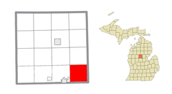 Location within Clare County | |
 Sheridan Township Location within the state of Michigan | |
| Coordinates: 43°51′44″N 84°39′50″W / 43.86222°N 84.66389°WCoordinates: 43°51′44″N 84°39′50″W / 43.86222°N 84.66389°W | |
| Country | United States |
| State | Michigan |
| County | Clare |
| Government | |
| • Supervisor | William Strouse |
| Area | |
| • Total | 36.5 sq mi (94.5 km2) |
| • Land | 36.1 sq mi (93.6 km2) |
| • Water | 0.3 sq mi (0.9 km2) |
| Elevation | 791 ft (241 m) |
| Population (2010) | |
| • Total | 1,575 |
| • Density | 44/sq mi (16.8/km2) |
| Time zone | UTC-5 (Eastern (EST)) |
| • Summer (DST) | UTC-4 (EDT) |
| ZIP code(s) | 48617 (Clare) |
| Area code(s) | 989 |
| FIPS code | 26-73000[1] |
| GNIS feature ID | 1627065[2] |


Sheridan Township is a civil township of Clare County in the U.S. state of Michigan. The population was 1,575 at the 2010 census.[3]
Communities[]
- Colonville is a mostly historical settlement in the township at 43°50′39″N 84°42′21″W / 43.84417°N 84.70583°W.[4] Storekeeper Curtis Palmer was the first postmaster of a rural post office here, which operated from December 4, 1894, until January 15, 1904.[5]
- The city of Beaverton is to the east in Gladwin County, and the Beaverton ZIP code 48612 serves the northeast corner of Sheridan Township.[6]
- The city of Clare is to the southwest, and the Clare ZIP code 48617 serves most of Sheridan Township.[7]
Geography[]
Sheridan Township occupies the southeastern corner of Clare County and is bordered to the east by Gladwin County and to the south by Isabella County. According to the United States Census Bureau, the township has a total area of 36.5 square miles (94.5 km2), of which 36.1 square miles (93.6 km2) is land and 0.35 square miles (0.9 km2), or 0.95%, is water.[3] The South Branch of the Tobacco River flows from west to east across the southern part of the township.
Demographics[]
As of the census[1] of 2000, there were 1,588 people, 482 households, and 382 families residing in the township. The population density was 43.7 per square mile (16.9/km2). There were 569 housing units at an average density of 15.7 per square mile (6.0/km2). The racial makeup of the township was 97.61% White, 0.57% African American, 0.76% Native American, 0.06% Asian, 0.06% from other races, and 0.94% from two or more races. Hispanic or Latino of any race were 0.88% of the population.
There were 482 households, out of which 45.2% had children under the age of 18 living with them, 66.0% were married couples living together, 8.7% had a female householder with no husband present, and 20.7% were non-families. 16.8% of all households were made up of individuals, and 6.8% had someone living alone who was 65 years of age or older. The average household size was 3.28 and the average family size was 3.72.
In the township the population was spread out, with 37.0% under the age of 18, 9.3% from 18 to 24, 28.4% from 25 to 44, 17.5% from 45 to 64, and 7.8% who were 65 years of age or older. The median age was 29 years. For every 100 females, there were 94.6 males. For every 100 females age 18 and over, there were 95.3 males.
The median income for a household in the township was $32,069, and the median income for a family was $34,107. Males had a median income of $28,300 versus $22,841 for females. The per capita income for the township was $12,163. About 17.9% of families and 22.2% of the population were below the poverty line, including 31.7% of those under age 18 and 24.6% of those age 65 or over.
References[]
- ^ a b "U.S. Census website". United States Census Bureau. Retrieved 2008-01-31.
- ^ U.S. Geological Survey Geographic Names Information System: Sheridan Township, Clare County, Michigan
- ^ a b "Geographic Identifiers: 2010 Demographic Profile Data (G001): Sheridan township, Clare County, Michigan". U.S. Census Bureau, American Factfinder. Archived from the original on February 12, 2020. Retrieved September 30, 2014.
- ^ U.S. Geological Survey Geographic Names Information System: Colonville, Michigan
- ^ Romig, Walter (1986) [1973]. Michigan Place Names. Detroit, Michigan: Wayne State University Press. ISBN 0-8143-1838-X.
- ^ 48612 5-Digit ZCTA, 486 3-Digit ZCTA - Reference Map - American FactFinder[permanent dead link], U.S. Census Bureau, 2000 census
- ^ 48617 5-Digit ZCTA, 486 3-Digit ZCTA - Reference Map - American FactFinder[permanent dead link], U.S. Census Bureau, 2000 census
Municipalities and communities of Clare County, Michigan, United States | ||
|---|---|---|
| Cities |  | |
| Village | ||
| Civil townships | ||
| Unincorporated communities | ||
| Footnotes | ‡This populated place also has portions in an adjacent county or counties | |
| ||
- Townships in Clare County, Michigan
- Townships in Michigan