Cena Parish
Cena Parish | |
|---|---|
parish of Latvia | |
 Coat of arms | |
 | |
| Country | Latvia |
| Area | |
| • Total | 121.34 km2 (46.85 sq mi) |
| • Land | 114.43 km2 (44.18 sq mi) |
| • Water | 6.91 km2 (2.67 sq mi) |
| Population (1 January 2021)[2] | |
| • Total | 4,347 |
| • Density | 36/km2 (93/sq mi) |

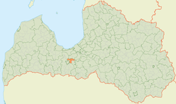
Cena Parish is an administrative unit of Jelgava Municipality[3] in the Semigallia region of Latvia. From 2009 until 2021, it was part of the former Ozolnieki Municipality.[4][5][6][7]
References[]
- ^ https://data.stat.gov.lv/pxweb/lv/OSP_PUB/START__ENV__DR__DRT/DRT010/; Central Statistical Bureau of Latvia; retrieved: 26 February 2021.
- ^ https://data.stat.gov.lv/pxweb/lv/OSP_PUB/START__POP__IR__IRS/IRD060/; Central Statistical Bureau of Latvia; retrieved: 15 June 2021.
- ^ [1] Law on Administrative Territories and Populated Areas
- ^ "Administratīvo teritoriju un apdzīvoto vietu likums" (in Latvian). likumi.lv. 2008-12-18. Retrieved 2010-01-05.
- ^ "Administratīvo teritoriju un apdzīvoto vietu likums" (in Latvian). nais.lv. 2008-12-18. Archived from the original on 2015-11-17. Retrieved 2015-09-10.
- ^ "Grozījumi Administratīvo teritoriju un apdzīvoto vietu likumā". LIKUMI.LV (in Latvian). Retrieved 2019-02-17.
- ^ "2011 Census Results" (PDF). Archived from the original (PDF) on 2016-11-14. Retrieved 2017-08-02.
Coordinates: 56°41′59″N 23°51′17″E / 56.69972°N 23.85472°E
This Semigallia location article is a stub. You can help Wikipedia by . |
Categories:
- Parishes of Latvia
- Jelgava Municipality
- Semigallia
- Zemgale geography stubs