Center Township, Starke County, Indiana
Center Township | |
|---|---|
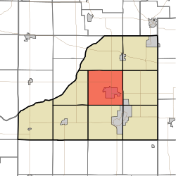 Location in Starke County | |
| Coordinates: 41°18′11��N 86°38′20″W / 41.30306°N 86.63889°WCoordinates: 41°18′11″N 86°38′20″W / 41.30306°N 86.63889°W | |
| Country | |
| State | |
| County | Starke |
| Government | |
| • Type | Indiana township |
| Area | |
| • Total | 36.34 sq mi (94.1 km2) |
| • Land | 36.34 sq mi (94.1 km2) |
| • Water | 0 sq mi (0 km2) 0% |
| Elevation | 696 ft (212 m) |
| Population (2010) | |
| • Total | 6,229 |
| • Density | 171.4/sq mi (66.2/km2) |
| Time zone | UTC-6 (Central (CST)) |
| • Summer (DST) | UTC-5 (CDT) |
| ZIP code | 46534 |
| Area code(s) | 574 |
| GNIS feature ID | 453193 |

Center Township is one of nine townships in Starke County, in the U.S. state of Indiana.[2] As of the 2010 census, its population was 6,229 and it contained 2,650 housing units.[3]
Geography[]
According to the 2010 census, the township has a total area of 36.34 square miles (94.1 km2), all land.[3]
Cities, towns, villages[]
- Knox (the county seat)
Unincorporated towns[]
- Brems at 41°20′21″N 86°41′51″W / 41.339208°N 86.697517°W
- Indian Hill at 41°19′31″N 86°41′00″W / 41.32532°N 86.68335°W
- Toto at 41°15′34″N 86°41′53″W / 41.259485°N 86.698071°W
(This list is based on USGS data and may include former settlements.)
Adjacent townships[]
- Davis Township (north)
- Oregon Township (northeast)
- Washington Township (east)
- North Bend Township (southeast)
- California Township (south)
- Wayne Township (southwest)
- Jackson Township (west)
Cemeteries[]
The township contains these three cemeteries: Crown Hill, Oak Grove and Oak Park.
Major highways[]
 US 35
US 35 SR 8
SR 8
Airports and landing strips[]
- Starke County Airport
- Wilson Airport
Landmarks[]
- Wythougan Park
School districts[]
- Knox Community School Corporation
Political districts[]
- Indiana's 2nd congressional district
- State House District 17
- State Senate District 5
References[]
- United States Census Bureau 2008 TIGER/Line Shapefiles
- United States Board on Geographic Names (GNIS)
- IndianaMap
- ^ "US Board on Geographic Names". United States Geological Survey. October 25, 2007. Retrieved 2017-05-09.
- ^ "Center Township". Geographic Names Information System. United States Geological Survey. Retrieved 2009-07-05.
- ^ a b "Population, Housing Units, Area, and Density: 2010 - County -- County Subdivision and Place -- 2010 Census Summary File 1". United States Census. Archived from the original on 2020-02-12. Retrieved 2013-05-10.
External links[]
Places adjacent to Center Township, Starke County, Indiana | |
|---|---|
Municipalities and communities of Starke County, Indiana, United States | ||
|---|---|---|
| City | ||
| Towns | ||
| Townships | ||
| CDPs | ||
| Other unincorporated communities | ||
| Footnotes | ‡This populated place also has portions in an adjacent county or counties | |
| ||
Categories:
- Townships in Starke County, Indiana
- Townships in Indiana