Central Greece (region)
Central Greece
Περιφέρεια Στερεάς Ελλάδας | |
|---|---|
 | |
| Coordinates: 38°42′N 22°42′E / 38.7°N 22.7°ECoordinates: 38°42′N 22°42′E / 38.7°N 22.7°E | |
| Country | |
| Decentralized Administration | Thessaly and Central Greece |
| Capital | Lamia |
| Largest city | Chalcis |
| Regional units | |
| Government | |
| • Regional governor | (New Democracy) |
| Area | |
| • Total | 15,549.31 km2 (6,003.62 sq mi) |
| Population (2011)[1] | |
| • Total | 547,390 |
| • Density | 35/km2 (91/sq mi) |
| Time zone | UTC+2 (EET) |
| • Summer (DST) | UTC+3 (EEST) |
| ISO 3166 code | GR-H |
| HDI (2019) | 0.848[2] very high · 10th |
| Website | www |

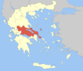
Central Greece (Greek: Περιφέρεια Στερεάς Ελλάδας, romanized: Periféria Stereás Elládhas, Greek pronunciation: [periˈferia stereˈas eˈlaðas], colloquially known as Ρούμελη (Roúmeli)) is one of the thirteen administrative regions of Greece. The region occupies the eastern half of the traditional region of Central Greece, including the island of Euboea. To the south it borders the regions of Attica and the Peloponnese, to the west the region of West Greece and to the north the regions of Thessaly and Epirus. Its capital city is Lamia.
Administration[]
The region was established in the 1987 administrative reform. With the 2010 Kallikratis plan, its powers and authority were redefined and extended. Along with Thessaly, it is supervised by the Decentralized Administration of Thessaly and Central Greece based at Larissa. The region is based at Lamia and is divided into five regional units (pre-Kallikratis prefectures), Boeotia, Euboea, Evrytania, Phocis and Phthiotis, which are further subdivided into 25 municipalities.[3]
Economy[]
The Gross domestic product (GDP) of the province was 8.8 billion € in 2018, accounting for 4.7% of the Greek economic output. GDP per capita adjusted for purchasing power was 18,900 € or 63% of the EU27 average in the same year. The GDP per employee was 81% of the EU average. Central Greece is the region in Greece with the fourth highest GDP per capita.[4]
Towns[]
Biggest towns in each regional unit, according to the census of 2001 (only communities with population more than 2,000 recorded):
| Regional unit | Capital | Area (km²) | Population | |
|---|---|---|---|---|
| Boeotia | Livadeia | 2,952 | 117,920 | |
| 1 | Thebes | 22,883 | ||
| 2 | Livadeia | 22,193 | ||
| 3 | Schimatari | 7,173 | ||
| 4 | Orchomenos | 5,238 | ||
| 5 | Oinofyta | 4,903 | ||
| 6 | Aliartos | 4,847 | ||
| 7 | Vagia | 3,248 | ||
| 8 | Distomo | 3,192 | ||
| 9 | Arachova | 2,770 | ||
| 10 | Kyriaki | 2,298 | ||
| Euboea | Chalcis | 4,167 | 210,815 | |
| 1 | Chalcis | 59,125 | ||
| 2 | Nea Artaki | 9,489 | ||
| 3 | Vasiliko | 6,571 | ||
| 4 | Eretria | 6,330 | ||
| 5 | Psachna | 6,050 | ||
| 6 | Drosia | 5,950 | ||
| 7 | Istiaia | 5,522 | ||
| 8 | Aliveri | 5,249 | ||
| 9 | Karystos | 5,121 | ||
| 10 | Loutra Aidipsou | 4,519 | ||
| 11 | Vathy | 4,098 | ||
| 12 | Amarynthos | 3,672 | ||
| 13 | Agios Nikolaos | 3,426 | ||
| 14 | Paralia Avlidas | 3,115 | ||
| 15 | Kymi | 2,870 | ||
| 16 | Nea Lampsakos | 2,196 | ||
| 17 | Limni | 2,046 | ||
| 18 | Gymno | 2,033 | ||
| Evrytania | Karpenisi | 1,869 | 20,081 | |
| 1 | Karpenisi | 7,348 | ||
| Phocis | Amfissa | 2,120 | 40,343 | |
| 1 | Amfissa | 6,919 | ||
| 2 | Itea | 4,362 | ||
| 3 | Galaxidi | 2,011 | ||
| Phthiotis | Lamia | 4,441 | 158,231 | |
| 1 | Lamia | 52,006 | ||
| 2 | Atalanti | 5,199 | ||
| 3 | Stylida | 5,011 | ||
| 4 | Malesina | 4,427 | ||
| 5 | Roditsa | 3,509 | ||
| 6 | Amfikleia | 3,191 | ||
| 7 | Agios Konstantinos | 2,886 | ||
| 8 | Kamena Vourla | 2,796 | ||
| 9 | Spercheiada | 2,691 | ||
| 10 | Livanates | 2,559 | ||
| 11 | Stavros | 2,489 | ||
| 12 | Elateia | 2,372 | ||
| 13 | Makrakomi | 2,245 | ||
| Total | Central Greece | Lamia | 15,549 | 547,390[5] |
References[]
- ^ "Demographic and social characteristics of the Resident Population of Greece according to the 2011 Population - Housing Census revision of 20/3/2014" (PDF). Hellenic Statistical Authority. 12 September 2014. Archived from the original (PDF) on 8 September 2015. Retrieved 3 April 2015.
- ^ "Sub-national HDI - Area Database - Global Data Lab". hdi.globaldatalab.org. Retrieved 2021-07-20.
- ^ "ΦΕΚ A 87/2010, Kallikratis reform law text" (in Greek). Government Gazette.
- ^ "Regional GDP per capita ranged from 30% to 263% of the EU average in 2018". Eurostat.
- ^ 2011 census
External links[]
| Wikimedia Commons has media related to Central Greece. |
- Official website
 (in Greek)
| show Administrative division of the Central Greece Region |
|---|
| Authority control |
|---|
- 1987 establishments in Greece
- Central Greece
- NUTS 2 statistical regions of the European Union
- States and territories established in 1987
- Administrative regions of Greece