Cestayrols
Cestayrols | |
|---|---|
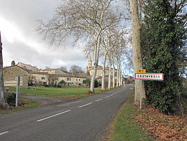 The road into Cestayrols | |
 Coat of arms | |
show Location of Cestayrols | |
 Cestayrols | |
| Coordinates: 43°58′52″N 1°59′07″E / 43.9811°N 1.9853°ECoordinates: 43°58′52″N 1°59′07″E / 43.9811°N 1.9853°E | |
| Country | France |
| Region | Occitanie |
| Department | Tarn |
| Arrondissement | Albi |
| Canton | Les Deux Rives |
| Intercommunality | CA Gaillac-Graulhet |
| Area 1 | 17.03 km2 (6.58 sq mi) |
| Population (Jan. 2018)[1] | 468 |
| • Density | 27/km2 (71/sq mi) |
| Time zone | UTC+01:00 (CET) |
| • Summer (DST) | UTC+02:00 (CEST) |
| INSEE/Postal code | 81067 /81150 |
| Elevation | 188–282 m (617–925 ft) (avg. 240 m or 790 ft) |
| 1 French Land Register data, which excludes lakes, ponds, glaciers > 1 km2 (0.386 sq mi or 247 acres) and river estuaries. | |


Cestayrols is a commune in the Tarn department in southern France.
Geography[]
The Vère flows southwestward through the northern part of the commune.
See also[]
- Communes of the Tarn department
References[]
- ^ "Populations légales 2018". INSEE. 28 December 2020.
| Wikimedia Commons has media related to Cestayrols. |
This Tarn geographical article is a stub. You can help Wikipedia by . |
Categories:
- Communes of Tarn (department)
- Tarn (department) geography stubs