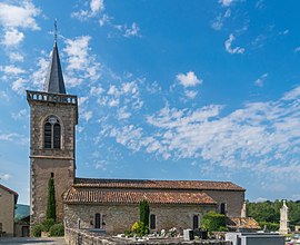
Milhars
Milhars | |
|---|---|
 | |
 Coat of arms | |
show Location of Milhars | |
 Milhars | |
| Coordinates: 44°07′41″N 1°52′48″E / 44.1281°N 1.88°ECoordinates: 44°07′41″N 1°52′48″E / 44.1281°N 1.88°E | |
| Country | France |
| Region | Occitanie |
| Department | Tarn |
| Arrondissement | Albi |
| Canton | Carmaux-2 Vallée du Cérou |
| Area 1 | 16.28 km2 (6.29 sq mi) |
| Population (Jan. 2018)[1] | 244 |
| • Density | 15/km2 (39/sq mi) |
| Time zone | UTC+01:00 (CET) |
| • Summer (DST) | UTC+02:00 (CEST) |
| INSEE/Postal code | 81165 /81170 |
| Elevation | 130–461 m (427–1,512 ft) (avg. 140 m or 460 ft) |
| 1 French Land Register data, which excludes lakes, ponds, glaciers > 1 km2 (0.386 sq mi or 247 acres) and river estuaries. | |


Milhars is a commune in the Tarn department in southern France.
Geography[]
The Cérou river flows into the Aveyron River in the commune, 1.4 km north to the village itself.
See also[]
- Communes of the Tarn department
References[]
- ^ "Populations légales 2018". INSEE. 28 December 2020.
| Wikimedia Commons has media related to Milhars. |
This Tarn geographical article is a stub. You can help Wikipedia by . |
Categories:
- Communes of Tarn (department)
- Tarn (department) geography stubs