Chalatenango, Chalatenango
This article does not cite any sources. (November 2011) |
Chalatenango | |
|---|---|
Municipality | |
 | |
 Flag  Coat of arms | |
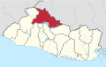
 Chalatenango Location in El Salvador | |
| Coordinates: 14°02′21″N 88°56′29″W / 14.03917°N 88.94139°W | |
| Country | |
| Department | Chalatenango Department |
| Area | |
| • Municipality | 131.5 km2 (50.8 sq mi) |
| Elevation | 396 m (1,299 ft) |
| Population (2012) | |
| • Municipality | 21,102 |
| • Density | 160/km2 (420/sq mi) |
| • Metro | 29,271 |
| Time zone | UTC-6 (CST) |
| • Summer (DST) | UTC-5 (CDT) |
| Website | Official website |

Chalatenango (known as "Chalate" by locals) is a town and municipality in the Chalatenango department of El Salvador. It is the capital of the department.
Overview[]
The coat of arms is the same as the department's, as is the flag.
As of 2007, the municipality covers an area of 131.5 square kilometres (50.8 sq mi) and has a population of 29,271. It is divided administratively into 6 cantons and 36 caserios.
Sports[]
Chalatenango is home to the professional football teams Alacranes Del Norte and C.D. Chalatenango. The home ground for both clubs is Estadio José Gregorio Martínez. It features floodlights and a main stand with seating accommodation.
Another popular sport in the region is ranching or Jaripeo. Events take place every few months in the villages around Chalatenango and in the field opposite the Gregorio Martinez outside of Chalatenango city.
Notable residents[]
- Samuel Castillo – footballer
- Gladys Landaverde – Olympic long-distance runner for El Salvador
References[]
External links[]
 Media related to Chalatenango at Wikimedia Commons
 Chalatenango travel guide from Wikivoyage
| show Authority control |
|---|
- Municipalities of the Chalatenango Department