El Paraíso, Chalatenango
This article needs additional citations for verification. (January 2021) |
El Paraíso, Chalatenango | |
|---|---|
Municipality | |
| Nickname(s): Villa del paraiso | |
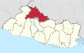
 El Paraíso, Chalatenango Location in El Salvador | |
| Coordinates: 14°5′N 89°5′W / 14.083°N 89.083°WCoordinates: 14°5′N 89°5′W / 14.083°N 89.083°W | |
| Country | |
| Department | Chalatenango Department |
| Government | |
| Area | |
| • Water | 5 sq mi (12 km2) |
| • Urban | 1 sq mi (3 km2) |
| • Metro | 0.4 sq mi (1 km2) |
| Elevation | 850 ft (260 m) |
| Population (13,890) | |
| • Municipality | 12,708 |
| Time zone | UTC-6 (CST) |
| • Summer (DST) | UTC-5 (CDT) |
| Sv | 00989 |
| Area code(s) | 78 |

El Paraíso is a municipality in the Chalatenango of El Salvador. El Paraiso has many towns, including , La Angostura, El Desvio, Santa Bárbara, Calle Nueva, El tamarindo, and Coyotera. El Paraíso has one of three natural reservation of department Chalatenango is located in El arenal. El Paraiso has two rivers: El Rio Grande, and El rio de la Arenal. A massacre of 8 Dutch journalists and FMLN guerrillas occurred near El Paraíso on 17 March 1982.[1]
References[]
- ^ "Report of the UN Truth Commission on El Salvador". Derechos Human Rights. 29 March 1993. pp. 69–75. Retrieved 16 September 2020.
This El Salvador location article is a stub. You can help Wikipedia by . |
Categories:
- Municipalities of the Chalatenango Department
- El Salvador geography stubs