Changtu County
Changtu
昌图县 | |
|---|---|
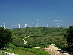
 A wind farm in Changtu County | |
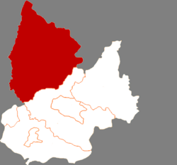
 Location in Tieling | |
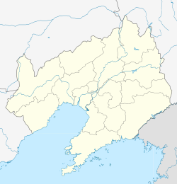
 Changtu Location of the seat in Liaoning | |
| Coordinates (Changtu County government): 42°47′09″N 124°06′40″E / 42.7858°N 124.1111°ECoordinates: 42°47′09″N 124°06′40″E / 42.7858°N 124.1111°E | |
| Country | People's Republic of China |
| Province | Liaoning |
| Prefecture-level city | Tieling |
| County seat | |
| Area | |
| • Total | 4,321.7 km2 (1,668.6 sq mi) |
| Elevation | 152 m (499 ft) |
| Population (2019) | |
| • Total | 984,226 |
| • Density | 230/km2 (590/sq mi) |
| Time zone | UTC+8 (China Standard) |
| Postal code | 112500 |
| Website | http://www.changtu.gov.cn/ |
Changtu County (simplified Chinese: 昌图县; traditional Chinese: 昌圖縣; pinyin: Chāngtú Xiàn) is a county in the northeast of Liaoning province, China, bordering Jilin to the northeast and Inner Mongolia in the northwest. It is under the administration of Tieling City, the downtown of which lies 60 kilometres (37 mi) to the south-southwest, and is 47 kilometres (29 mi) southwest of Siping, Jilin. It is served by both China National Highway 102 and G1 Beijing–Harbin Expressway.
Administrative divisions[]

The Skyline of Changtu
There are 33 towns under the county's administration.[1]
Towns:
- (昌图镇)
- (老城镇)
- (八面城镇)
- (三江口镇)
- (金家镇)
- (宝力镇)
- Quantou (泉头镇)
- (双庙子镇)
- (亮中桥镇)
- (马仲河镇)
- (毛家店镇)
- (老四平镇)
- (大洼镇)
- (头道镇)
