Chapadinha
Chapadinha | |
|---|---|
 Flag | |
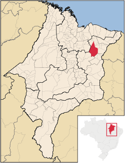 Location in Maranhão state | |
 Chapadinha Location in Brazil | |
| Coordinates: 03°44′31″S 43°21′36″W / 3.74194°S 43.36000°WCoordinates: 03°44′31″S 43°21′36″W / 3.74194°S 43.36000°W | |
| Country | Brazil |
| Region | Northeast |
| State | Maranhão |
| Area | |
| • Total | 3,247 km2 (1,254 sq mi) |
| Population (2020 [1]) | |
| • Total | 80,195 |
| • Density | 25/km2 (64/sq mi) |
| Time zone | UTC-03:00 (BRT) |

Chapadinha is a Brazilian municipality in the state of Maranhão. It is located 235 km south-east of the state capital São Luís. The population is 80,195 (2020) and the total area is 3,247 km2.
The municipality lies in the Munim River basin.[2] The municipality contains the 11,971 hectares (29,580 acres) Chapada Limpa Extractive Reserve, created in 2007.[3]
References[]
- ^ IBGE 2020
- ^ Comitê de Bacia Hidrográfica do Rio Munim convoca primeira assembleia (in Portuguese), Governo do Maranhão, 14 September 2015, archived from the original on 11 February 2017, retrieved 2017-02-09
- ^ RESEX Chapada Limpa (in Portuguese), ISA: Instituto Socioambiental, retrieved 2016-08-31

| show Authority control |
|---|
 | This Maranhão, Brazil location article is a stub. You can help Wikipedia by . |
Categories:
- Municipalities in Maranhão
- Maranhão geography stubs