Charlo, Montana
Charlo, Montana | |
|---|---|
 | |
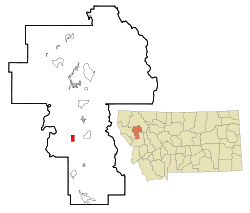 Location of Charlo, Montana | |
| Coordinates: 47°26′24″N 114°10′23″W / 47.44000°N 114.17306°WCoordinates: 47°26′24″N 114°10′23″W / 47.44000°N 114.17306°W | |
| Country | United States |
| State | Montana |
| County | Lake |
| Area | |
| • Total | 2.00 sq mi (5.19 km2) |
| • Land | 1.99 sq mi (5.16 km2) |
| • Water | 0.01 sq mi (0.03 km2) |
| Elevation | 2,936 ft (895 m) |
| Population (2010) | |
| • Total | 379 |
| • Density | 190/sq mi (73.5/km2) |
| Time zone | UTC-7 (Mountain (MST)) |
| • Summer (DST) | UTC-6 (MDT) |
| ZIP code | 59824 |
| Area code(s) | 406 |
| FIPS code | 30-13900 |
| GNIS feature ID | 0769768 |

Charlo (Salish: sallu [1]) is an unincorporated community and census-designated place (CDP) in Lake County, Montana, United States. The population was 379 at the 2010 census,[2] down from 439 in 2000. The 2018 population estimate was 320.[3]
The town was named in 1918 for a Salish chief.[4] Previously it had been called Big Flat, Charlotte, and Tabor.[4]
Geography[]
Charlo is located in southern Lake County at 47°26′24″N 114°10′23″W / 47.44000°N 114.17306°W (47.440017, -114.173171),[5] along . It is 4 miles (6 km) west of U.S. Route 93 and 22 miles (35 km) south of Polson, the county seat. Via Highway 212 it is 13 miles (21 km) northeast of Dixon. Ninepipe National Wildlife Refuge, surrounding Ninepipe Reservoir, is 1.5 miles (2.4 km) east of Charlo.
According to the United States Census Bureau, the CDP has a total area of 2.0 square miles (5.2 km2), of which 0.01 square miles (0.03 km2), or 0.58%, are water.[6]
Charlo is within the Flathead Indian Reservation.
Demographics[]
Warning[]
The 2000 data below is out of date. To access the last available data (2018 estimate), connect to data.census.gov. Note that the numbers are estimated with an important margin error. It would be better to wait the results of the 2020 Census.
2000 Data[]
At the 2000 census,[7] there were 439 people, 166 households and 112 families residing in the CDP. The population density was 219.4 per square mile (84.7/km2). There were 175 housing units at an average density of 87.5 per square mile (33.8/km2). The racial makeup of the CDP was 76.77% White, 1.14% African American, 17.77% Native American, 2.05% from other races, and 2.28% from two or more races. Hispanic or Latino of any race were 2.73% of the population.
There were 166 households, of which 42.8% had children under the age of 18 living with them, 47.6% were married couples living together, 15.7% had a female householder with no husband present, and 32.5% were non-families. 26.5% of all households were made up of individuals, and 14.5% had someone living alone who was 65 years of age or older. The average household size was 2.64 and the average family size was 3.22.
36.0% of the population were under the age of 18, 7.3% from 18 to 24, 26.4% from 25 to 44, 18.2% from 45 to 64, and 12.1% who were 65 years of age or older. The median age was 32 years. For every 100 females, there were 96.0 males. For every 100 females age 18 and over, there were 97.9 males.
The median household income was $24,167 and the median family income was $32,500. Males had a median income of $25,577 and females $17,250. The per capita income was $10,687. About 16.0% of families and 21.2% of the population were below the poverty line, including 23.9% of those under age 18 and 8.1% of those age 65 or over.
Town events[]
Each year, residents of Charlo host a Fourth of July parade and cookout along Main Street (Highway 212). Regular participants include local equestrian units, Charlo "all school" alumni, representatives from all branches of military service, and the local fire department.
Conservation[]
Charlo borders several protected areas, including the Herak Waterfowl Production area and Ninepipes Reservoir. These protected areas, along with seasonal flood irrigation, provide habitats for various native fauna such as white-tailed deer, pheasants, bald eagles, and western painted turtles.
Charlo is host of Owl Research Institute managing scientific research on Owls of all species. Close to the lake, are implemented 2 platforms for osprey nests. During the 2020 season, the first nest, used by ospreys in 2019, was squattered by geese and the osprey family - Charlie and Charlotte - moved to the second one. Actually, they are taking care of two chicks.
Education[]
Charlo School District educates students from kindergarten through 12th grade.[8] They are known as the Vikings.[9] is a Class C school.
References[]
- ^ Tachini, Pete (2010). Seliš nyoʻnuntn, Medicine for the Salish language : English to Salish translation dictionary (2nd ed.). Pablo, MT: Salish Kootenai College Press. p. 109. ISBN 9781934594063.
- ^ "Total Population: 2010 Census DEC Summary File 1 (P1), Charlo CDP, Montana". data.census.gov. U.S. Census Bureau. Retrieved April 16, 2020.
- ^ "Explore Census Data".
- ^ a b "Charlo". Montana Place Names Companion. Montana Historical Society. Retrieved 2 April 2021.
- ^ "US Gazetteer files: 2010, 2000, and 1990". United States Census Bureau. February 12, 2011. Retrieved April 23, 2011.
- ^ "U.S. Gazetteer Files: 2019: Places: Montana". U.S. Census Bureau Geography Division. Retrieved April 16, 2020.
- ^ "U.S. Census website". United States Census Bureau. Retrieved January 31, 2008.
- ^ "Charlo School District". Charlo School District. Retrieved 17 April 2021.
- ^ "Member Schools". Montana High School Association. Retrieved 19 April 2021.
Municipalities and communities of Lake County, Montana, United States | ||
|---|---|---|
| Cities |  | |
| Town | ||
| CDPs | ||
| Unincorporated community | ||
| Indian reservation | ||
| Footnotes | ‡This populated place also has portions in an adjacent county or counties | |
| ||
- Census-designated places in Lake County, Montana
- Census-designated places in Montana