Charlot River Airport
Charlot River Airport | |||||||||||
|---|---|---|---|---|---|---|---|---|---|---|---|
| Summary | |||||||||||
| Airport type | Public | ||||||||||
| Operator | Saskatchewan Power Corp. | ||||||||||
| Location | , Saskatchewan | ||||||||||
| Time zone | CST (UTC−06:00) | ||||||||||
| Elevation AMSL | 705 ft / 215 m | ||||||||||
| Coordinates | 59°36′05″N 109°08′18″W / 59.60139°N 109.13833°WCoordinates: 59°36′05″N 109°08′18″W / 59.60139°N 109.13833°W | ||||||||||
| Map | |||||||||||
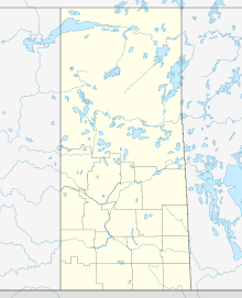 CJP9 Location in Saskatchewan | |||||||||||
| Runways | |||||||||||
| |||||||||||
Source: Canada Flight Supplement[1] | |||||||||||


Charlot River Airport (TC LID: CJP9) is located along the on the banks of Lake Athabasca, Saskatchewan, Canada. The airport is operated by SaskPower and serves the Charlot River Power Station, part of the Athabasca System Hydroelectric Stations. The closest community is Uranium City and the airport is serviced by Highway 999.
See also[]
References[]
External links[]
- Page about this airport on COPA's Places to Fly airport directory
| By name | |
|---|---|
| By location indicator | |
| By province/territory | |
| By area | |
| National Airports System | |
| Related | |
| |
This article about an airport in Saskatchewan is a stub. You can help Wikipedia by . |
Categories:
- Registered aerodromes in Saskatchewan
- Saskatchewan airport stubs