Cheltenham, Pennsylvania
Cheltenham | |
|---|---|
Unincorporated community Neighborhood of Cheltenham Township | |
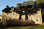
 Rowland House, ca. 1774 | |
| Motto(s): The Pride of the East Side | |
 Cheltenham Location of Cheltenham in Pennsylvania | |
| Coordinates: 40°3′39″N 75°5′39″W / 40.06083°N 75.09417°WCoordinates: 40°3′39″N 75°5′39″W / 40.06083°N 75.09417°W | |
| Country | United States |
| State | Pennsylvania |
| County | |
| Township | |
| Area | |
| • Total | 0.707 sq mi (1.83 km2) |
| • Land | 0.707 sq mi (1.83 km2) |
| • Water | 0.00 sq mi (0.0 km2) |
| Elevation | 125 ft (38 m) |
| Population (2010) | |
| • Total | 4,810 |
| • Density | 6,800/sq mi (2,600/km2) |
| Time zone | UTC-5 (Eastern Standard Time) |
| • Summer (DST) | UTC-4 (Eastern Daylight Time) |
| ZIP Code | 19012 |
| Area code(s) | 215, 267, and 445 |


Cheltenham is an unincorporated community in Cheltenham Township, Montgomery County, Pennsylvania, United States, with a ZIP code of 19012. It is located directly over the city line (Cheltenham Avenue) of Philadelphia. It also borders Northeast Philadelphia over the Fox Chase Line on the east and over Cottman Avenue (PA 73) on the north side.
By the mid-1980s, many Korean Americans moved out of Logan and moved into Cheltenham and other communities.[1]
Cheltenham is represented by Madeleine Dean in the 4th Congressional District.
As of 2016, Taiwanese airline EVA Air provides a private bus service to and from John F. Kennedy International Airport in New York City for customers based in the Philadelphia area. It stops in Cheltenham.[2]
References[]
- ^ Kaufman, Marc. "'Koreatown': From Logan Into Olney." The Philadelphia Inquirer. July 13, 1986. 1. Retrieved on July 31, 2011.
- ^ "Service to Connect PA & NJ." EVA Air. Retrieved on February 29, 2016.
| show Places adjacent to Cheltenham, Pennsylvania |
|---|
| show Articles relating to Cheltenham |
|---|


| show Authority control |
|---|
Categories:
- Unincorporated communities in Montgomery County, Pennsylvania
- Unincorporated communities in Pennsylvania
- Cheltenham Township, Pennsylvania