Cherokee, North Carolina
Cherokee, North Carolina
ᏣᎳᎩ (Cherokee), ᎡᎳᏬᏗ (Elawodi) | |
|---|---|
 Main street of Cherokee | |
| Motto(s): "Trails of Legends and Adventures" | |
| Coordinates: 35°28′37″N 83°19′13″W / 35.47694°N 83.32028°W | |
| Country | United States |
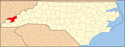
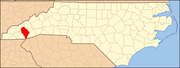
| State | North Carolina |
| Counties | Swain and Jackson |
| Area | |
| • Total | 12.0 sq mi (31.2 km2) |
| • Land | 12.0 sq mi (31.2 km2) |
| • Water | 0 sq mi (0 km2) |
| Elevation | 1,991 ft (607 m) |
| Population (2010) | |
| • Total | 2,138 |
| • Density | 180/sq mi (69/km2) |
| Time zone | UTC-5 (Eastern (EST)) |
| • Summer (DST) | UTC-4 (EDT) |
| ZIP code | 28719 |
| Area code(s) | 828 |


Cherokee /ˈtʃɛrəkˌiː/[1] (Cherokee: ᏣᎳᎩ, romanized: Tsalagi) is a census-designated place (CDP) in Swain and Jackson counties in Western North Carolina, United States, within the Qualla Boundary land trust.[2] Cherokee is located in the Oconaluftee River Valley around the intersection of U.S. Routes 19 and 441. As of the 2010 census, the CDP had a population of 2,138. It is the capital of the federally recognized Eastern Band of Cherokee Indians, one of three recognized Cherokee tribes and the only one in North Carolina.
History[]
Cherokee is the capital of the Eastern Band of the Cherokee Nation and part of the traditional homelands of the Cherokee people. In the 1870s, the Eastern Band purchased the land for what is called the "Qualla Boundary".[3][4] To continue the heritage of the Cherokee in the town, several signs for Cherokee's streets and buildings are written in both Cherokee syllabary and English. As a census-designated place (CDP), Cherokee overlaps most or part of three of the seven communities of the Qualla Boundary: Painttown, Wolftown, and Yellowhill.
Geography[]
Cherokee town and its surrounding Qualla Boundary is in the very mountainous Swain and Jackson counties. The highest elevation is 6,643-foot (2,025 m) Clingman's Dome at the border with Tennessee. Clingman's Dome is the highest point in the Great Smoky Mountains.[5] The Oconaluftee River flows through downtown Cherokee.
Economy[]
The EBCI negotiated an agreement with the state, and in 1997 opened Harrah's Cherokee Casino for gaming. It has generated jobs and revenue for the tribe, providing money that the EBCI applies to its people's education, welfare and culture. In 2005, nearly four million people visited the casino and generated a per capita profit of roughly $8,000 annually.[6] Each member of the tribe is paid some annual income; the tribe reinvests other monies for health and related services, and long-term development.
Since the late 20th century, most manufacturing and textile plants left the area, moving their jobs offshore to lower wage areas, such as Southeast Asia. The regional economy suffered. Many of the Cherokee had to rely on jobs related to national park tourism and recreation, which provided work for about half of the year. Many tribal members had to rely on public assistance to survive during the winter.[6]
Tourism[]
Cherokee is a tourist-oriented area, located at the entrance to Great Smoky Mountains National Park and at the southern end of the Blue Ridge Parkway. In addition to the casino, it is the site of attractions such as:
- Cherokee Botanical Garden and Nature Trail
- Trail to Mount Guyot
- [7]
- Oconaluftee Indian Village
- Oconaluftee (Great Smoky Mountains)
- Oconaluftee River
Eastern Cherokee history, culture, and crafts are portrayed in the historical drama Unto These Hills, presented annually during the tourist season.
The Cherokee area offers many campgrounds, trails and river adventures. It is also home to three roadside attractions with zoos: Cherokee Bear Zoo, Chief Saunooke Bear Park, and Santa's Land.
The zoos have been considered controversial. Bob Barker, a retired game show host and animal rights activist, has called for closing the black bear zoos at these attractions.[8][9]
and were two amusement parks that operated in the area in the late 1960s and into the early 21st century, respectively. The latter was converted into a water park before being closed to make way for development of Harrah's Cherokee. When they were open, both parks featured their own 3 ft (914 mm) narrow gauge[10] railroads (named and ).
Notable people[]
- Walker Calhoun, musician, dancer, and teacher[11]
- Amanda Crowe, woodcarver and educator
- Raymond Fairchild, banjo player[12]
- Charles George, Medal of Honor recipient
- Leon Miller, American football player and lacrosse coach[13]
- Clyde Moody, bluegrass musician
- Stan Powell, NFL player for the Oorang Indians[14]
- William Holland Thomas, Cherokee leader and Confederate general
Education[]
Cherokee Central Schools operates the K–12 public schools.[15][16] Cherokee High School is the local high school.
The private elementary school, New Kituwah Academy, is based on language immersion in Cherokee.
Previously the Bureau of Indian Affairs (BIA) provided educational services, and in their schools students were not permitted to speak Cherokee.[17]
Popular culture[]
Scenes from movies such as Davy Crockett, King of the Wild Frontier, Digging to China, Forces of Nature, The Fugitive, and Stroszek were shot in Cherokee.[18]
References[]
- ^ "Cherokee". Merriam-Webster Dictionary. Retrieved 2016-01-24.
- ^ "Qualla Boundary | NCpedia". www.ncpedia.org. Retrieved Aug 27, 2020.
- ^ Official website of Cherokee and the Eastern Band of the Cherokee Indians
- ^ Cherokee Indians - Part 1: Overview | NCpediawww.ncpedia.org › cherokee : "These people and their descendants were recognized in 1868 by the federal government as the Eastern Band of Cherokee Indians. In the early 2000s these Cherokee, living on the Qualla Boundary in the western part of the state, are the only Indian tribe in North Carolina fully recognized by the federal government.
- ^ Gatlinburg, Mailing Address: 107 Park Headquarters Road; Us, TN 37738 Phone:436-1200 Contact. "Clingmans Dome - Great Smoky Mountains National Park (U.S. National Park Service)". www.nps.gov. Retrieved Aug 27, 2020.
- ^ Jump up to: a b "The business of gambling", CNN, 06 July 2005
- ^ "Cherokeemuseum.org". www.cherokeemuseum.org. Retrieved Aug 27, 2020.
- ^ Bob Barker Showcases Cruelty to Bears in Meeting With Cherokees Archived 2009-08-09 at the Wayback Machine, a July 29, 2009 post on the PETA File blog
- ^ "Cherokee’s Unbearable Bear Pits", Larry King Live blog, 04 August 2009
- ^ "Surviving Steam Locomotive Search". www.steamlocomotive.com. Retrieved Aug 27, 2020.
- ^ Remembering Walker Calhoun, A Cherokee Musician, Dancer, And Teacher. ncarts.org. Retrieved October 19, 2020.
- ^ Lawless, John. (October 14, 2019). Raymond Fairchild passes. Bluegrass Today. Retrieved October 19, 2020.
- ^ Lipsyte, Robert. (January 29, 1993). Lacrosse; A Goalie Keeps Faith For an Iroquois Nation. The New York Times. Retrieved October 19, 2020.
- ^ Stan Powell Stats. Pro-Football-Reference. Retrieved October 19, 2020.
- ^ "2020 CENSUS - SCHOOL DISTRICT REFERENCE MAP: Swain County, NC" (PDF). U.S. Census Bureau. Retrieved 2021-07-18.
- ^ "2020 CENSUS - SCHOOL DISTRICT REFERENCE MAP: Jackson County, NC" (PDF). U.S. Census Bureau. Retrieved 2021-07-18.
- ^ Parris, John (1996-10-30). "Boys Club provides independence". Asheville Citizen-Times. Asheville, North Carolina. p. B1. - Clipping from Newspapers.com.
- ^ Locations in Cherokee, NC[permanent dead link] from Internet Movie Database
External links[]
 Cherokee travel guide from Wikivoyage
- Cherokee Tourism website
- 2009 Boundary and Annexation Survey[permanent dead link], a U.S. Census map for Cherokee and the surrounding area[dead link]
- The argument for a basic income
| Wikimedia Commons has media related to Cherokee, North Carolina. |
Coordinates: 35°28′37″N 83°19′14″W / 35.47694°N 83.32056°W
| show Municipalities and communities of Swain County, North Carolina, United States |
|---|
| show Municipalities and communities of Jackson County, North Carolina, United States |
|---|
| show Authority control |
|---|
- Census-designated places in Jackson County, North Carolina
- Census-designated places in North Carolina
- Census-designated places in Swain County, North Carolina
- Cherokee towns in North Carolina
- Communities of the Great Smoky Mountains
- Eastern Band of Cherokee Indians
- Tourism in North Carolina