Chiautla de Tapia
Coordinates: 18°17′57″N 98°36′10″W / 18.29917°N 98.60278°W

Chiautla de Tapia | |
|---|---|
Municipality and town | |
 | |
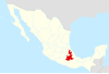
 Location of the municipality in Puebla | |
| Country | |
| State | Puebla |
| Time zone | UTC-6 (Central Standard Time) |
| • Summer (DST) | UTC-5 (Central Daylight Time) |
Chiautla de Tapia is a city and municipality in La Mixteca region of Puebla in south-eastern Mexico.[1] The municipality of Chiautla has a surface area of 685.05 km² which makes it the largest municipality in the state of Puebla. The BUAP has a Regional Section there.
Notable figures[]
References[]
- ^ "-". Enciclopedia de los Municipios de México. Instituto Nacional para el Federalismo y el Desarrollo Municipal. Archived from the original on April 5, 2007. Retrieved January 4, 2010.
External links[]
This article about a location in the Mexican state of Puebla is a stub. You can help Wikipedia by . |
Categories:
- Puebla geography stubs
- Municipalities of Puebla