Zacapoaxtla (municipality)
Zacapoaxtla Municipality | |
|---|---|
 | |
 Seal | |
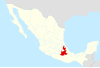
 Location of the municipality in Puebla | |
| Country | |
| State | Puebla |
| Time zone | UTC-6 (Central Standard Time) |
| • Summer (DST) | UTC-5 (Central Daylight Time) |
Zacapoaxtla Municipality is a municipality in Puebla in south-eastern Mexico.[1]
Zacapoaxtla Municipality is located in the mountains northeast of Puebla, between geographical coordinates 19° 44' 18 and 19° 59' 18 N latitude and 97° 31' 42 and 97° 37' 54 W longitude.
Zacapoaxtla is bounded
- on the east by Tlatlauquitepec Municipality and Zaragoza Municipality,
- on the north by Cuetzalan del Progreso Municipality,
- on the northwest by Nauzontla Municipality,
- on the west by Xochiapulco Municipality, and
- on the south by Zautla Municipality.
It has an area of 188.8 km², that makes it the 66th largest with respect to the other municipalities of the state of Puebla.
References[]
- ^ "-". Enciclopedia de los Municipios de México. Instituto Nacional para el Federalismo y el Desarrollo Municipal. Retrieved January 4, 2010.
This article about a location in the Mexican state of Puebla is a stub. You can help Wikipedia by . |

Categories:
- Puebla geography stubs
- Municipalities of Puebla