Chicken 224
Chicken 224 | |
|---|---|
| Chicken Indian Reserve No. 224 | |
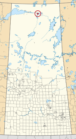 Location in Saskatchewan | |
| First Nation | Black Lake |
| Country | Canada |
| Province | Saskatchewan |
| Area | |
| • Total | 25,819.4 ha (63,801.1 acres) |
| Population (2016)[2] | |
| • Total | 1,379 |
| • Density | 5.3/km2 (14/sq mi) |
| Community Well-Being Index[3] | 42 |
Chicken 224 is an Indian reserve of the Black Lake Denesuline First Nation in Saskatchewan.[1][4] It is 170 kilometers southeast of Uranium City. In the 2016 Canadian Census, it recorded a population of 1379 living in 263 of its 280 total private dwellings.[2] In the same year, its Community Well-Being index was calculated at 42 of 100, compared to 58.4 for the average First Nations community and 77.5 for the average non-Indigenous community.[3]
Etymology[]
The three Chicken reserves were named after a Chief Chicken, early leader of the Black Lake band.[5]
References[]
- ^ a b "Reserve/Settlement/Village Detail". Indigenous and Northern Affairs Canada. Government of Canada. Retrieved August 12, 2019.
- ^ a b "Census Profile, 2016 Census". Statistics Canada. February 8, 2017. Retrieved 2019-08-10.
- ^ a b "The Community Well-Being index". Indigenous Services Canada. 2019-05-24. Retrieved 2019-10-09.
- ^ "Canada Lands Survey System - CLSS Map Browser". Natural Resources Canada. Retrieved 2019-10-09.
- ^ Barry, Bill (September 2005). Geographic Names of Saskatchewan. Regina, Saskatchewan: People Places Publishing, Ltd. p. 82. ISBN 1-897010-19-2.
| District |  | ||||||
|---|---|---|---|---|---|---|---|
| Cities |
| ||||||
| Northern towns | |||||||
| Northern villages |
| ||||||
| First Nations | |||||||
| Indian reserves |
| ||||||
| Unorganized areas | |||||||
| Unincorporated communities |
| ||||||
Coordinates: 59°11′56″N 105°37′33″W / 59.1988°N 105.6259°W

This article about a location in the Census Division No. 18 of Saskatchewan is a stub. You can help Wikipedia by . |
This article about an Indian reserve in Saskatchewan is a stub. You can help Wikipedia by . |
- Indian reserves in Saskatchewan
- Division No. 18, Saskatchewan
- Saskatchewan Division No. 18 geography stubs
- Saskatchewan Indian reserve stubs