Chotýšany
Chotýšany | |
|---|---|
 Common in Chotýšany | |
 Flag | |
 Chotýšany Location in the Czech Republic | |
| Coordinates: 49°44′39″N 14°48′53″E / 49.74417°N 14.81472°ECoordinates: 49°44′39″N 14°48′53″E / 49.74417°N 14.81472°E | |
| Country | |
| Region | Central Bohemian |
| District | Benešov |
| First mentioned | 1250 |
| Area | |
| • Total | 13.97 km2 (5.39 sq mi) |
| Elevation | 450 m (1,480 ft) |
| Population (2021-01-01)[1] | |
| • Total | 596 |
| • Density | 43/km2 (110/sq mi) |
| Time zone | UTC+1 (CET) |
| • Summer (DST) | UTC+2 (CEST) |
| Postal codes | 257 01, 257 28 |
| Website | www |

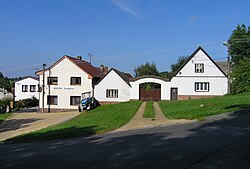
Chotýšany is a municipality and village in Benešov District in the Central Bohemian Region of the Czech Republic. It has about 600 inhabitants.
Administrative parts[]
Villages of Křemení, Městečko and Pařezí are administrative parts of Chotýšany.
Gallery[]

Common pond

Local elementary school


References[]
| Wikimedia Commons has media related to Chotýšany. |
| Authority control: National libraries |
|---|
Categories:
- Populated places in Benešov District
- Villages in Benešov District
- Benešov geography stubs