Chuen Chom District
Chuen Chom
ชื่นชม | |
|---|---|
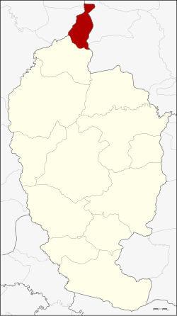 District location in Maha Sarakham Province | |
| Coordinates: 16°31′53″N 103°10′18″E / 16.53139°N 103.17167°ECoordinates: 16°31′53″N 103°10′18″E / 16.53139°N 103.17167°E | |
| Country | Thailand |
| Province | Maha Sarakham |
| Seat | Chuen Chom |
| Area | |
| • Total | 113.0 km2 (43.6 sq mi) |
| Population (2005) | |
| • Total | 24,586 |
| • Density | 217.6/km2 (564/sq mi) |
| Time zone | UTC+7 (ICT) |
| Postal code | 44160 |
| Geocode | 4413 |

Chuen Chom District (Thai: ชื่นชม, pronounced [t͡ɕʰɯ̂ːn t͡ɕʰōm]) is a district (amphoe) in the north of Maha Sarakham Province, northeastern Thailand.
Geography[]
Neighboring districts are (from the south clockwise): Chiang Yuen of Maha Sarakham Province; Sam Sung and Kranuan of Khon Kaen Province; Huai Mek and Yang Talat of Kalasin Province.
History[]
The minor district (king amphoe) was split off from Chiang Yuen District on 1 July 1997.[1]
The Thai government on 15 May 2007 upgraded all 81 minor districts to full districts.[2] With publication in the Royal Gazette on 24 August the upgrade became official.[3]
Administration[]
The district is divided into four sub-districts (tambons), which are further subdivided into 47 villages (mubans). There are no municipal (thesabans). There are four tambon administrative organizations (TAO).
| No. | Name | Thai name | Villages | Pop. | |
|---|---|---|---|---|---|
| 1. | Chuen Chom | ชื่นชม | 11 | 5,886 | |
| 2. | Kut Pla Duk | กุดปลาดุก | 15 | 8,264 | |
| 3. | Lao Dok Mai | เหล่าดอกไม้ | 11 | 6,329 | |
| 4. | Nong Kung | หนองกุง | 10 | 4,107 |
References[]
- ^ ประกาศกระทรวงมหาดไทย เรื่อง แบ่งเขตท้องที่อำเภอเชียงยืน จังหวัดมหาสารคาม ตั้งเป็นกิ่งอำเภอชื่นชม (PDF). Royal Gazette (in Thai). 114 (Special 51 ง): 15. June 25, 1997.
- ^ แถลงผลการประชุม ครม. ประจำวันที่ 15 พ.ค. 2550 (in Thai). Manager Online.
- ^ พระราชกฤษฎีกาตั้งอำเภอฆ้องชัย...และอำเภอเหล่าเสือโก้ก พ.ศ. ๒๕๕๐ (PDF). Royal Gazette (in Thai). 124 (46 ก): 14–21. August 24, 2007.
External links[]
This Maha Sarakham Province location article is a stub. You can help Wikipedia by . |
- Amphoe of Maha Sarakham Province
- Isan geography stubs