Chvojnica, Myjava District
Chvojnica | |
|---|---|
Village | |
 | |
 Chvojnica Location of Chvojnica in the Trenčín Region | |
| Coordinates: 48°47′43″N 17°24′24″E / 48.79528°N 17.40667°ECoordinates: 48°47′43″N 17°24′24″E / 48.79528°N 17.40667°E | |
| Country | Slovakia |
| Region | Trenčín |
| District | Myjava |
| First mentioned | 1957 |
| Area | |
| • Total | 16.345 km2 (6.311 sq mi) |
| Elevation | 370 m (1,210 ft) |
| Population | |
| • Total | 505 |
| • Density | 31/km2 (80/sq mi) |
| Postal code | 906 06 |
| Car plate | MY |
| Website | www.chvojnica.sk |


Chvojnica (Hungarian: Fenyvesd) is a village and municipality in Myjava District in the Trenčín Region of north-western Slovakia.
History[]
In historical records the village was first mentioned in 1957.
Geography[]
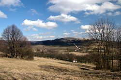
The municipality lies at an altitude of 370 metres and covers an area of 16.345 km². It has a population of about 400 people.
External links[]
![]() Media related to Chvojnica (Myjava District) at Wikimedia Commons
Media related to Chvojnica (Myjava District) at Wikimedia Commons
- Official page
- https://web.archive.org/web/20071217080336/http://www.statistics.sk/mosmis/eng/run.html
| hide Municipalities of Myjava District | ||
|---|---|---|
| Authority control |
|
|---|
This Trenčín District location article is a stub. You can help Wikipedia by . |
Categories:
- Villages and municipalities in Myjava District
- Trenčín geography stubs