Cifuentes, Cuba
Cifuentes | |
|---|---|
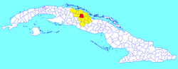 Cifuentes municipality (red) within Villa Clara Province (yellow) and Cuba | |
| Coordinates: 22°37′15″N 80°03′58″W / 22.62083°N 80.06611°WCoordinates: 22°37′15″N 80°03′58″W / 22.62083°N 80.06611°W | |
| Country | Cuba |
| Province | Villa Clara |
| Founded | 1819[1] |
| Established | 1919 (Municipality) |
| Area | |
| • Total | 512 km2 (198 sq mi) |
| Elevation | 65 m (213 ft) |
| Population (2004)[3] | |
| • Total | 28,850 |
| • Density | 56/km2 (150/sq mi) |
| Time zone | UTC-5 (EST) |
| Area code(s) | +53-422 |

Cifuentes (Spanish pronunciation: [siˈfwentes]) is a municipality and town in the Villa Clara Province of Cuba founded in 1819[1] and established as a municipality in 1919.
Demographics[]
In 2009 the municipality of Cifuentes had a population of 28,850, having dropped from 41,789 in 1976.[3] With a total area of 512 km2 (198 sq mi),[2] it had a population density of 56/km2 (150/sq mi).
The municipality is divided into the barrios of Alacrán, Amaro, Barro, Cabecera Norte, Cabecera Sur, Este, Oeste and Sitio Grande.[1]
See also[]
References[]
- ^ a b c Guije.com. "Cifuentes" (in Spanish). Retrieved 2007-10-09.
- ^ a b Statoids (July 2003). "Municipios of Cuba". Retrieved 2007-10-09.
- ^ a b "Población de Cuba, Provincias y Municipios 1976-2009 Edición 2010" (PDF) (in Spanish). 2010. Retrieved 2010-09-01.
External links[]
![]() Media related to Cifuentes, Cuba at Wikimedia Commons
Media related to Cifuentes, Cuba at Wikimedia Commons
Places adjacent to Cifuentes, Cuba | |
|---|---|
This Cuban location article is a stub. You can help Wikipedia by . |
Categories:
- Populated places in Villa Clara Province
- Cuba geography stubs