Ranchuelo
Ranchuelo | |
|---|---|
 Town hall | |
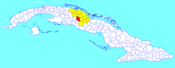 Ranchuelo municipality (red) within Villa Clara Province (yellow) and Cuba | |
| Coordinates: 22°22′35.2″N 80°09′03.6″W / 22.376444°N 80.151000°WCoordinates: 22°22′35.2″N 80°09′03.6″W / 22.376444°N 80.151000°W | |
| Country | Cuba |
| Province | Villa Clara |
| Founded | 1734[1] |
| Established | 1879 (Municipality) |
| Area | |
| • Total | 556 km2 (215 sq mi) |
| Elevation | 125 m (410 ft) |
| Population (2004)[3] | |
| • Total | 59,062 |
| • Density | 106.2/km2 (275/sq mi) |
| Time zone | UTC-5 (EST) |
| Area code(s) | +53-422 |

Ranchuelo is a town and municipality in the Villa Clara Province of Cuba. It was founded in 1734[1] and has a municipal population of 59,062, of which about 16,804 in the town itself.
History[]
Originally named Boca de Ranchuelo, the settlement was founded by Dionisio Consuegra on October 1, 1734. In 1856 it was linked to the national rail network, and in 1879 gained the municipal status.[1]
Geography[]


The town is divided into the barrios of Norte, Poza de la China, Sitio Viejo and Sur.[1] The municipality counts the town proper (with 16,804 inhabitants)[4] and the consejos populares (i.e. "people's councils", mainly villages and hamlets) of Carlos Caraballo, Castaño, Conyedo, Diez de Octubre, Esperanza, Horqueta-Delicias, Ifraín Alfonso (also known as Central Santa María), Jicotea, Osvaldo Herrera (also known as Pastora), Rancho Grande-Jagua and San Juan de los Yeras.[5]
Ranchuelo is 7 km from San Juan de los Yeras, 9 from Esperanza, 16 from Cruces, 28 from Santa Clara, 43 from Cienfuegos and 256 from Havana. It borders with the municipalities of Santo Domingo, Cifuentes, Santa Clara, Manicaragua, Cruces and Lajas.[6]
Demographics[]
In 2004, the municipality of Ranchuelo had a population of 59,062.[3] With a total area of 556 km2 (215 sq mi),[2] it has a population density of 106.2/km2 (275/sq mi).
Transport[]
Ranchuelo is served by the A1 motorway at the homonym exit, also known as "Ranchuelo-Cienfuegos".[7] It counts a railway station on the Santa Clara-Cienfuegos line, that is also the western terminus of a freight line to Mataguá.[8]
Esperanza, the most populated municipal hamlet, is crossed in the middle by the "Carretera Central" state highway.
Notable people[]
- Samuel Feijóo (1914-1992), singer, born in San Juan de los Yeras
- María Dámasa Jova Baró (1890-1940), writer, educator and feminist
See also[]
References[]
- ^ a b c d Guije.com. "Ranchuelo" (in Spanish). Retrieved 2007-10-09.
- ^ a b Statoids (July 2003). "Municipios of Cuba". Retrieved 2007-10-09.
- ^ a b Atenas.cu (2004). "2004 Population trends, by Province and Municipality" (in Spanish). Archived from the original on 2007-09-27. Retrieved 2007-10-09.
- ^ (in Spanish) Ranchuelo (town) on EcuRed
- ^ (in Spanish) Consejos populares of Ranchuelo
- ^ 5884799 Ranchuelo on OpenStreetMap
- ^ 1308266444 Ranchuelo (A1 exit) on OpenStreetMap
- ^ 2925075943 Ranchuelo railway station on OpenStreetMap
External links[]
| Wikimedia Commons has media related to Ranchuelo. |
- (in Spanish) Ranchuelo on EcuRed
- (in Spanish) (historical info on guije.com)
Places adjacent to Ranchuelo | ||||||||||||||||
|---|---|---|---|---|---|---|---|---|---|---|---|---|---|---|---|---|
| ||||||||||||||||
- Populated places in Villa Clara Province