Clermont, Kentucky
Clermont is a USGS-designated populated place (one of 32) in Bullitt County, Kentucky, United States, south of Louisville. It is an unincorporated community.
Geography[]
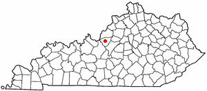
Clermont is located at (37.5547, -85.3910) and is 531 feet (162 meters) above sea level. This is in the Eastern Time Zone (Standard Time: GMT -5 hours, DST: GMT -4 hours), ZIP code 40110.
A large portion of Clermont consists of the Bernheim Arboretum and Research Forest.
Culture[]
Clermont is home to the famous Jim Beam distillery, and Bullitt County is a "wet" county.[1]
The Boy Scouts of America Camp Crooked Creek, which is associated with the Lincoln Heritage Council, is also located in Clermont.
History[]
The area was officially recognized by the USGS on September 20, 1979, during the rapid expansion of Shepherdsville due to the development of Interstate 65.
References[]
- ^ "Wet & Dry Counties in Kentucky as of 05/01/2017" (PDF). Kentucky Department of Alcoholic Beverage Control. 2017-06-20. Retrieved 2018-10-06.
External links[]
Coordinates: 37°33′17″N 85°23′28″W / 37.5547°N 85.3910°W

Municipalities and communities of Bullitt County, Kentucky, United States | ||
|---|---|---|
| Cities |  | |
| CDP | ||
| Unincorporated communities | ||
| ||
This Bullitt County, Kentucky state location article is a stub. You can help Wikipedia by . |
- Unincorporated communities in Bullitt County, Kentucky
- Unincorporated communities in Kentucky
- Louisville metropolitan area
- Bullitt County, Kentucky geography stubs