Coleman, Alberta
Coleman | |
|---|---|
 | |
 Coleman | |
| Coordinates: 49°38′07″N 114°30′11″W / 49.6353°N 114.5031°WCoordinates: 49°38′07″N 114°30′11″W / 49.6353°N 114.5031°W | |
| Country | Canada |
| Province | Alberta |
| Specialized municipality | Municipality of Crowsnest Pass |
| Government | |
| • Type | Unincorporated |
| • Governing body | Municipality of Crowsnest Pass Council |
| Elevation | 1,320 m (4,330 ft) |
| Population (2016)[1] | |
| • Total | 1,475 |
| Time zone | UTC−7 (MST) |
| • Summer (DST) | UTC−6 (MDT) |


Coleman is a community in the Rocky Mountains within the Municipality of Crowsnest Pass in southwest Alberta, Canada. It was formerly incorporated as a town prior to 1979 when it amalgamated with four other municipalities to form Crowsnest Pass.
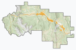
Coleman is located in census division No. 15 and in the riding of Macleod. It is served by Highway 3 (Crowsnest Highway) and the Canadian Pacific Railway.
History[]
In 1903 a new townsite was laid out a few kilometres west of Blairmore, Alberta, to service a new coal mine operated by the International Coal and Coke Company. Initial names of Paulson's Camp or McGillivray Hill were rejected by the post office, settling on Coleman (after the mothers maiden name of the president and mine owner A. C. Flumerfelt's wife, Ada and the middle name of his youngest daughter, Norma Coleman Flumerfelt) in 1904.[3] A feature of the town was the mine's 100 (later 216) coke ovens located at the edge of town, which operated from 1906 to 1952. The town grew rapidly, surpassing its neighbour Blairmore as the largest in the region. Coleman boasted a successful opera house from 1908 until it burned down in 1948.
Coleman persevered through strikes (1911 and 1932), floods (1923 and 1942) and fires (1948). As the coal mines in the region gradually closed, Coleman's commercial importance waned in favour of Blairmore. Coleman amalgamated with four other municipalities to form the Municipality of Crowsnest Pass in 1979.
Coleman's coal mining heritage is evident in its several historic buildings, a regional museum, the ruins of its coal plant and coke ovens, several nearby abandoned mines and the "biggest piggy bank in the world" made from a 36-inch (910 mm) gauge air driven thermos bottle mine locomotive. Much of the downtown section now forms the Coleman National Historic Site.[4]
Demographics[]
According to the 2006 Census of Canada, the population of Coleman is 1,065, which represents 19% of the overall population of the Municipality of Crowsnest Pass (5,749).[1]
People[]
- Joe Kryczka, Justice of the Court of Queen's Bench of Alberta, president of the Canadian Amateur Hockey Association
Climate[]
| hideClimate data for Coleman | |||||||||||||
|---|---|---|---|---|---|---|---|---|---|---|---|---|---|
| Month | Jan | Feb | Mar | Apr | May | Jun | Jul | Aug | Sep | Oct | Nov | Dec | Year |
| Record high °C (°F) | 11.5 (52.7) |
13.9 (57.0) |
18.3 (64.9) |
25.6 (78.1) |
29.0 (84.2) |
30.0 (86.0) |
35.0 (95.0) |
34.0 (93.2) |
32.0 (89.6) |
26.0 (78.8) |
16.0 (60.8) |
13.5 (56.3) |
35 (95) |
| Average high °C (°F) | −1.6 (29.1) |
0.1 (32.2) |
4.6 (40.3) |
9.5 (49.1) |
14.4 (57.9) |
18.7 (65.7) |
22.1 (71.8) |
22.8 (73.0) |
17.0 (62.6) |
10.2 (50.4) |
1.4 (34.5) |
−3.0 (26.6) |
9.7 (49.5) |
| Daily mean °C (°F) | −6.4 (20.5) |
−5.0 (23.0) |
−0.8 (30.6) |
3.6 (38.5) |
7.9 (46.2) |
11.8 (53.2) |
14.3 (57.7) |
14.3 (57.7) |
9.5 (49.1) |
4.6 (40.3) |
−2.7 (27.1) |
−7.4 (18.7) |
3.6 (38.5) |
| Average low °C (°F) | −11.3 (11.7) |
−10.1 (13.8) |
−6.2 (20.8) |
−2.4 (27.7) |
1.3 (34.3) |
4.9 (40.8) |
6.5 (43.7) |
5.7 (42.3) |
2.0 (35.6) |
−1.1 (30.0) |
−6.8 (19.8) |
−11.9 (10.6) |
−2.4 (27.7) |
| Record low °C (°F) | −39.4 (−38.9) |
−37.5 (−35.5) |
−37.2 (−35.0) |
−24.4 (−11.9) |
−8.3 (17.1) |
−5.6 (21.9) |
−3.3 (26.1) |
−7.0 (19.4) |
−11.0 (12.2) |
−27.0 (−16.6) |
−37.0 (−34.6) |
−41.1 (−42.0) |
−41.1 (−42.0) |
| Average precipitation mm (inches) | 34.8 (1.37) |
37.1 (1.46) |
38.6 (1.52) |
39.8 (1.57) |
69.6 (2.74) |
70.2 (2.76) |
62.6 (2.46) |
43.7 (1.72) |
45.9 (1.81) |
46.4 (1.83) |
56.2 (2.21) |
37.3 (1.47) |
582.1 (22.92) |
| Average rainfall mm (inches) | 12.7 (0.50) |
10.8 (0.43) |
13.0 (0.51) |
23.0 (0.91) |
60.8 (2.39) |
70.2 (2.76) |
62.6 (2.46) |
43.2 (1.70) |
44.3 (1.74) |
32.8 (1.29) |
22.4 (0.88) |
9.2 (0.36) |
404.8 (15.94) |
| Average snowfall cm (inches) | 22.1 (8.7) |
26.4 (10.4) |
25.6 (10.1) |
16.7 (6.6) |
8.8 (3.5) |
0.0 (0.0) |
0.0 (0.0) |
0.5 (0.2) |
1.7 (0.7) |
13.6 (5.4) |
33.9 (13.3) |
28.1 (11.1) |
177.3 (69.8) |
| Source: Environment Canada[5] | |||||||||||||
See also[]
References[]
- ^ Jump up to: a b Alberta Municipal Affairs (15 September 2009). "Alberta 2009 Official Population List" (PDF). Retrieved 12 September 2010.
- ^ "Alberta Private Sewage Systems 2009 Standard of Practice Handbook: Appendix A.3 Alberta Design Data (A.3.A. Alberta Climate Design Data by Town)" (PDF) (PDF). Safety Codes Council. January 2012. pp. 212–215 (PDF pages 226–229). Archived from the original (PDF) on 16 October 2013. Retrieved 8 October 2013.
- ^ Coleman Board of Trade (1953). Coleman's 50th Anniversary Booklet. Lethbridge: Lethbridge Herald. p. 17.[permanent dead link]
- ^ "Discover Crowsnest Heritage » Coleman National Historic Site". www.crowsnestheritage.ca. Retrieved 24 September 2018.
- ^ "Coleman, Alberta". Canadian Climate Normals 1981–2010 (in English and French). Environment Canada. Retrieved 12 March 2014.
| Wikimedia Commons has media related to Coleman, Alberta. |
| show Authority control |
|---|
- Crowsnest Pass, Alberta
- Former towns in Alberta
- National Historic Sites in Alberta
- Populated places disestablished in 1979