Blairmore, Alberta
Blairmore | |
|---|---|
 The Cosmopolitan Hotel and Bar in Blairmore | |
 Blairmore | |
| Coordinates: 49°36′29″N 114°26′34″W / 49.6081°N 114.4428°WCoordinates: 49°36′29″N 114°26′34″W / 49.6081°N 114.4428°W | |
| Country | |
| Province | |
| Census division | No. 15 |
| Specialized municipality | Municipality of Crowsnest Pass |
| Government | |
| • Type | Unincorporated |
| • Governing body | Municipality of Crowsnest Pass Council |
| Population (2016)[1] | |
| • Total | 2,088 |
| Time zone | UTC−7 (MST) |
| • Summer (DST) | UTC−6 (MDT) |


Blairmore is a community in the Rocky Mountains within the Municipality of Crowsnest Pass in southwest Alberta, Canada. It was formerly incorporated as a town prior to 1979 when it amalgamated with four other municipalities to form Crowsnest Pass. Blairmore is the principal commercial centre of Crowsnest Pass.
History[]

Originally a Canadian Pacific Railway stop called Tenth Siding or The Springs (for the cold sulphur spring to the east), the settlement was renamed Blairmore in November 1898 and it got a post office the following year.[2] A ten-year dispute over land ownership between the CPR station agent and the section foreman stunted early development.[3] Blairmore's principal industry was lumber and, after 1907, coal. Other industries followed and on September 29, 1911 Blairmore was incorporated as a town. With the declining fortunes of the nearby community of Frank, Blairmore soon became the region's economic centre. The Greenhill mine, located just north of Blairmore, became the mainstay of the community until its closure in 1957.[citation needed]
One of the town's early characters was Emilio Picariello (1875 – 1923). "Emperor Pic" settled in Blairmore in 1918 and operated several businesses, but also illegally imported alcohol from nearby British Columbia during prohibition. Picariello and Florence Lassandro were hanged in 1923 after the shooting death of Alberta Provincial Police constable Steve Lawson in 1922.[4][5]
Like many Canadian industrial towns in the 1930s, Blairmore had some sympathies with Communism. Canada's first Communist town council and school board were elected in Blairmore in 1933, which reformed the tax system, and refused to observe Remembrance Day as an Imperialist holiday and honoured the Russian Revolution instead. A street was named after the leader of the Communist Party of Canada, Tim Buck, a decision that was reversed by the next town council.[6]
Blairmore amalgamated with four other municipalities to form the Municipality of Crowsnest Pass in 1979.[7]
Canadian Militia[]
From 1946 to 1965, Blairmore was home to Canadian Militia units associated with the Royal Canadian Electrical Mechanical Engineers. From 1946 to 1950, No. 22 Armoured Workshop existed prior to being renamed as a Troop of 39 Technical Squadron (1950-1954) and eventually the 31st Technical Squadron (1954-1965). During this time, the Squadron had a band which regularly paraded within the town as well as a 535 Royal Canadian Army Cadet Corps which existed until 1971.
Geography[]

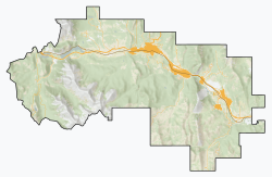
Blairmore is located in southwest Alberta in the Canadian Rockies. It is approximately 135 km (84 mi) west of Lethbridge on Highway 3 (Crowsnest Highway) and approximately 20 km (12 mi) east of the British Columbia border.[8] Fellow Crowsnest Pass communities Frank and Coleman are 3 km (1.9 mi) to the east and 6 km (3.7 mi) to the west respectively.
Geology[]
Volcanic rocks in the Blairmore area are related to the Crowsnest Formation. As a geological unit, the volcanics received some attention in the late 1980s when geologists stated they had found trace amounts of gold in certain units of the volcanics.[9] Blairmorite, a rare volcanic rock of the Crowsnest Formation, is named after Blairmore.[10]
Demographics[]
According to the 2006 Census of Canada, the population of Blairmore is 2,088, which represents 36% of the overall population of the Municipality of Crowsnest Pass (5,749).[1]
See also[]
References[]
| Wikimedia Commons has media related to Blairmore, Alberta. |
- ^ Jump up to: a b Alberta Municipal Affairs (2009-09-15). "Alberta 2009 Official Population List" (PDF). Retrieved 2010-09-12.
- ^ Crowsnest Pass Historical Society (1979). Crowsnest and its people. Coleman: Crowsnest Pass Historical Society. p. 39. ISBN 0-88925-046-4. Archived from the original on 2015-09-24. Retrieved 2013-06-19.
- ^ Crowsnest and its People Crowsnest Pass Historical Society, 1979
- ^ "The day Emilio Picariello and Florence Losandro gunned down Const. Stephen Lawson". calgarysun.com. 7 September 2016. Archived from the original on 20 December 2016. Retrieved 11 December 2016.
- ^ "The only woman hanged in Alberta". edmontonjournal.com. Archived from the original on 20 December 2016. Retrieved 11 December 2016.
- ^ Crownest Pass Promoter Archived 2006-03-23 at the Wayback Machine - street name controversy
- ^ Alberta Municipal Affairs. "Crowsnest Pass - Town Profile". Archived from the original on 2008-06-20. Retrieved 2008-06-24.
- ^ Your Official Road Map of Alberta (Map) (2014 ed.). Travel Alberta.
- ^ Mineral Assessment Report 20060025 - A report for Assessment in reference to Metallic and Industrial Minerals Permit 9304091032
- ^ Pearce, T.H. "Analcime phenocrysts in igneous rocks: Primary or secondary? – Discussion" (PDF). American Mineralogist 78: 225-229, 1993. Retrieved 2014-10-06.
- Crowsnest Pass, Alberta
- Former towns in Alberta
- Populated places disestablished in 1979
- 1979 disestablishments in Alberta