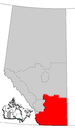
Southern Alberta
Southern Alberta is a region located in the Canadian province of Alberta. In 2004, the region's population was approximately 272,017.[1][2] The primary cities are Lethbridge and Medicine Hat. The region is known mostly for agricultural production, but other sectors, such as alternative energy, film production and tourism, are emerging.
Geography[]
The region has a total area of approximately 75,500 km2 (29,151 sq mi).
Southern Alberta is in the northern Great Plains region, lined to the east from the Canadian Rocky Mountains and their foothills. The rest of the region is dominated by the semi-arid prairies of the Palliser's Triangle, where farms and ranches have been built, often with the help of irrigation. Rivers generally flow from west to east and include the Oldman River, Bow River, Red Deer River, South Saskatchewan River, and Milk River. Milk River is the only river in Canada that eventually flows into the Gulf of Mexico.[3]
The environment is protected in such areas as Waterton Lakes National Park, Cypress Hills Interprovincial Park and Writing-on-Stone Provincial Park, while sites such as Head-Smashed-In Buffalo Jump and Dinosaur Provincial Park were declared UNESCO World Heritage Sites. The Alberta Badlands are developed in the northeast of the region, prominently along the Red Deer River. Cypress Hills, located in the east, at the border with Saskatchewan, are the highest point between the Rocky Mountains and Labrador.
Infrastructure[]
Major highways[]
- Highway 1
- Highway 2
- Highway 3 (Crowsnest Highway)
- Highway 4
- Highway 5
- Highway 36 (Veteran Memorial Highway)
- Highway 41 (Buffalo Trail)
Health regions[]
Economy[]
In 2007, Alberta Human Resources and Employment reported the fields of finance, insurance, real estate, professions, technicians and senior managers will lead the Lethbridge–Medicine Hat region's growth with an average 2.8% real GDP growth each year until 2011. The industries of manufacturing, energy, mining and forestry would account for 2.6% each. All ten of these fields would account for more than half of the region's domestic product.[4]
| Sector | Labour force | % of total |
|---|---|---|
| Agriculture | 18,085 | 13% |
| Mining | 6,450 | 5% |
| Manufacturing | 11,930 | 9% |
| Construction | 10,020 | 7% |
| Transportation and utilities | 7,450 | 5% |
| Retail and wholesale | 19,865 | 15% |
| Finance | 4,700 | 3% |
| Business and community services | 52,110 | 38% |
| Public administration | 6,110 | 4% |
Politics[]
On a provincial level, southern Alberta is represented in the Legislative Assembly of Alberta by MLAs elected in the ridings of Airdrie-Chestermere, Cardston-Taber-Warner, Cypress-Medicine Hat, Highwood, Lethbridge East, Lethbridge West, Little Bow, Livingstone-Macleod, Medicine Hat and Strathmore-Brooks.
Municipalities[]
|
Cities
Towns
|
Villages |
Specialized municipalities Improvement districts Municipal districts
Special areas
|
Notes[]
- ^ Southwest Regional. Marketplace Profile, AlbertaFirst.com. Accessed 22 December 2006. Archived October 21, 2006, at the Wayback Machine
- ^ Southeast Regional Marketplace Profile, AlbertaFirst.com. Accessed 22 December 2006. Archived October 21, 2006, at the Wayback Machine
- ^ "Milk River Watershed Council Canada :: The Watershed". www.mrwcc.ca. Retrieved 23 March 2018.
- ^ Mabell, Dave (2006-01-06). "People skills key to building success". Lethbridge Herald. pp. E1.
External links[]
| Subdivisions | |
|---|---|
| Communities | |
| Cities and urban service areas | |
| Regions | |
| |

- Southern Alberta
- Great Plains
- Geographic regions of Alberta