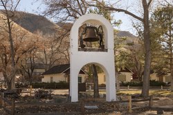
Coleville, California
Coleville | |
|---|---|
 Coleville | |
 Coleville Location in California | |
| Coordinates: 38°33′59″N 119°30′26″W / 38.56639°N 119.50722°WCoordinates: 38°33′59″N 119°30′26″W / 38.56639°N 119.50722°W | |
| Country | United States |
| State | California |
| County | Mono |
| Area | |
| • Total | 13.757 sq mi (35.631 km2) |
| • Land | 13.757 sq mi (35.631 km2) |
| • Water | 0 sq mi (0 km2) 0% |
| Elevation | 5,141 ft (1,567 m) |
| Population (2010) | |
| • Total | 495 |
| • Density | 36/sq mi (14/km2) |
| Time zone | UTC-8 (Pacific) |
| • Summer (DST) | UTC-7 (PDT) |
| ZIP code | 96107 |
| Area codes | 442/760 (de jure); 530 (de facto) |
| FIPS code | 06-14484 |
| GNIS feature IDs | 1655911, 2582978 |
| U.S. Geological Survey Geographic Names Information System: Coleville, California; U.S. Geological Survey Geographic Names Information System: Coleville, California | |

Coleville is a census-designated place[3] in Mono County, California.[2] It is located in the Antelope Valley on the West Walker River 26 miles (42 km) northwest of Bridgeport,[4] at an elevation of 5141 feet (1567 m).[2] The population was 495 at the 2010 census.
Coleville is located in northern Mono County. It is the hometown of General John Abizaid and the birthplace of trick shooter Lillian Smith. Coleville is located on U.S. Route 395. The ZIP Code is 96107. The community is inside area codes 442 and 760.
Geography[]
Coleville is one of the three northernmost communities in Mono County.[5] According to the Mono County government, Antelope Valley, including Coleville, is expected to see significant population growth.[5] It is named after California's first congressman, Cornelius Cole, who arrived with his brother during the gold rush and established a law firm in San Francisco before entering politics. He died, at the age of 102, in Los Angeles where he owned a large plantation that occupied the area that is now Hollywood.
According to the United States Census Bureau, the CDP covers an area of 13.8 square miles (35.6 km2), all land.
Climate[]
This region experiences warm (but not hot) and dry summers, with no average monthly temperatures above 71.6 °F. According to the Köppen Climate Classification system, Coleville has a warm-summer Mediterranean climate, abbreviated "Csb" on climate maps.[6]
Fire Protection District[]
Coleville is served by the , founded in 1947 and covering 33 square miles (85 km2) of the Antelope Valley.[5] The District maintains a 12 acres (4.9 ha) training facility in Coleville.[5]
Water District[]
Coleville is served by the , which was formed in 1961.[7]
History[]
The first post office at Coleville was established in 1868.[4] The name honors Cornelius Cole, a United States Senator.[4] On June 1, 2007, the Larson fire threatened Coleville while burning 1,100 acres (450 ha) and causing US$3,000,000 damage.[5]
Education[]
Coleville is in the Eastern Sierra Unified School District.[8] An elementary school and a high school () are located in Coleville.[8]
Due to Coleville's geographic isolation from other California schools, Coleville High competes in the Nevada Interscholastic Activities Association along with four other similarly-isolated California schools.
Coleville also has a public library.[8]
Demographics[]
| Historical population | |||
|---|---|---|---|
| Census | Pop. | %± | |
| U.S. Decennial Census[9] | |||
The 2010 United States Census[10] reported that Coleville had a population of 495. The population density was 36.0 people per square mile (13.9/km2). The racial makeup of Coleville was 386 (78.0%) White, 6 (1.2%) African American, 10 (2.0%) Native American, 8 (1.6%) Asian, 0 (0.0%) Pacific Islander, 62 (12.5%) from other races, and 23 (4.6%) from two or more races. Hispanic or Latino of any race were 110 persons (22.2%).
The Census reported that 495 people (100% of the population) lived in households, 0 (0%) lived in non-institutionalized group quarters, and 0 (0%) were institutionalized.
There were 171 households, out of which 90 (52.6%) had children under the age of 18 living in them, 129 (75.4%) were opposite-sex married couples living together, 8 (4.7%) had a female householder with no husband present, 4 (2.3%) had a male householder with no wife present. There were 6 (3.5%) unmarried opposite-sex partnerships, and 2 (1.2%) same-sex married couples or partnerships. 25 households (14.6%) were made up of individuals, and 8 (4.7%) had someone living alone who was 65 years of age or older. The average household size was 2.89. There were 141 families (82.5% of all households); the average family size was 3.23.
The population was spread out, with 167 people (33.7%) under the age of 18, 66 people (13.3%) aged 18 to 24, 170 people (34.3%) aged 25 to 44, 60 people (12.1%) aged 45 to 64, and 32 people (6.5%) who were 65 years of age or older. The median age was 25.7 years. For every 100 females, there were 93.4 males. For every 100 females age 18 and over, there were 101.2 males.
There were 201 housing units at an average density of 14.6 per square mile (5.6/km2), of which 48 (28.1%) were owner-occupied, and 123 (71.9%) were occupied by renters. The homeowner vacancy rate was 2.0%; the rental vacancy rate was 4.7%. 107 people (21.6% of the population) lived in owner-occupied housing units and 388 people (78.4%) lived in rental housing units.
Government[]
In the California State Legislature, Coleville is in the 8th Senate District, represented by Republican Andreas Borgeas, and in the 5th Assembly District, represented by Republican Frank Bigelow.[11]
In the United States House of Representatives, Coleville is in California's 8th congressional district, represented by Republican Jay Obernolte.[12]


See also[]
References[]
- ^ "2010 Census U.S. Gazetteer Files – Places – California". United States Census Bureau.
- ^ Jump up to: a b c U.S. Geological Survey Geographic Names Information System: Coleville, California
- ^ U.S. Geological Survey Geographic Names Information System: Coleville, California
- ^ Jump up to: a b c Durham, David L. (1998). California's Geographic Names: A Gazetteer of Historic and Modern Names of the State. Clovis, Calif.: Word Dancer Press. p. 1155. ISBN 1-884995-14-4.
- ^ Jump up to: a b c d e Report of the Mono County Planning Department regarding the Antelope Valley Fire Protection District Archived 2009-06-21 at the Wayback Machine
- ^ Climate Summary for Coleville, California
- ^ Report of the Mono County Planning Department regarding the Antelope Valley Water District Archived 2009-06-21 at the Wayback Machine
- ^ Jump up to: a b c Mono County Office of Education
- ^ "Census of Population and Housing". Census.gov. Retrieved June 4, 2016.
- ^ "2010 Census Interactive Population Search: CA - Coleville CDP". U.S. Census Bureau. Archived from the original on July 15, 2014. Retrieved July 12, 2014.
- ^ "Statewide Database". UC Regents. Archived from the original on February 1, 2015. Retrieved January 12, 2015.
- ^ "California's 8th Congressional District - Representatives & District Map". Civic Impulse, LLC. Retrieved October 1, 2014.
| Wikimedia Commons has media related to Coleville, California. |
External links[]
| show Municipalities and communities of Mono County, California, United States |
|---|

| show Authority control |
|---|
- Census-designated places in Mono County, California
- Census-designated places in California