Columbus-Lowndes County Airport
Columbus-Lowndes County Airport | |||||||||||
|---|---|---|---|---|---|---|---|---|---|---|---|
| Summary | |||||||||||
| Airport type | Public | ||||||||||
| Owner | City of Columbus & Lowndes County | ||||||||||
| Serves | Columbus, Mississippi | ||||||||||
| Elevation AMSL | 188 ft / 57 m | ||||||||||
| Coordinates | 33°27′55″N 088°22′49″W / 33.46528°N 88.38028°WCoordinates: 33°27′55″N 088°22′49″W / 33.46528°N 88.38028°W | ||||||||||
| Map | |||||||||||
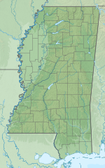 UBS Location of airport in Mississippi | |||||||||||
| Runways | |||||||||||
| |||||||||||
| Statistics (2012) | |||||||||||
| |||||||||||

Columbus-Lowndes County Airport (IATA: UBS[2], ICAO: KUBS, FAA LID: UBS) is a public use airport located three nautical miles (6 km) southeast of the central business district of Columbus, a city in Lowndes County, Mississippi, United States.[1] It is owned by the City of Columbus and Lowndes County.[1]
Facilities and aircraft[]
Columbus-Lowndes County Airport covers an area of 215 acres (87 ha) at an elevation of 188 feet (57 m) above mean sea level. It has one runway designated 18/36 with an asphalt surface measuring 4,500 by 100 feet (1,372 x 30 m).[1]
For the 12-month period ending January 18, 2012, the airport had 13,200 aircraft operations, an average of 36 per day: 96% general aviation, 2% air taxi, and 2% military. At that time there were 24 aircraft based at this airport: 71% single-engine, 12.5% multi-engine, 12.5% ultralight, and 4% glider.[1]
See also[]
References[]
- ^ a b c d e FAA Airport Form 5010 for UBS PDF. Federal Aviation Administration. Effective November 15, 2012.
- ^ "IATA Airport Code Search (UBS – City: Columbus, Airport: Lowndes County)". International Air Transport Association. Retrieved September 30, 2014.
External links[]
- Aerial image as of February 1996 from USGS The National Map
- FAA Terminal Procedures for UBS, effective February 24, 2022
- Resources for this airport:
- FAA airport information for UBS
- AirNav airport information for KUBS
- ASN accident history for UBS
- FlightAware airport information and live flight tracker
- SkyVector aeronautical chart for KUBS
- Airports in Mississippi
- Buildings and structures in Lowndes County, Mississippi
- Transportation in Lowndes County, Mississippi