Coochin Creek
| Coochin Creek Sunshine Coast, Queensland | |||||||||||||||
|---|---|---|---|---|---|---|---|---|---|---|---|---|---|---|---|
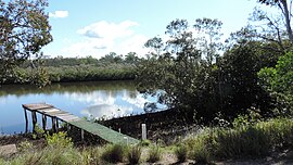 Coochin Creek as seen from The Esplanade, 2019 | |||||||||||||||
 Coochin Creek | |||||||||||||||
| Coordinates | 26°53′22″S 153°03′20″E / 26.8894°S 153.0555°ECoordinates: 26°53′22″S 153°03′20″E / 26.8894°S 153.0555°E | ||||||||||||||
| Population | 84 (2016 census)[1] | ||||||||||||||
| Postcode(s) | 4519 | ||||||||||||||
| Location | 17 km (11 mi) SE of Landsborough | ||||||||||||||
| LGA(s) | Sunshine Coast Region | ||||||||||||||
| County | Canning | ||||||||||||||
| Parish | Beerwah | ||||||||||||||
| State electorate(s) | Caloundra, Glass House | ||||||||||||||
| Federal division(s) | Fisher | ||||||||||||||
| |||||||||||||||

Coochin Creek is a coastal locality in the southern hinterland of the Sunshine Coast Region, Queensland, Australia.[2] In the 2016 census, Coochin Creek had a population of 84 people.[1]
Geography[]

Almost all of the locality's area is part of the Beerburrum State Forest.[3] The abandoned township of Campbellville is within Coochin Creek (26°52′29″S 153°02′17″E / 26.8747°S 153.0380°E).[4]
Although bounded to the east by the Australian mainland coast, Coochin does not face towards the Coral Sea but rather it faces the Pumicestone Passage which separates the mainland from Bribie Island. Pumicestone Passage is very narrow at that point and congested with low unnamed mangrove islands.[3]
History[]

James Campbell had a sawmill in Creek Street, Brisbane. Logs were cut in the Blackall Range and upper Caboolture River and hauled to Mellum Creek from where they were rafted down the Pumicestone Passage to the Creek Street sawmill. In 1881, James Campbell decided to establish a sawmill on the Coochin Creek near the confluence with Mellum Creek, from where the sawn timber was transported to Brisbane, initially via sailing cutter and from 1883 by paddlesteamer.[5]
The township of Campbellville of around 100 people developed around the sawmill. There was a wharf with cranes and a provisional school and cemetery. Campbellville lasted until 1890 when the mill closed down. By that time, the North Coast railway line had made it easier to transport logs and timber by rail than by ship.[5] The most obvious evidence remaining of the township is its cemetery.[6]
The Coochin Creek Provisional School opened in November 1888, becoming Coochin Creek State School on 1 January 1909. In about November 1928, it was renamed Beerwah State School. On 10 July 1952, another Coochin Creek State School opened, but it closed on 11 March 1962.[7][8]
Heritage listings[]
Coochin Creek has a number of heritage listings, including:
- Roys Road: Campbellville Settlement and Cemetery[6]
Amenities[]
There is a camping area off Roys Rd run by Queensland Government.[9]
References[]
- ^ a b Australian Bureau of Statistics (27 June 2017). "Coochin Creek (SSC)". 2016 Census QuickStats. Retrieved 20 October 2018.

- ^ "Coochin Creek – locality in the Sunshine Coast Region (entry 48576)". Queensland Place Names. Queensland Government. Retrieved 28 September 2017.
- ^ a b "Queensland Globe". State of Queensland. Retrieved 25 May 2019.
- ^ "Campbellville (entry 43530)". Queensland Place Names. Queensland Government. Retrieved 17 June 2015.
- ^ a b Powell, Judith. "Travel Routes, Forest Towns and Settlements" (PDF). Australian Government. p. 112. Archived from the original (PDF) on 17 June 2015. Retrieved 17 June 2015.
- ^ a b "Campbellville Settlement and Cemetery" (PDF). Sunshine Coast Region Heritage Register. Sunshine Coast Regional Council. Retrieved 20 April 2019.
- ^ "Agency ID 4832, Beerwah State School". Queensland State Archives. Retrieved 15 April 2014.
- ^ "Agency ID 4832, Coochin Creek State School". Queensland State Archives. Retrieved 15 April 2014.
- ^ Queensland Dept of National Parks, Sport and Racing. "Beerburrum and Beerwah State Forests - Camping Information". Archived from the original on 17 June 2015. Retrieved 17 June 2015.
Further reading[]
| Wikimedia Commons has media related to Coochin Creek, Queensland. |
- Gubby, A. C (1976), Campbellville and cedar days : an outline history of the former south-east Queensland sawmilling township of Campbellville and pioneers of the associated timber industry (2nd ed.), Department of Forestry, Queensland, ISBN 978-0-7242-0338-3
- Suburbs of the Sunshine Coast Region
- Coastline of Queensland
- Localities in Queensland