Corda, Ribeira Grande
Corda | |
|---|---|
Settlement | |
 The center of the village with the northernmost mountains of the island | |
 Corda | |
| Coordinates: 17°08′10″N 25°05′17″W / 17.136°N 25.088°WCoordinates: 17°08′10″N 25°05′17″W / 17.136°N 25.088°W | |
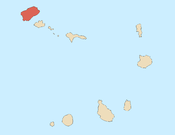
| Country | Cape Verde |
| Island | Santo Antão |
| Municipality | Ribeira Grande |
| Civil parish | Santo Crucifixo |
| Population (2010)[1] | |
| • Total | 833 |
| ID | 11307 |

Corda is a settlement in the island of Santo Antão, Cape Verde. It is part of the municipality Ribeira Grande. It is situated in the mountainous interior of the island at about 1,000 meters elevation, 13 km north of the island capital Porto Novo. Corda consists of several villages, including Chã de Corda and Esponjeiro. The national road from Porto Novo to Ribeira Grande (EN1-SA01) passes through Corda. The crater of Cova lies 4 km to the southeast. Corda lies in the Cova-Paul-Ribeira da Torre Natural Park.

Two species of cuckoo bees, Thyreus batelkai and Chiasmognathus batelkai, have been found near Esponjeiro.[2] Also a subspecies of butterflies, Leptotes pirithous capvertis has been found near Esponjeiro.[3]
Climate data[]
Esponjeiro (south of Corda) has a steppe climate. The annual rainfall is 351 millimeters. The average annual temperature is 15.1 °C (59.2 °F).[4]
| Climate data for Esponjeiro, 1371 metres ASL | |||||||||||||
|---|---|---|---|---|---|---|---|---|---|---|---|---|---|
| Month | Jan | Feb | Mar | Apr | May | Jun | Jul | Aug | Sep | Oct | Nov | Dec | Year |
| Average high °C (°F) | 15.5 (59.9) |
15.3 (59.5) |
15.9 (60.6) |
16.3 (61.3) |
17.2 (63.0) |
17.9 (64.2) |
19.0 (66.2) |
20.0 (68.0) |
20.3 (68.5) |
19.8 (67.6) |
18.5 (65.3) |
16.5 (61.7) |
17.7 (63.9) |
| Daily mean °C (°F) | 13.2 (55.8) |
12.8 (55.0) |
13.2 (55.8) |
13.6 (56.5) |
14.5 (58.1) |
15.3 (59.5) |
16.3 (61.3) |
17.3 (63.1) |
17.7 (63.9) |
17.4 (63.3) |
16.0 (60.8) |
14.4 (57.9) |
15.1 (59.2) |
| Average low °C (°F) | 10.9 (51.6) |
10.4 (50.7) |
10.6 (51.1) |
10.9 (51.6) |
11.9 (53.4) |
12.8 (55.0) |
13.7 (56.7) |
14.7 (58.5) |
15.1 (59.2) |
15.0 (59.0) |
13.6 (56.5) |
12.3 (54.1) |
12.7 (54.9) |
| Average rainfall mm (inches) | 24 (0.9) |
4 (0.2) |
4 (0.2) |
1 (0.0) |
0 (0) |
0 (0) |
20 (0.8) |
82 (3.2) |
105 (4.1) |
55 (2.2) |
31 (1.2) |
25 (1.0) |
351 (13.8) |
| Source: Climate-Data.ORG[4] | |||||||||||||
References[]
- ^ "2010 Census results". Instituto Nacional de Estatística Cabo Verde (in Portuguese). 24 November 2016.
- ^ Straka, J.; Engel, M.S. (2012). "The apid cuckoo bees of the Cape Verde Islands (Hymenoptera, Apidae)". ZooKeys (218): 77–109. doi:10.3897/zookeys.218.3683. PMC 3433874. PMID 22977347.
- ^ Libert, M.; Baliteau, L.; Baliteau, S. 2011: Two new Lycaenidae from Cape Verde (Lepidoptera). Bulletin de la Société entomologique de France, 116(1): 63–67.
- ^ a b "Climate: Espongeiro". Retrieved 5 January 2014.
External links[]
 Media related to Corda (Ribeira Grande) at Wikimedia Commons
Subdivisions of the island of Santo Antão | |||||||||
|---|---|---|---|---|---|---|---|---|---|
| Paul |
|  | |||||||
| Porto Novo |
| ||||||||
| Ribeira Grande |
| ||||||||
- Villages and settlements in Santo Antão, Cape Verde
- Ribeira Grande Municipality