Tarrafal de Monte Trigo
Tarrafal de Monte Trigo | |
|---|---|
Settlement | |
 | |
 | |
| Coordinates: 16°57′32″N 25°18′36″W / 16.959°N 25.310°WCoordinates: 16°57′32″N 25°18′36″W / 16.959°N 25.310°W | |
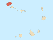
| Country | Cape Verde |
| Island | Santo Antão |
| Municipality | Porto Novo |
| Civil parish | São João Baptista |
| Population (2010)[1] | |
| • Total | 841 |
| ID | 13121 |

Tarrafal de Monte Trigo is a settlement in the southwestern part of the island of Santo Antão, Cape Verde. In 2010 its population was 841. It is situated on the coast, 27 km west of the island capital Porto Novo. The settlement was mentioned as Terrafal in the 1747 map by Jacques-Nicolas Bellin.[2]

The dirt road connecting Tarrafal with Porto Novo
History[]
Tarrafal de Monte Trigo is a rather long name considered important to avoid confusing it with other tarrafals in Cape Verde. There are over four of them, one on São Nicolau, and even another one on the island of Santo Antão, which is not really a village, but a section of Ribeira Grande, one of the largest towns on the island. The name Tarrafal comes from the shrub/tree Tamarix senegalensis or Tamarisk, called Tarrafe in Cape Verde.
See also[]
- List of villages and settlements in Cape Verde
References[]
- ^ "2010 Census results". Instituto Nacional de Estatística Cabo Verde (in Portuguese). 24 November 2016.
- ^ Jacques-Nicolas Bellin (1747). "Carte des Isles du Cap Verd = Kaart van de Eilanden van Kabo Verde" (in French).
External links[]
| hide Subdivisions of the island of Santo Antão | |||||||||
|---|---|---|---|---|---|---|---|---|---|
| Paul |
|  | |||||||
| Porto Novo |
| ||||||||
| Ribeira Grande |
| ||||||||
Categories:
- Villages and settlements in Santo Antão, Cape Verde
- Populated coastal places in Cape Verde
- Porto Novo Municipality
- Ports and harbours of Cape Verde