Crawford State Park (Kansas)
| Crawford State Park | |
|---|---|
 The shore and lake at Crawford State Park | |
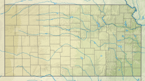 Location of Crawford State Park in Kansas | |
| Location | Crawford, Kansas, United States |
| Coordinates | 37°38′12″N 94°48′48″W / 37.63667°N 94.81333°WCoordinates: 37°38′12″N 94°48′48″W / 37.63667°N 94.81333°W |
| Area | 500 acres (200 ha) |
| Elevation | 994 ft (303 m)[1] |
| Established | 1930s |
| Named for | Gov. Samuel J. Crawford |
| Governing body | Kansas Department of Wildlife, Parks and Tourism |

Crawford State Park is a state park in Crawford County, Kansas, United States, located 9 miles (14 km) north of Girard.
The 500-acre (200 ha) park, resides on a 150-acre (61 ha) lake built by the Civilian Conservation Corps (CCC) in the 1930s. There are two recorded archaeological sites within the park's boundaries, including remnants of a 19th-century U.S. military outpost. An interpretive trail connects the park with the Kansas Department of Wildlife and Parks' , which was built shortly after the CCC completed construction of the lake.
Crawford State Park is known as a fishing destination for channel catfish, crappie, and striped bass. Boating and scuba diving are also popular in the park.
Located on the edge of the Ozarks, Crawford State Park features numerous redbud trees.
See also[]
References[]
- ^ "Crawford State Park". Geographic Names Information System. United States Geological Survey. 1984-07-01. Retrieved 2012-11-24.
External links[]
- "Crawford State Park". Kansas Department of Wildlife, Parks and Tourism. Retrieved 2012-11-11.
- State parks of Kansas
- State parks of the U.S. Interior Highlands
- Civilian Conservation Corps in Kansas
- Protected areas of Crawford County, Kansas