Croker Island
Native name: Margo | |
|---|---|
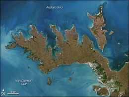 Image of Croker Island with Cobourg Peninsula | |
 Croker Island Croker Island (Northern Territory, Australia) | |
| Geography | |
| Location | Arafura Sea |
| Coordinates | 11°08′S 132°33′E / 11.133°S 132.550°E |
| Major islands | Croker, Darch, Templer |
| Area | 331.5 km2 (128.0 sq mi) |
| Length | 43 km (26.7 mi) |
| Width | 15 km (9.3 mi) |
| Highest elevation | 15 m (49 ft) |
| Administration | |
Australia | |
| Territory | Northern Territory |
| Shire | West Arnhem Region |
| Ward | |
| Largest settlement | Minjilang (pop. 271) |
| Demographics | |
| Population | 300 |
| Pop. density | 0.9/km2 (2.3/sq mi) |
| Ethnic groups | Yarmirr |

Croker Island is an island in the Arafura Sea off the coast of the Northern Territory, Australia, 200 km northeast of Darwin. It is separated from Cobourg Peninsula in the west by Bowen Strait, which is 2.5 km wide in the south and up to 7 km in the north, and 8.5 km long. In the north and east is the Arafura Sea, and in the south and southeast Mountnorris Bay. Croker Island measures 43 km from Point David (south, local name Inngirnatj) to Cape Croker (north), up to 15 km wide, and has an area of 331.5 km2 (128.0 sq. miles). At its highest point it is only 15 m (50 feet) above sea level. Croker Island is the largest island, and the only permanently inhabited island, in the Croker Group.
Settlement[]
At the earliest time of European contact, the indigenous people of Croker Island were the Jaako, who spoke Marrgu, a language isolate. The modern indigenous communities speak Iwaidja and Mawng.[1]
The only notable settlement on Croker Island is the Aboriginal community of Minjilang, located on Mission Bay on the east coast. Apart from that, there are nine small family outstations, the largest ones of which is Inngirnatj (Point David) at the southern end of the island. The settlements from north to south:
- Alamirra (close to Somerville Bay 1.5 km further the north)
- Timor Springs (north of Minjilang, 8 km by road)
- Wanakutja (on Palm Bay in the north-west)
- Minjilang (Mission Bay), the only village and main settlement of the island
- Adjamarrago (800 metres north of Croker Island Aerodrome, west of Minjilang)
- Keith William's Outstation (Arrgamumu, Arrgamurrmur) (south-east of Mission Bay)
- Walka (Barge Landing) (south side of Mission Bay, with barge pier)
- Sandy Bay (close to Sandy Bay on the east coast, but two kilometres to the coast)
- Marramarrani (southwest coast)
- Inngirnatj (Point David) (southern end, west side, with boat pier)
Between 1940 and 1968, the Methodist Overseas Mission operated the Croker Island Mission at Minjilang.[2][3]
1942 exodus[]
The Pacific theatre of World War II saw the Japanese military aerial bombing Darwin in February 1942. Non-indigenous children from the island were evacuated. To avoid the bombing, missionary Margaret Somerville led 95 indigenous children from the island's orphanage, part of the Croker Island Mission, on a journey that saw the party arrive on the Australian mainland. Travelling a distance overland, they boarding a train through central Australia, arriving in Sydney, New South Wales.[4] Over forty-four days, the group covered 5,000 miles (8,000 km).[5] The children returned to Croker Island in 1946.[2]
This expedition was described by Somerville in her book They crossed a continent, and later explored in the ABC documentary Croker Island Exodus.[5] The period is considered part of the Stolen Generations events.
Croker Island native title claim[]
The traditional custodians of Croker Island, the Yarmirr people, filed a claim over the sea surrounding Croker Island. The case, Yarmirr v Northern Territory, was settled in the High Court of Australia on 11 October 2001. The case established that the Yarmirr people do have native title of the sea and sea-bed, however common law rights of fishing and navigation mean that only non-exclusive native title can exist over the sea.[6]
Environment[]
Croker Island was severely damaged by Cyclone Ingrid in March 2005.[7]
A cull of feral horses was undertaken in 2015.[8]
References[]
- ^ Robert Mailhammer, 'Place names as clues to lost languages? A comparison between Europe and Australia,' in Peter K. Austin, Harold Koch & Jane Simpson (eds. Language, land & song:Studies in honour of Luise Hercus, EL Publishing. pp. 318–329
- ^ a b "Croker Island Mission (1940–1968)". Australian Government (Find and Connect Services). Retrieved 30 October 2018.
- ^ "Methodist Overseas Mission Croker Island Part-Aboriginal". Centre for Indigenous Family History Studies. Retrieved 30 October 2018.
National Archives of Australia Series F1 Item 1952/559
- ^ "Margaret Somerville, leader of World War II child exodus from Croker Island, dies aged 101". Australian Broadcasting Corporation. 1 August 2014. Retrieved 30 October 2018.
- ^ a b NICOL, Emily (16 March 2018). "Croker Island Exodus: A documentary telling the remarkable adventure story". National Indigenous Television. Retrieved 30 October 2018.
- ^ "The Commonwealth v Yarmirr [2001] HCA 56". High Court of Australia. Australian Government. Retrieved 11 September 2016.
- ^ "Cyclone batters NT's Croker Island". ABC News. 13 March 2005. Retrieved 11 September 2016.
- ^ McCue, Fred (4 February 2015). "Mission to cull the wild horses of Croker Island". NT News. Retrieved 11 September 2016.
- Arafura Sea
- Islands of the Northern Territory