Cross Keys Airport
Cross Keys Airport | |||||||||||
|---|---|---|---|---|---|---|---|---|---|---|---|
| Summary | |||||||||||
| Airport type | Public use | ||||||||||
| Owner | Cross Keys Airport Inc. | ||||||||||
| Serves | Cross Keys, New Jersey | ||||||||||
| Location | Gloucester County | ||||||||||
| Elevation AMSL | 162 ft / 49 m | ||||||||||
| Coordinates | 39°42′20″N 075°01′59″W / 39.70556°N 75.03306°WCoordinates: 39°42′20″N 075°01′59″W / 39.70556°N 75.03306°W | ||||||||||
| Map | |||||||||||
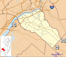 17N Location in Gloucester County, New Jersey | |||||||||||
| Runways | |||||||||||
| |||||||||||
| Statistics (2010) | |||||||||||
| |||||||||||

Cross Keys Airport (FAA LID: 17N) is a privately owned, public use airport located one nautical mile (2 km) south of the Cross Keys area of Monroe Township in Gloucester County, New Jersey, United States.[1] A skydiving operation is based at the airport.
History[]
Cross Keys Airport made international news on May 25, 2006 when several F-16 jets escorted a Cessna aircraft to land there after it strayed into a 30-mile restricted area temporarily imposed during the visit of U.S. President George W. Bush to a town in Pennsylvania. The pilot was said to be "in radio contact... compliant."[2]
Facilities and aircraft[]
Cross Keys Airport covers an area of 280 acres (113 ha) at an elevation of 162 feet (49 m) above mean sea level. It has one runway designated 9/27 with an asphalt surface measuring 3,500 by 50 feet (1,067 x 15 m).[1]
For the 12-month period ending December 31, 2010, the airport had 25,620 general aviation aircraft operations, an average of 70 per day. At that time there were 41 aircraft based at this airport: 90% single-engine and 10% multi-engine.[1]
See also[]
References[]
- ^ a b c d FAA Airport Form 5010 for 17N PDF. Federal Aviation Administration. Effective November 15, 2012.
- ^ "Fighters intercept small plane near Bush flight". SpaceWar.com. May 26, 2006.
External links[]
- Cross Keys Airport (17N) from New Jersey DOT Airport Directory
- Aerial image as of March 1995 from USGS The National Map
- Aviation photos of Cross Keys Airport at jetphotos.net
- Skydive Cross Keys / Freefall Adventures, Inc.
- FAA Terminal Procedures for 17N, effective February 24, 2022
- Resources for this airport:
- FAA airport information for 17N
- AirNav airport information for 17N
- FlightAware airport information and live flight tracker
- SkyVector aeronautical chart for 17N
- Airports in New Jersey
- Transportation buildings and structures in Gloucester County, New Jersey
- Monroe Township, Gloucester County, New Jersey