Croton River watershed
This page is about the Croton River watershed, a hydrological feature. For the component of the New York City water supply system with a similar name, see Croton Watershed

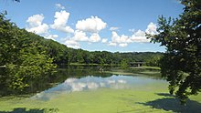
The Croton River watershed is the drainage basin of the Croton River and its seven tributary rivers, a hydrological feature in far southwestern New York State. Spanning large swaths of Putnam and Westchester counties, it is over 350 square miles (910 km2) in area and holds some 115 billion US gallons (440,000,000 m3) of fresh water.[a]
Largely physically overlapping the New York City water supply system's Croton Watershed,[b] the Croton River watershed represents the drainage and flow of some seven rivers, one dozen reservoirs, three controlled lakes,[1] large Lake Mahopac, and countless smaller lakes and ponds.
The vast majority of this[c] ends up at the Jerome Park Reservoir in the Bronx via the New Croton Aqueduct, from which it is distributed to New York City. Water in excess of the City's needs spills over the New Croton Dam at the New Croton Reservoir and is carried by the Croton River into the Hudson River at Croton-on-Hudson, New York, about 30 miles north of the Metropolitan area.
Definition[]

The Croton River watershed is a hydrological feature, the 361 sq mi (930 km2) [2] drainage basin of the Croton River and its tributaries. It is not synonymous with the Croton Watershed, a term describing the rivers, reservoirs, dams, pump systems, and other infrastructure of the southernmost watershed of the New York City water supply system. Numerous small natural lakes and ponds, as well as large Lake Mahopac, are within the river's watershed but not owned, leased, or controlled by the City water supply system (even though they too ultimately drain into it). A map of the actual Croton Watershed is found here.
The Croton River (/ˈkroʊtən/ KROH-tən) is a river in southern New York with three principal tributaries: the West Branch, Middle Branch, and East Branch. Their waters, all part of the City water supply system,[3] join downstream from the Croton Falls Reservoir.[d] Together, their waters and the reservoirs linked to them represent the northern half of the New York City water system's Croton Watershed.
Shortly after the confluence of the three Croton River branches the Croton River proper, along with its tributary, the Muscoot River, flow into the Muscoot Reservoir, after which it empties into the New Croton Reservoir, which feeds the New Croton Aqueduct supplying water to New York City via the Jerome Park Reservoir in the Bronx. Excess water leaves the spillway at the New Croton Dam and empties into the Hudson River at Croton-on-Hudson, New York at Croton Point, about 30 miles (50 km) north of New York City.[2]
Watershed[]
Waterways[]
Lakes and ponds[]
- Lake Mahopac
- Lake Carmel
- Long Pond (Carmel)
Reservoirs[]
- Boyds Corner
- West Branch
- Middle Branch
- Croton Falls / Diverting
- East Branch / Bog Brook
- Titicus
- Cross River
- Amawalk
- Muscoot
- New Croton
Controlled lakes[]
Aqueduct[]
- The New Croton Aqueduct, completed in 1890, brings water from the New Croton Reservoir in Westchester and Putnam counties.
Recreation[]
Limited recreation is permitted within the Croton Watershed. Its guidelines and requirements are listed here.
Notes[]
- ^ 15 billion US gallons (57,000,000 m3) in freshwater lakes and ponds, 86.6 billion US gallons (328,000,000 m3) in reservoirs, roughly 5.5 billion US gallons (21,000,000 m3) in controlled lakes, and 7.5 billion US gallons (28,000,000 m3) in its river system.
- ^ The land areas are the same, but their drainages are not. Numerous small natural lakes and ponds, as well as large Lake Mahopac, are part of the Croton River's watershed but not part of the NYC water supply system. A map of the actual Croton Watershed is found here.
The Croton Watershed, the New York City water supply system's term for its southernmost watershed area, also includes the physical infrastructure of dams, spillways, tunnels, pumps, and related mechanical components. - ^ Less the principal flows of the Boyds Corner Reservoir and the West Branch Reservoir, which are part of the system's Delaware Aqueduct supply
- ^ As a result of dam construction, the waters of the Middle and West Branches mingle in Croton Falls Reservoir before exiting as a brief stretch of the West Branch alone, which joins the East Branch at the confluence of the Croton River proper.
See also[]
- Old Croton aqueduct
- Water supply network
References[]
- ^ New York State Department of Health Regulations, Part 128-1.6(a)(20) - Definitions: Controlled lake
- ^ a b Institution of Civil Engineers (Great Britain) (1901). Minutes of proceedings of the Institution of Civil Engineers. The Institution. Retrieved 24 October 2011.
- ^ "Map of the Croton Watershed, at New York City Department of Environmental Protection". Archived from the original on 2019-02-21. Retrieved 2019-02-25.
External links[]
- Water infrastructure of New York City
- Watersheds of the United States