Cuito Cuanavale
Cuito Cuanavale | |
|---|---|
Municipality | |
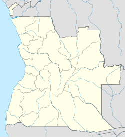 Cuito Cuanavale Location in Angola | |
| Coordinates: 15°10′S 19°10′E / 15.167°S 19.167°ECoordinates: 15°10′S 19°10′E / 15.167°S 19.167°E | |
| Country | |
| Province | Cuando Cubango |
| Area | |
| • Total | 35,610 km2 (13,750 sq mi) |
| Population (2014)[1] | |
| • Total | 40,829 |
| • Density | 1.8/km2 (5/sq mi) |
| Time zone | UTC+1 (WAT) |
| Climate | Cwa |

Cuito Cuanavale is a town and municipality in Cuando Cubango (Kuando-Kubango) province in Angola.[2][3] The names Kuito Kuanavale or Kwito Kwanavale are sometimes used, although this is a mutation of the original Portuguese name.
It covers an area of 35,610 square kilometres (13,750 sq mi) and its population as of 2014 is 40,829 inhabitants.[1] Cuito Cuanavale is bordered to the north by the municipality of Luchazes, to the east by the municipality of Mavinga, to the south by the municipality of Nancova, and to the west by the municipalities of Menongue and Chitembo
The area around the town was the scene of heavy fighting during various campaigns during the Angolan Civil War and the South African Border War, with the Battle of Cuito Cuanavale from 1987-1988 being the largest land battle in Africa since World War II. The town is served by Cuito Cuanavale Airport.
History[]
The town owes its name to two local rivers: the and the .[4] The city day is celebrated on October 21, with an annual celebration being organized for the occasion.
[]
It was in this municipality that some of the bloodiest clashes of the Angolan Civil War took place. On the one hand, the FAPLA, the armed forces of the MPLA, at the height of power fought, supported by the Cuban army, and on the other, the FALA, armed forces of UNITA, supported by the South African Army. Thousands of combatants died on both sides. At the end of the battle of Cuito Cuanavale, both UNITA and the MPLA declared themselves victorious. The biggest consequence of this conflict was the withdrawal of Cuban and South African forces from Angolan territory, and the consequent independence of Namibia.
See also[]
References[]
- ^ Jump up to: a b "Resultados Definitivos Recenseamento Geral da População e Habitação – 2014 Província do Cuando Cubango" (PDF). Instituto Nacional de Estatística, República de Angola. Retrieved 3 May 2020.
- ^ "City councils of Angola". Statoids. Retrieved April 7, 2009.
- ^ "Reference Center: Provinces". Angolan Embassy in the United States. Archived from the original on 11 February 2006.
- ^ "Perfil do Município do Cuito Cuanavale" (PDF) (in Portuguese). ANGOP.com. Retrieved 22 Mar 2016.
- Polack, Peter (2013). Last Hot Battle of the Cold War. Casemate. ISBN 978-1612001951.
| show Authority control |
|---|
This Angola location article is a stub. You can help Wikipedia by . |
- Populated places in Cuando Cubango Province
- Municipalities of Angola
- Angola geography stubs