Culebra Creek
| Culebra Creek | |
|---|---|
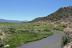 The creek near the town of San Luis | |
| Location | |
| Country | United States |
| Location | Costilla County, Colorado |
| Physical characteristics | |
| Source | |
| • location | Junction of El Valle Creek and Carneros Creek |
| • coordinates | 37°10′58″N 105°14′13″W / 37.1827°N 105.2369°W |
| Mouth | |
• location | Rio Grande |
• coordinates | 37°10′44″N 105°43′47″W / 37.1790°N 105.7297°WCoordinates: 37°10′44″N 105°43′47″W / 37.1790°N 105.7297°W |
| Length | 30 mi (48 km) |

Culebra Creek (also called Culebra River, Río de la Culebra or Río Culebra) is a stream in Costilla County, Colorado. It begins at the junction of El Valle and Carneros creeks and flows into the Rio Grande 11 miles east of Manassa, Colorado.[1]
History[]
In 1851, the first Europeans to live permanently in Colorado settled along the banks of Culebra Creek.[2] The creek is the source of the San Luis People's Ditch, an acequia, which was given the highest priority water rights in the state. The entire Culebra Creek Watershed supports fourteen acequias.[3]
See also[]
References[]
- ^ United States Geological Survey. Geographical Names Information System, Case brief for Culebra Creek Archived 2013-04-08 at the Wayback Machine. Viewed June 29, 2012.
- ^ Colorado State Archives. Colorado State Archives History FAQs. Archived June 29, 2013, at the Wayback Machine
- ^ Coyote Gulch [Blog]. Rio Grand River Basin: First Valley Water 2012 tour takes in the San Luis People’s Ditch./
| Authority control: National libraries |
|---|
Categories:
- Rivers of Colorado
- Rivers of Costilla County, Colorado
- Tributaries of the Rio Grande