San Luis, Colorado
San Luis, Colorado
San Luis de la Culebra | |
|---|---|
Statutory Town | |
| Town of San Luis | |
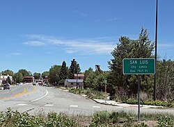 Entering San Luis from the west | |
| Motto(s): The Oldest Town in Colorado | |
 Location of San Luis in Costilla County, Colorado. | |
 San Luis Location of San Luis in Costilla County, Colorado. | |
| Coordinates: 37°12′7″N 105°25′22″W / 37.20194°N 105.42278°WCoordinates: 37°12′7″N 105°25′22″W / 37.20194°N 105.42278°W | |
| Country | |
| State | |
| County[1] | Costilla County - seat[2] |
| Established | April 9, 1851 |
| Incorporated | 1885 |
| Government | |
| • Type | Statutory Town[1] |
| Area | |
| • Total | 0.57 sq mi (1.47 km2) |
| • Land | 0.57 sq mi (1.47 km2) |
| • Water | 0.00 sq mi (0.00 km2) |
| Elevation | 7,979 ft (2,432 m) |
| Population (2010) | |
| • Total | 629 |
| • Estimate (2019)[6] | 658 |
| • Density | 1,160.49/sq mi (448.20/km2) |
| Time zone | UTC-7 (MST) |
| • Summer (DST) | UTC-6 (MDT) |
| ZIP code[5] | 81152 |
| Area code(s) | 719 |
| FIPS code | 08-68105 |
| GNIS feature ID | 0204787 |
| Website | townofsanluisco |

The Town of San Luis is a statutory town that is the county seat and the most populous town of Costilla County, Colorado, United States.[7] Formerly known as San Luis de la Culebra, San Luis is the oldest continuously occupied town in Colorado. The population was 629 at the 2010 census.[8]
History[]

The Town of San Luis is centuries younger than the pueblos and villages of northern New Mexico because Hispanic settlers were wary of venturing north of the 37th parallel north for fear of Ute and Comanche raids. Armed traders traveled the Old Spanish Trail through the area in the early 19th century. In 1821, the Treaty of Córdoba recognized the independence of Mexico from the Spanish Empire. The Treaty of Guadalupe Hidalgo annexed northern Mexico to the United States in 1848, and the Compromise of 1850 created the U.S. Territory of New Mexico.
Hispanic settlers from the Taos Valley established several small villages along the Rio Culebra in the San Luis Valley and officially took possession of this portion of the Sangre de Cristo Land Grant on April 9, 1851.[9][10][11][12][13] The settlers built a church in the central village of La Plaza Medio and dedicated it on the Feast of Saint Louis, June 21, 1851, renaming the village San Luis de la Culebra in honor of the saint.
The United States Army established Fort Massachusetts in 1852 and Fort Garland in 1858 to provide protection for the settlers in the valley. The village of San Luis remained part of the Territory of New Mexico until 1861 when the Territory of Colorado was established. San Luis became the seat of Costilla County in 1863, and remains so to this day. Colonel Christopher "Kit" Carson, Commander of Fort Garland, negotiated a treaty with the Ute people in 1867. Colorado became a state in 1876 and the Town of San Luis incorporated in 1885. Today, San Luis is the oldest continuously inhabited town in the State of Colorado.
A Pueblo Chieftain article dated June 8, 1872 describes the three stores of San Luis as kept by Fred Meyer & Co, Auguste Lacome, and Mazers & Rich in addition to a blacksmith, butcher, beer saloon, carpenter, and two hotels.
Today, the town is renowned for its Stations of the Cross ascending the local mesa. The town celebrates the Fiesta de Santiago y Santa Ana each July and the San Luis Manito Christmas celebration in December.
Geography[]
The town of San Luis lies in the San Luis Valley at 37°12′7″N 105°25′20″W / 37.20194°N 105.42222°W (37.201988, -105.422360).[14] Colorado State Highway 159 leads north 15 miles (24 km) to Fort Garland and U.S. Route 160, and south 18 miles (29 km) to the New Mexico border. Highway 142 leads west 31 miles (50 km) to Manassa.
According to the United States Census Bureau, the town has a total area of 0.54 square miles (1.4 km2), all of it land.[8]
Demographics[]
| Historical population | |||
|---|---|---|---|
| Census | Pop. | %± | |
| 1970 | 781 | — | |
| 1980 | 842 | 7.8% | |
| 1990 | 800 | −5.0% | |
| 2000 | 739 | −7.6% | |
| 2010 | 629 | −14.9% | |
| 2019 (est.) | 658 | [6] | 4.6% |
| U.S. Decennial Census[15] | |||
As of the census of 2000,[16] there were 739 people, 322 households, and 200 families residing in the town. The population density was 1,555.2 people per square mile (594.4/km2). There were 376 housing units at an average density of 791.3 per square mile (302.4/km2). The racial makeup of the town was 60.49% White, 0.27% African American, 2.44% Native American, 0.14% Pacific Islander, 29.50% from other races, and 7.17% from two or more races. Hispanic or Latino of any race were 88.77% of the population.
There were 322 households, out of which 28.3% had children under the age of 18 living with them, 40.7% were married couples living together, 16.8% had a female householder with no husband present, and 37.6% were non-families. 33.2% of all households were made up of individuals, and 14.0% had someone living alone who was 65 years of age or older. The average household size was 2.30 and the average family size was 2.94.
In the town, the population was spread out, with 23.4% under the age of 18, 7.3% from 18 to 24, 21.7% from 25 to 44, 27.9% from 45 to 64, and 19.8% who were 65 years of age or older. The median age was 43 years. For every 100 females, there were 94.5 males. For every 100 females age 18 and over, there were 89.9 males.
The median income for a household in the town was $14,213, and the median income for a family was $20,875. Males had a median income of $20,156 versus $13,333 for females. The per capita income for the town was $8,887. About 29.9% of families and 34.3% of the population were below the poverty line, including 41.1% of those under age 18 and 21.2% of those age 65 or over.
See also[]
- Old Spanish National Historic Trail
- Culebra Range
- Auguste Lacome
References[]
- ^ Jump up to: a b "Active Colorado Municipalities". State of Colorado, Department of Local Affairs. Archived from the original on 2009-12-12. Retrieved 2007-09-01.
- ^ "Colorado County Seats". State of Colorado, Department of Public Health and Environment. Retrieved 2007-12-31.
- ^ "2019 U.S. Gazetteer Files". United States Census Bureau. Retrieved July 1, 2020.
- ^ "US Board on Geographic Names". United States Geological Survey. 2007-10-25. Retrieved 2008-01-31.
- ^ "ZIP Code Lookup". United States Postal Service. Archived from the original (JavaScript/HTML) on November 4, 2010. Retrieved January 1, 2008.
- ^ Jump up to: a b "Population and Housing Unit Estimates". United States Census Bureau. May 24, 2020. Retrieved May 27, 2020.
- ^ "Find a County". National Association of Counties. Retrieved 2011-06-07.
- ^ Jump up to: a b "Geographic Identifiers: 2010 Demographic Profile Data (G001): San Luis town, Colorado". U.S. Census Bureau, American Factfinder. Archived from the original on February 12, 2020. Retrieved June 24, 2014.
- ^ The Culebra River Villages of Costilla County, Colorado, Colorado Historical Society
- ^ Land of Contrast: A History of Southeast Colorado, U.S. Bureau of Land Management
- ^ San Luis, Colorado @ sangre.com
- ^ Town of San Luis Archived 2010-06-25 at the Wayback Machine, Costilla County, Colorado
- ^ San Luis de la Culebra.
- ^ "US Gazetteer files: 2010, 2000, and 1990". United States Census Bureau. 2011-02-12. Retrieved 2011-04-23.
- ^ "Census of Population and Housing". Census.gov. Retrieved June 4, 2015.
- ^ "U.S. Census website". United States Census Bureau. Retrieved 2008-01-31.
External links[]
| Wikimedia Commons has media related to San Luis, Colorado. |
| show Municipalities and communities of Costilla County, Colorado, United States |
|---|


| show Authority control |
|---|
- County seats in Colorado
- Hispanic and Latino American culture in Colorado
- Populated places established in 1851
- Towns in Costilla County, Colorado
- Towns in Colorado
- 1851 establishments in New Mexico Territory