Elbert County, Colorado
Elbert County | |
|---|---|
U.S. county | |
 | |
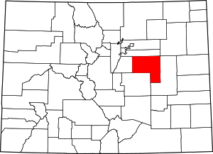 Location within the U.S. state of Colorado | |
 Colorado's location within the U.S. | |
| Coordinates: 39°17′N 104°08′W / 39.28°N 104.13°W | |
| Country | |
| State | |
| Founded | February 2, 1874 |
| Named for | Samuel Hitt Elbert |
| Seat | Kiowa |
| Largest town | Elizabeth |
| Area | |
| • Total | 1,851 sq mi (4,790 km2) |
| • Land | 1,851 sq mi (4,790 km2) |
| • Water | 0.2 sq mi (0.5 km2) 0.01%% |
| Population | |
| • Estimate (2020) | 26,062 |
| • Density | 12/sq mi (5/km2) |
| Time zone | UTC−7 (Mountain) |
| • Summer (DST) | UTC−6 (MDT) |
| Congressional district | 4th |
| Website | www |

Elbert County is a county located in the U.S. state of Colorado. As of the 2020 census, the population was 26,062.[1] The county seat is Kiowa and the largest town is Elizabeth.[2]
Elbert County is included in the Denver-Aurora-Lakewood, CO Metropolitan Statistical Area.
History[]
Elbert County was created on February 2, 1874, from the eastern portions of Douglas County. On February 6, 1874, the county was enlarged to include part of northern Greenwood County upon Greenwood's dissolution, and originally extended south and east of its present boundaries to reach to the Kansas state line. The county was named for Samuel Hitt Elbert,[3] the Governor of the Territory of Colorado when the county was formed. In 1889, Elbert County was reduced to its modern size when its eastern portions were taken to create Lincoln, Kit Carson, and Cheyenne counties.
Geography[]
According to the U.S. Census Bureau, the county has a total area of 1,851 square miles (4,790 km2), of which 1,851 square miles (4,790 km2) is land and 0.2 square miles (0.52 km2) (0.01%) is water.[4]
Adjacent counties[]
- Arapahoe County - north
- Lincoln County - east
- El Paso County - south
- Douglas County - west
Major Highways[]
 Interstate 70
 I-70 BS
- I-70 BS
 U.S. Highway 24
 U.S. Highway 40
 U.S. Highway 287
 State Highway 86
Demographics[]
| Historical population | |||
|---|---|---|---|
| Census | Pop. | %± | |
| 1880 | 1,708 | — | |
| 1890 | 1,856 | 8.7% | |
| 1900 | 3,101 | 67.1% | |
| 1910 | 5,331 | 71.9% | |
| 1920 | 6,980 | 30.9% | |
| 1930 | 6,580 | −5.7% | |
| 1940 | 5,460 | −17.0% | |
| 1950 | 4,477 | −18.0% | |
| 1960 | 3,708 | −17.2% | |
| 1970 | 3,903 | 5.3% | |
| 1980 | 6,850 | 75.5% | |
| 1990 | 9,646 | 40.8% | |
| 2000 | 19,872 | 106.0% | |
| 2010 | 23,086 | 16.2% | |
| 2020 | 26,062 | 12.9% | |
| U.S. Decennial Census[5] 1790-1960[6] 1900-1990[7] 1990-2000[8] 2010-2020[1] | |||
At the 2000 census there were 19,872 people, 6,770 households, and 5,652 families in the county. The population density was 11 people per square mile (4/km2). There were 7,113 housing units at an average density of 4 per square mile (1/km2). The racial makeup of the county was 95.22% White, 0.64% Black or African American, 0.63% Native American, 0.37% Asian, 0.09% Pacific Islander, 1.28% from other races, and 1.76% from two or more races. 3.85% of the population were Hispanic or Latino of any race.[9] Of the 6,770 households 42.80% had children under the age of 18 living with them, 75.10% were married couples living together, 5.70% had a female householder with no husband present, and 16.50% were non-families. 12.20% of households were one person and 3.10% were one person aged 65 or older. The average household size was 2.93 and the average family size was 3.19.
The age distribution was 30.20% under the age of 18, 5.50% from 18 to 24, 32.80% from 25 to 44, 25.50% from 45 to 64, and 6.00% 65 or older. The median age was 37 years. For every 100 females there were 100.60 males. For every 100 females age 18 and over, there were 99.90 males.
The median household income was $62,480 and the median family income was $66,740. Males had a median income of $45,329 versus $29,767 for females. The per capita income for the county was $24,960. About 2.50% of families and 4.00% of the population were below the poverty line, including 4.60% of those under age 18 and 4.50% of those age 65 or over.
Communities[]
Towns[]
Census-designated places[]
Other unincorporated places[]
Politics[]
Elbert is a strongly Republican county in Presidential elections. Along with Rio Blanco County and Kit Carson County, it was one of three Colorado counties to be won by Alf Landon in 1936, and stood together with Hinsdale and Washington Counties by supporting Barry Goldwater over Lyndon Johnson in 1964. The last Democratic presidential nominee to carry Elbert County was Franklin Delano Roosevelt in 1932.
Elbert County is in the and the current representative is Republican Ken Buck from Windsor.
In senatorial elections, the county has been similarly Republican. No Democratic senatorial candidate has obtained even thirty percent of the county's vote since Ben Nighthorse Campbell, who was later to shift to the Republican Party, in 1992, and none have actually won since before 1990. In gubernatorial elections, Elbert County has also generally been powerfully Republican, but was nonetheless carried by Democrat Roy Romer by a narrow margin in 1990[11] – when he carried all but four counties statewide – by Dick Lamm in 1982[12] and by Constitution Party candidate Tom Tancredo in 2010.[13]
The official newspaper of record used by the county is the weekly Elbert County News.[14] The weekly Ranchland News and monthly Prairie Times also cover local events.
See also[]
- Outline of Colorado
- Index of Colorado-related articles
- Greenwood County, Colorado Territory
- National Register of Historic Places listings in Elbert County, Colorado
Notes[]
- ^ The leading "other" candidate, Progressive Theodore Roosevelt, received 630 votes, while Socialist candidate Eugene Debs received 121 votes, Prohibition candidate Eugene Chafin received 41 votes, and Socialist Labor candidate Arthur Reimer received 3 votes.
External links[]
References[]
- ^ Jump up to: a b "State & County QuickFacts". United States Census Bureau. Retrieved September 5, 2021.
- ^ "Find a County". National Association of Counties. Archived from the original on July 12, 2012. Retrieved June 7, 2011.
- ^ Gannett, Henry (1905). The Origin of Certain Place Names in the United States. Govt. Print. Off. pp. 116.
- ^ "US Gazetteer files: 2010, 2000, and 1990". United States Census Bureau. February 12, 2011. Retrieved April 23, 2011.
- ^ "U.S. Decennial Census". United States Census Bureau. Retrieved June 7, 2014.
- ^ "Historical Census Browser". University of Virginia Library. Retrieved June 7, 2014.
- ^ "Population of Counties by Decennial Census: 1900 to 1990". United States Census Bureau. Retrieved June 7, 2014.
- ^ "Census 2000 PHC-T-4. Ranking Tables for Counties: 1990 and 2000" (PDF). United States Census Bureau. Retrieved June 7, 2014.
- ^ "U.S. Census website". United States Census Bureau. Retrieved May 14, 2011.
- ^ Leip, David. "Dave Leip's Atlas of U.S. Presidential Elections". uselectionatlas.org. Retrieved May 26, 2017.
- ^ Dave Leip’s U.S. Election Atlas; 1990 Gubernatorial General Election Results – Colorado
- ^ Dave Leip’s U.S. Election Atlas; 1982 Gubernatorial General Election Results – Colorado
- ^ Dave Leip’s U.S. Election Atlas; 2010 Gubernatorial General Election Results – Colorado
- ^ Humanities, National Endowment for the. "Elbert County news". Retrieved December 8, 2019.
| show Places adjacent to Elbert County, Colorado |
|---|
| show Municipalities and communities of Elbert County, Colorado, United States |
|---|


| show Authority control |
|---|
- Colorado counties
- Elbert County, Colorado
- 1874 establishments in Colorado Territory
- Eastern Plains
- Populated places established in 1874