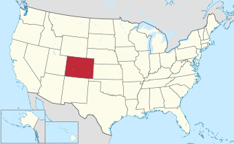
List of counties in Colorado

Carson
Plata
The U.S. State of Colorado is divided into 64 counties. Counties are important units of government in Colorado since there are no townships or other minor civil divisions. Two of these counties, Broomfield and Denver, have consolidated city and county governments.
Colorado's ISO 3166-2:US state code is US-CO and its ANSI INCITS 38:2009 state code is 08.
History[]
On November 1, 1861, the new Territory of Colorado created 17 original counties: Arapahoe, Boulder, Clear Creek, Costilla, Douglas, El Paso, Fremont, Gilpin, Guadalupe, Huerfano, Jefferson, Lake, Larimer, Park, Pueblo, Summit, and Weld; plus the Cheyenne Reserve.[1][2]
On February 9, 1866, the first new county, Las Animas, was created, followed by Saguache in December of that year. Bent County was created in February 1870, followed by Greenwood the following month. On February 2, 1874, Grand County and Elbert County were formed, and on February 10, La Plata, Hinsdale, and Rio Grande counties were created. Greenwood was absorbed into Bent on February 5. The last county to be created under the Colorado Territory name was San Juan County, created three months before statehood.
By the time Colorado became a state on August 1, 1876, it had only 26 counties. In January 1877, Routt and Ouray were formed, followed by Gunnison and Custer counties in March. In February 1879, Chaffee County was created. From February 8–10, 1879, Lake county was renamed Carbonate County. In 1881, Dolores County and Pitkin County were created. In 1883, Montrose, Mesa, Garfield, Eagle, Delta, and San Miguel counties were formed, leaving the total number of counties at 39. The number rose to 40 in 1885 with the creation of Archuleta County on April 14. Washington County and Logan County were both created in 1887. Between February 19 and April 16 in 1889, Morgan, Yuma, Cheyenne, Otero, Rio Blanco, Phillips, Sedgwick, Kiowa, Kit Carson, Lincoln, Prowers, Baca, and Montezuma counties were formed, bringing the total to 55. By 1900, Mineral County and Teller County had been added. On November 15, 1902, Arapahoe County was split into Adams and South Arapahoe Counties, and Denver was consolidated as a city and county from portions of both newly formed counties on December 1, 1902.[3] By 1912, Jackson County, Moffat County, and Crowley County had been created. Alamosa was created in 1913, and in 2001, Broomfield was consolidated as a city and county, bringing the total to 64 counties.
Table of counties[]
| County |
FIPS code[4][a] | County seat[5][6] | Est.[7] | Formed from[7] | Etymology[7] | Population[8] | Area[5] | Map |
|---|---|---|---|---|---|---|---|---|
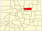
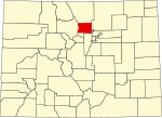
| Adams County | 001 | Brighton | 1902-11-15 | Split from Arapahoe County. | Named in honor of Alva Adams, the 5th, 10th, and 14th Governor of the State of Colorado. | 519,572 | 1,182.29 sq mi (3,062 km2) |
|
| Alamosa County | 003 | Alamosa | 1913-03-08 | Split from Costilla County and Conejos County. | Named for the cottonwood trees which grow along the Rio Grande and its tributaries. Alamosa is a Spanish word for a cottonwood grove. | 16,376 | 723.21 sq mi (1,873 km2) |
|
| Arapahoe County | 005 | Littleton | 1861-11-01 | Created as one of the 17 original counties of the Territory of Colorado. Renamed South Arapahoe County for the five months from November 15, 1902 to April 11, 1903. | Named for predecessor Arapahoe County, Kansas Territory, which in turn was named for the Arapaho Nation of Native Americans. | 655,070 | 804.41 sq mi (2,083 km2) |

|
| Archuleta County | 007 | Pagosa Springs | 1885-04-14 | Split from Conejos County. | Named in honor of Colorado State Senator Antonio D. Archuleta and his father, José Manuel Archuleta. | 13,359 | 1,354.53 sq mi (3,508 km2) |
|
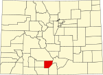
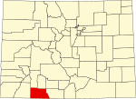
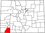
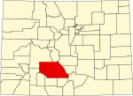
| Baca County | 009 | Springfield | 1889-04-16 | Split from Las Animas County. | Named in honor of pioneer and Colorado territorial legislator Felipe Baca. | 3,506 | 2,558.48 sq mi (6,626 km2) |

|
| Bent County | 011 | Las Animas | 1870-02-11 | Split from Huerfano County and former Cheyenne and Arapaho tribal land. | Named in honor of frontier trader William Bent. | 5,650 | 1,541.07 sq mi (3,991 km2) |

|
| Boulder County | 013 | Boulder | 1861-11-01 | Created as one of the 17 original counties of the Territory of Colorado. | Named for the abundance of granite boulders along Boulder Creek. | 330,758 | 740.48 sq mi (1,918 km2) |
|
| City and County of Broomfield | 014 | Broomfield | 2001-11-15 | Split from Boulder, Adams, Jefferson, and Weld counties and reorganized as a consolidated city and county. | Named for the broom corn that was formerly grown in the area. | 74,112 | 33.57 sq mi (87 km2) |

|
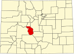
| Chaffee County | 015 | Salida | 1879-02-10 | Split from Carbonate County. | Named in honor of Jerome Bunty Chaffee, one of Colorado's first two U.S. Senators from 1876 to 1879. | 19,476 | 1,014.12 sq mi (2,627 km2) |
|
| Cheyenne County | 017 | Cheyenne Wells | 1889-03-25 | Split from Elbert and Bent counties. | Named for the Cheyenne Nation of Native Americans. | 1,748 | 1,781.90 sq mi (4,615 km2) |

|
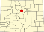
| Clear Creek County | 019 | Georgetown | 1861-11-01 | Created as one of the 17 original counties of the Territory of Colorado. | Named for Clear Creek which originates in the county. | 9,397 | 396.53 sq mi (1,027 km2) |
|
| Conejos County | 021 | Conejos | 1861-11-01 | Guadalupe County, one of the 17 original counties of the Territory of Colorado, was renamed Conejos County after six days on November 7, 1861. | Named for the cottontail rabbits in the area. Conejos is a Spanish word for rabbits. | 7,461 | 1,290.22 sq mi (3,342 km2) |

|
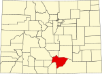
| Costilla County | 023 | San Luis | 1861-11-01 | Created as one of the 17 original counties of the Territory of Colorado. | Named for the Costilla River. Costilla is a Spanish word meaning either little rib or furring timber. | 3,499 | 1,229.38 sq mi (3,184 km2) |

|
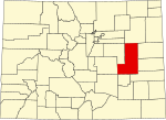
| Crowley County | 025 | Ordway | 1911-05-29 | Split from Otero County. | Named in honor of Colorado State Senator John H. Crowley. | 5,922 | 800.27 sq mi (2,073 km2) |

|
| Custer County | 027 | Westcliffe | 1877-03-09 | Split from Fremont County. | Named in memory of George Armstrong Custer, (1839 - 1876), the U.S. Army colonel defeated and killed at the Battle of the Little Bighorn. | 4,704 | 739.24 sq mi (1,915 km2) |

|
| Delta County | 029 | Delta | 1883-02-11 | Split from Gunnison County. | Named for the town of Delta located at the delta of the Uncompahgre River. | 31,196 | 1,149.44 sq mi (2,977 km2) |

|
| City and County of Denver | 031 | Denver | 1902-12-01 | The original Arapahoe County Seat was split from Arapahoe and the newly-created Adams Counties, and reorganized as a consolidated city and county. | Named to curry favor with James W. Denver, Governor of the Territory of Kansas from 1857 to 1859. | 715,522 | 155.66 sq mi (403 km2) |

|
| Dolores County | 033 | Dove Creek | 1881-03-04 | Split from Ouray County. | Named for the Dolores River, which was originally named el Rio de Nuestra Senora de los Dolores, which is Spanish for the River of our Lady of Sorrows. | 2,326 | 1,076.93 sq mi (2,789 km2) |

|
| Douglas County | 035 | Castle Rock | 1861-11-01 | Created as one of the 17 original counties of the Territory of Colorado. | Named in honor of Stephen Arnold Douglas, (1813 - 1861), U.S. Senator from Illinois from 1847 to 1861. | 357,978 | 842.30 sq mi (2,182 km2) |

|
| Eagle County | 037 | Eagle | 1883-02-11 | Split from Summit County. | Named for the Eagle River which originates in the county. | 55,731 | 1,700.76 sq mi (4,405 km2) |

|
| El Paso County | 041 | Colorado Springs | 1861-11-01 | Created as one of the 17 original counties of the Territory of Colorado. | Named for Ute Pass, which connects the Great Plains to South Park and was formerly located within the county. El Paso means the pass in Spanish. | 730,395 | 2,128.60 sq mi (5,513 km2) |

|
| Elbert County | 039 | Kiowa | 1874-02-02 | Split from Douglas County. | Named in honor of Samuel Hitt Elbert, the sixth Governor of the Territory of Colorado. | 26,062 | 1,849.08 sq mi (4,789 km2) |

|
| Fremont County | 043 | Cañon City | 1861-11-01 | Created as one of the 17 original counties of the Territory of Colorado. | Named in honor of John Charles Frémont (1813 - 1890), the explorer, U.S. Army general, and U.S. Senator from California. | 48,939 | 1,533.09 sq mi (3,971 km2) |

|
| Garfield County | 045 | Glenwood Springs | 1883-02-10 | Split from Summit County. | Named in honor of James Abram Garfield (1831 - 1881), the twentieth President of the United States. | 61,685 | 2,958.23 sq mi (7,662 km2) |

|
| Gilpin County | 047 | Central City | 1861-11-01 | Created as one of the 17 original counties of the Territory of Colorado. | Named in honor of William Gilpin, the first Governor of the Territory of Colorado. | 5,808 | 150.15 sq mi (389 km2) |

|
| Grand County | 049 | Hot Sulphur Springs | 1874-02-02 | Split from Summit County. | Named for the Grand River which originates in the county. The Grand River was renamed the Colorado River in 1921, but the county retains the original name. | 15,717 | 1,868.53 sq mi (4,839 km2) |

|
| Gunnison County | 051 | Gunnison | 1877-03-09 | Split from Lake County. | Named in honor of John Williams Gunnison, the U.S. Army captain who explored the region. | 16,918 | 3,259.22 sq mi (8,441 km2) |

|
| Hinsdale County | 053 | Lake City | 1874-02-10 | Split from Lake, Conejos, and Costilla counties. | Named in honor of George Aaron Hinsdale, a Lieutenant Governor of the Territory of Colorado. | 788 | 1,123.35 sq mi (2,909 km2) |

|
| Huerfano County | 055 | Walsenburg | 1861-11-01 | Created as one of the 17 original counties of the Territory of Colorado. | Named for Huerfano Butte, a solitary volcanic plug. Huérfano is a Spanish word meaning orphan. | 6,820 | 1,592.37 sq mi (4,124 km2) |
|
| Jackson County | 057 | Walden | 1909-05-05 | Split from Larimer County. | Named in honor of Andrew Jackson (1767 - 1845), the seventh President of the United States. | 1,379 | 1,619.75 sq mi (4,195 km2) |

|
| Jefferson County | 059 | Golden | 1861-11-01 | Created as one of the 17 original counties of the Territory of Colorado. | Named for its extralegal predecessor county, Jefferson County, Jefferson Territory, which in turn was named in honor of Thomas Jefferson (1743 - 1826), the author of the Declaration of Independence and the third President of the United States. | 582,910 | 772.85 sq mi (2,002 km2) |

|
| Kiowa County | 061 | Eads | 1889-04-11 | Split from Bent County. | Named for the Kiowa Nation of Native Americans. | 1,446 | 1,785.90 sq mi (4,625 km2) |

|
| Kit Carson County | 063 | Burlington | 1889-04-11 | Split from Elbert County. | Named in honor of Christopher Houston "Kit" Carson, the famous frontier scout and soldier. | 7,087 | 2,162.43 sq mi (5,601 km2) |

|
| La Plata County | 067 | Durango | 1874-02-10 | Split from Lake and Conejos counties. | Named for the many silver deposits in the area. La plata is a Spanish expression for the silver. | 55,638 | 1,700.44 sq mi (4,404 km2) |
|
| Lake County | 065 | Leadville | 1861-11-01 | Created as one of the 17 original counties of the Territory of Colorado. Renamed Carbonate County for the two days from February 8–10, 1879. | Named for the Twin Lakes in the county. | 7,436 | 383.55 sq mi (993 km2) |

|
| Larimer County | 069 | Fort Collins | 1861-11-01 | Created as one of the 17 original counties of the Territory of Colorado. | Named in honor of William Larimer, a pioneer entrepreneur. | 359,066 | 2,631.75 sq mi (6,816 km2) |

|
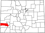
| Las Animas County | 071 | Trinidad | 1866-02-09 | Split from Huerfano County. | Named for the Purgatoire River, which was originally named el Rio de las Animas Perdidas, which is Spanish for the River of the Souls in Purgatory. | 14,555 | 4,773.27 sq mi (12,363 km2) |

|
| Lincoln County | 073 | Hugo | 1889-04-11 | Split from Elbert and Bent counties. | Named in honor of Abraham Lincoln (1809 - 1865), the sixteenth President of the United States. | 5,675 | 2,585.21 sq mi (6,696 km2) |
|
| Logan County | 075 | Sterling | 1887-02-25 | Split from Weld County. | Named in honor of John Alexander Logan (1826 - 1886), a U.S. Army general and U.S. Senator from Illinois. | 21,528 | 1,845.31 sq mi (4,779 km2) |

|
| Mesa County | 077 | Grand Junction | 1883-02-14 | Split from Gunnison County. | Named for the mesa formations which are widespread through the area. | 155,703 | 3,345.69 sq mi (8,665 km2) |

|
| Mineral County | 079 | Creede | 1893-03-27 | Split from Hinsdale, Rio Grande, and Saguache counties. | Named from the plentiful mineral deposits found in the area. | 865 | 878.16 sq mi (2,274 km2) |

|
| Moffat County | 081 | Craig | 1911-02-27 | Split from Routt County. | Named in honor of railroad pioneer David H. Moffat. | 13,292 | 4,755.86 sq mi (12,318 km2) |

|
| Montezuma County | 083 | Cortez | 1889-04-16 | Split from La Plata County. | Named in honor of Aztec leader Moctezuma II. Ruins in the area were once thought to be Aztec. | 25,849 | 2,035.80 sq mi (5,273 km2) |

|
| Montrose County | 085 | Montrose | 1883-02-11 | Split from Gunnison County. | Named for the town of Montrose, which in turn was probably named from the novel A Legend of Montrose, published in 1819 by Walter Scott. | 42,679 | 2,246.43 sq mi (5,818 km2) |

|
| Morgan County | 087 | Fort Morgan | 1889-02-19 | Split from Weld County. | Named for old Fort Morgan, which in turn was named in honor of U.S. Army Colonel . | 29,111 | 1,293.83 sq mi (3,351 km2) |

|
| Otero County | 089 | La Junta | 1889-03-25 | Split from Bent County. | Named in honor of Miguel A. Otero of the prominent Otero family of the Southwest. | 18,690 | 1,267.66 sq mi (3,283 km2) |

|
| Ouray County | 091 | Ouray | 1877-01-18 | Split from Hinsdale and Lake counties. Renamed Uncompaghre County for four days from 1883-02-27, to 1883-03-02. | Named in honor of Ouray, a Ute Native American leader. | 4,874 | 542.30 sq mi (1,405 km2) |

|
| Park County | 093 | Fairplay | 1861-11-01 | Created as one of the 17 original counties of the Territory of Colorado. | Named for South Park which occupies most of the county. | 17,390 | 2,209.36 sq mi (5,722 km2) |

|
| Phillips County | 095 | Holyoke | 1889-03-27 | Split from Logan County. | Named in honor of R.O. Phillips, secretary of the Lincoln Land Company, which sold farmsteads in the area. | 4,530 | 688.30 sq mi (1,783 km2) |

|
| Pitkin County | 097 | Aspen | 1881-02-23 | Split from Gunnison County. | Named in honor of Frederick Walker Pitkin, the second Governor of the State of Colorado. | 17,358 | 970.37 sq mi (2,513 km2) |

|
| Prowers County | 099 | Lamar | 1889-04-11 | Split from Bent County. | Named in honor of John W. Prowers, a pioneer of the Arkansas River valley. | 11,999 | 1,645.37 sq mi (4,261 km2) |

|
| Pueblo County | 101 | Pueblo | 1861-11-01 | Created as one of the 17 original counties of the Territory of Colorado. | Named for historic town of Pueblo. Pueblo is a Spanish word meaning village or people. | 168,162 | 2,396.77 sq mi (6,208 km2) |

|
| Rio Blanco County | 103 | Meeker | 1889-03-25 | Split from Garfield County. | Named for the White River, which was originally named Rio Blanco in Spanish. | 6,529 | 3,226.24 sq mi (8,356 km2) |

|
| Rio Grande County | 105 | Del Norte | 1874-02-10 | Split from Costilla County and Conejos County counties. | Named for the Rio Grande, which flows through the area. | 11,539 | 913.10 sq mi (2,365 km2) |

|
| Routt County | 107 | Steamboat Springs | 1877-01-29 | Split from Grand County. | Named in honor of John Long Routt, the first Governor of the State of Colorado. | 24,829 | 2,362.11 sq mi (6,118 km2) |

|
| Saguache County | 109 | Saguache | 1866-12-29 | Split from Lake and Costilla counties. | Name comes from a Ute language noun meaning "sand dunes".[b][9] | 6,368 | 3,168.32 sq mi (8,206 km2) |
|
| San Juan County | 111 | Silverton | 1876-01-31 | Split from Lake County. | Named for the San Juan River and San Juan Mountains, which in turn were named for Saint John the Evangelist. | 705 | 388.99 sq mi (1,007 km2) |

|
| San Miguel County | 113 | Telluride | 1883-03-02 | Split from San Juan County. | Named for the San Miguel River and San Miguel Mountains, which in turn were named for Saint Michael the Archangel. | 8,072 | 1,290.76 sq mi (3,343 km2) |
|
| Sedgwick County | 115 | Julesburg | 1889-04-09 | Split from Logan County. | Named for Fort Sedgwick, which, in turn, was named for U.S. Army General John Sedgwick (1813 - 1864). | 2,404 | 548.83 sq mi (1,421 km2) |

|
| Summit County | 117 | Breckenridge | 1861-11-01 | Created as one of the 17 original counties of the Territory of Colorado. | Named for the many high mountain summits in the area. | 31,055 | 618.92 sq mi (1,603 km2) |

|
| Teller County | 119 | Cripple Creek | 1899-03-23 | Split from El Paso and Fremont counties. | Named in honor of Henry Moore Teller, a U.S. Senator from Colorado and United States Secretary of the Interior. | 24,710 | 558.58 sq mi (1,447 km2) |

|
| Washington County | 121 | Akron | 1887-02-09 | Split from Weld County. | Named in honor of George Washington (1732 - 1799), the first President of the United States. | 4,817 | 2,522.90 sq mi (6,534 km2) |
|
| Weld County | 123 | Greeley | 1861-11-01 | Created as one of the 17 original counties of the Territory of Colorado. | Named in honor of Lewis Ledyard Weld, the first Secretary of the Territory of Colorado. | 328,981 | 4,013.84 sq mi (10,396 km2) |

|
| Yuma County | 125 | Wray | 1889-03-15 | Split from Washington County. | Named for the Quechan (Yuma) Nation of Native Americans. | 9,988 | 2,369.61 sq mi (6,137 km2) |

|
Table of county data[]
The following sortable table lists the 64 counties of the state of Colorado with the following information:
- The official name of the county,[10]
- The county seat,[11]
- The date the county was established,[12]
- A link to a detailed transportation map of the county.[13]
- The population rank among the 64 counties of Colorado as of April 1, 2020
- The county population as of April 1, 2020, as enumerated by the 2020 United States Census
- The percent population change from April 1, 2010 to April 1, 2020
- The county population as of April 1, 2010, as enumerated by the 2010 United States Census
- The percent population change from April 1, 2000 to April 1, 2010
- The county population as of April 1, 2000, as enumerated by the 2000 United States Census
- The average population density per land area of the county as of April 1, 2020
- The land area of the county as of January 1, 2020, as determined by the United States Census Bureau[14]
- The water area of the county as of January 1, 2020, as determined by the United States Census Bureau[14]
- The total area of the county as of January 1, 2020, as determined by the United States Census Bureau[14]
- The minimum surface elevation in the county,[15][c][d]
- The maximum surface elevation in the county,[16][c][e]
- The centroid coordinates of the county as of January 1, 2020, as determined by the United States Census Bureau[14]
| County Name | County Seat | Date Established | Map | Population | Area | Elevation | Coordinates | |||||||||
|---|---|---|---|---|---|---|---|---|---|---|---|---|---|---|---|---|
| 2020 Rank | 2020 Census | Change | 2010 Census | Change | 2000 Census | 2020 Density | Land | Water | Total | Min | Max | |||||
| Adams County | Brighton | 1902-11-15 | map | 5 | 519,572 | +17.66% | 441,603 | +26.87% | 348,076 | 445 mi−2 172 km−2 |
1,166.7 mi2 3,021.8 km2 |
16.9 mi2 43.7 km2 |
1,183.6 mi2 3,065.5 km2 |
4,432 ft 1351 m |
5,668 ft 1728 m |
39°52′27″N 104°20′16″W / 39.8741789°N 104.3378450°W |
| Alamosa County | Alamosa | 1913-03-08 | map | 31 | 16,376 | +6.03% | 15,445 | +3.21% | 14,965 | 22.66 mi−2 8.75 km−2 |
722.6 mi2 1,871.6 km2 |
0.6 mi2 1.7 km2 |
723.2 mi2 1,873.3 km2 |
6,387 ft 1947 m |
14,351 ft 4374 m |
37°34′22″N 105°47′18″W / 37.5728342°N 105.7884000°W |
| Arapahoe County | Littleton | 1861-11-01 | map | 3 | 655,070 | +14.52% | 572,003 | +17.01% | 488,829 | 821 mi−2 317 km−2 |
797.9 mi2 2,066.4 km2 |
7.6 mi2 19.8 km2 |
805.5 mi2 2,086.2 km2 |
4,730 ft 1442 m |
6,218 ft 1895 m |
39°39′01″N 104°20′22″W / 39.6503229°N 104.3393175°W |
| Archuleta County | Pagosa Springs | 1885-04-14 | map | 34 | 13,359 | +10.55% | 12,084 | +22.13% | 9,894 | 9.89 mi−2 3.82 km−2 |
1,350.1 mi2 3,496.7 km2 |
5.3 mi2 13.7 km2 |
1,355.4 mi2 3,510.4 km2 |
6,085 ft 1855 m |
13,308 ft 4056 m |
37°11′37″N 107°02′53″W / 37.1937061°N 107.0481382°W |
| Baca County | Springfield | 1889-04-16 | map | 55 | 3,506 | −7.44% | 3,788 | −16.14% | 4,517 | 1.37 mi−2 0.53 km−2 |
2,555.0 mi2 6,617.4 km2 |
2.4 mi2 6.1 km2 |
2,557.4 mi2 6,623.5 km2 |
3,458 ft 1054 m |
5,293 ft 1613 m |
37°19′09″N 102°33′38″W / 37.3191050°N 102.5604802°W |
| Bent County | Las Animas | 1870-02-11 | map | 50 | 5,650 | −13.06% | 6,499 | +8.39% | 5,996 | 3.73 mi−2 1.44 km−2 |
1,512.8 mi2 3,918.3 km2 |
28.2 mi2 73.1 km2 |
1,541.0 mi2 3,991.4 km2 |
3,671 ft 1119 m |
4,857 ft 1481 m |
37°57′17″N 103°04′18″W / 37.9548094°N 103.0717149°W |
| Boulder County | Boulder | 1861-11-01 | map | 8 | 330,758 | +12.29% | 294,567 | +9.19% | 269,784 | 455 mi−2 176 km−2 |
726.4 mi2 1,881.3 km2 |
14.1 mi2 36.5 km2 |
740.5 mi2 1,917.8 km2 |
4,717 ft 1438 m |
14,259 ft 4346 m |
40°05′33″N 105°21′28″W / 40.0924576°N 105.3577120°W |
| City and County of Broomfield | Broomfield | 2001-11-15 | map | 12 | 74,112 | +32.61% | 55,889 | +42.57% | 39,202 | 2,248 mi−2 868 km−2 |
33.0 mi2 85.4 km2 |
0.6 mi2 1.5 km2 |
33.6 mi2 86.9 km2 |
4,691 ft 1430 m |
5,848 ft 1783 m |
39°57′15″N 105°03′10″W / 39.9541268°N 105.0527103°W |
| Chaffee County | Salida | 1879-02-10 | map | 26 | 19,476 | +9.36% | 17,809 | +9.59% | 16,250 | 19.22 mi−2 7.42 km−2 |
1,013.4 mi2 2,624.7 km2 |
1.5 mi2 4.0 km2 |
1,014.9 mi2 2,628.7 km2 |
5,298 ft 1615 m |
14,427 ft 4397 m |
38°44′48″N 106°11′38″W / 38.7465981°N 106.1937627°W |
| Cheyenne County | Cheyenne Wells | 1889-03-25 | map | 59 | 1,748 | −4.79% | 1,836 | −17.63% | 2,229 | 0.98 mi−2 0.38 km−2 |
1,778.3 mi2 4,605.7 km2 |
3.2 mi2 8.2 km2 |
1,781.5 mi2 4,613.9 km2 |
3,740 ft 1140 m |
5,257 ft 1602 m |
38°49′41″N 102°36′12″W / 38.8281780°N 102.6034141°W |
| Clear Creek County | Georgetown | 1861-11-01 | map | 39 | 9,397 | +3.40% | 9,088 | −1.89% | 9,263 | 23.79 mi−2 9.18 km−2 |
395.1 mi2 1,023.2 km2 |
1.3 mi2 3.3 km2 |
396.4 mi2 1,026.5 km2 |
5,075 ft 1547 m |
14,278 ft 4352 m |
39°41′21″N 105°38′40″W / 39.6890622°N 105.6443074°W |
| Conejos County | Conejos | 1861-11-07 | map | 41 | 7,461 | −9.63% | 8,256 | −1.71% | 8,400 | 5.80 mi−2 2.24 km−2 |
1,287.4 mi2 3,334.4 km2 |
3.6 mi2 9.2 km2 |
1,291.0 mi2 3,343.6 km2 |
7,404 ft 2257 m |
13,179 ft 4017 m |
37°12′03″N 106°11′29″W / 37.2007929°N 106.1914806°W |
| Costilla County | San Luis | 1861-11-01 | map | 56 | 3,499 | −0.71% | 3,524 | −3.74% | 3,661 | 2.85 mi−2 1.10 km−2 |
1,227.6 mi2 3,179.5 km2 |
3.4 mi2 8.8 km2 |
1,231.0 mi2 3,188.3 km2 |
7,375 ft 2248 m |
14,351 ft 4374 m |
37°16′40″N 105°25′42″W / 37.2776823°N 105.4283908°W |
| Crowley County | Ordway | 1911-05-29 | map | 47 | 5,922 | +1.70% | 5,823 | +5.60% | 5,514 | 7.52 mi−2 2.90 km−2 |
787.4 mi2 2,039.4 km2 |
12.9 mi2 33.4 km2 |
800.3 mi2 2,072.8 km2 |
3,966 ft 1209 m |
5,228 ft 1593 m |
38°19′36″N 103°47′05″W / 38.3265917°N 103.7848382°W |
| Custer County | Westcliffe | 1877-03-09 | map | 53 | 4,704 | +10.55% | 4,255 | +21.29% | 3,508 | 6.37 mi−2 2.46 km−2 |
738.6 mi2 1,913.0 km2 |
1.3 mi2 3.4 km2 |
739.9 mi2 1,916.4 km2 |
4,547 ft 1386 m |
14,246 ft 4342 m |
38°06′31″N 105°22′03″W / 38.1086939°N 105.3674060°W |
| Delta County | Delta | 1883-02-11 | map | 18 | 31,196 | +0.79% | 30,952 | +11.24% | 27,824 | 27.3 mi−2 10.5 km−2 |
1,142.1 mi2 2,958.1 km2 |
6.5 mi2 16.8 km2 |
1,148.6 mi2 2,974.9 km2 |
4,763 ft 1452 m |
11,396 ft 3474 m |
38°51′41″N 107°51′48″W / 38.8613998°N 107.8631974°W |
| City and County of Denver | Denver | 1902-12-01 | map | 2 | 715,522 | +19.22% | 600,158 | +8.37% | 553,805 | 4,674 mi−2 1,805 km−2 |
153.1 mi2 396.5 km2 |
1.7 mi2 4.3 km2 |
154.8 mi2 400.8 km2 |
4,803 ft 1464 m |
5,688 ft 1734 m |
39°45′43″N 104°52′34″W / 39.7619809°N 104.8760040°W |
| Dolores County | Dove Creek | 1881-03-04 | map | 58 | 2,326 | +12.69% | 2,064 | +11.93% | 1,844 | 2.18 mi−2 0.84 km−2 |
1,067.2 mi2 2,764.0 km2 |
1.0 mi2 2.7 km2 |
1,068.2 mi2 2,766.7 km2 |
4,911 ft 1497 m |
14,252 ft 4344 m |
37°45′07″N 108°31′02″W / 37.7519785°N 108.5173060°W |
| Douglas County | Castle Rock | 1861-11-01 | map | 7 | 357,978 | +25.40% | 285,465 | +62.44% | 175,732 | 426 mi−2 164 km−2 |
840.2 mi2 2,176.2 km2 |
2.6 mi2 6.8 km2 |
842.8 mi2 2,183.0 km2 |
5,242 ft 1598 m |
9,836 ft 2998 m |
39°19′47″N 104°55′47″W / 39.3296108°N 104.9297053°W |
| Eagle County | Eagle | 1883-02-11 | map | 14 | 55,731 | +6.77% | 52,197 | +25.40% | 41,623 | 33.1 mi−2 12.8 km−2 |
1,684.5 mi2 4,362.8 km2 |
7.3 mi2 19.0 km2 |
1,691.8 mi2 4,381.8 km2 |
6,220 ft 1896 m |
14,011 ft 4271 m |
39°37′40″N 106°41′43″W / 39.6277366°N 106.6951442°W |
| El Paso County | Colorado Springs | 1861-11-01 | map | 1 | 730,395 | +17.38% | 622,263 | +20.38% | 516,934 | 343 mi−2 133 km−2 |
2,126.4 mi2 5,507.4 km2 |
2.7 mi2 7.1 km2 |
2,129.1 mi2 5,514.5 km2 |
5,055 ft 1541 m |
14,115 ft 4302 m |
38°49′55″N 104°31′31″W / 38.8320014°N 104.5253965°W |
| Elbert County | Kiowa | 1874-02-02 | map | 21 | 26,062 | +12.89% | 23,086 | +16.27% | 19,855 | 14.08 mi−2 5.44 km−2 |
1,850.8 mi2 4,793.6 km2 |
0.2 mi2 0.4 km2 |
1,851.0 mi2 4,794.0 km2 |
4,580 ft 1396 m |
7,374 ft 2248 m |
39°17′11″N 104°08′08″W / 39.2864464°N 104.1354658°W |
| Fremont County | Cañon City | 1861-11-01 | map | 16 | 48,939 | +4.52% | 46,824 | +1.48% | 46,140 | 31.9 mi−2 12.3 km−2 |
1,533.9 mi2 3,972.7 km2 |
0.9 mi2 2.2 km2 |
1,534.8 mi2 3,974.9 km2 |
4,573 ft 1394 m |
13,110 ft 3996 m |
38°28′24″N 105°26′22″W / 38.4732142°N 105.4394323°W |
| Garfield County | Glenwood Springs | 1883-02-10 | map | 13 | 61,685 | +9.39% | 56,389 | +28.78% | 43,786 | 20.93 mi−2 8.08 km−2 |
2,947.4 mi2 7,633.8 km2 |
8.4 mi2 21.7 km2 |
2,955.8 mi2 7,655.5 km2 |
4,471 ft 1363 m |
12,361 ft 3768 m |
39°36′01″N 107°54′19″W / 39.6003285°N 107.9052109°W |
| Gilpin County | Central City | 1861-11-01 | map | 48 | 5,808 | +6.75% | 5,441 | +14.64% | 4,746 | 38.7 mi−2 14.9 km−2 |
150.0 mi2 388.6 km2 |
0.4 mi2 0.9 km2 |
150.4 mi2 389.5 km2 |
4,983 ft 1519 m |
13,300 ft 4054 m |
39°51′27″N 105°31′21″W / 39.8575395°N 105.5225847°W |
| Grand County | Hot Sulphur Springs | 1874-02-02 | map | 32 | 15,717 | +5.89% | 14,843 | +19.38% | 12,433 | 8.51 mi−2 3.29 km−2 |
1,846.4 mi2 4,782.3 km2 |
23.1 mi2 59.9 km2 |
1,869.5 mi2 4,842.2 km2 |
6,040 ft 1841 m |
13,559 ft 4133 m |
40°06′09″N 106°07′05″W / 40.1025426°N 106.1181476°W |
| Gunnison County | Gunnison | 1877-03-09 | map | 30 | 16,918 | +10.40% | 15,324 | +9.46% | 14,000 | 5.22 mi−2 2.02 km−2 |
3,239.1 mi2 8,389.3 km2 |
20.5 mi2 53.1 km2 |
3,259.6 mi2 8,442.4 km2 |
7,178 ft 2188 m |
14,279 ft 4352 m |
38°39′59″N 107°01′55″W / 38.6663669°N 107.0318806°W |
| Hinsdale County | Lake City | 1874-02-10 | map | 63 | 788 | −6.52% | 843 | +6.44% | 792 | 0.71 mi−2 0.27 km−2 |
1,117.2 mi2 2,893.6 km2 |
5.9 mi2 15.3 km2 |
1,123.1 mi2 2,908.9 km2 |
7,299 ft 2225 m |
14,321 ft 4365 m |
37°49′15″N 107°18′01″W / 37.8208029°N 107.3003634°W |
| Huerfano County | Walsenburg | 1861-11-01 | map | 44 | 6,820 | +1.62% | 6,711 | −14.61% | 7,859 | 4.29 mi−2 1.66 km−2 |
1,591.0 mi2 4,120.8 km2 |
2.2 mi2 5.8 km2 |
1,593.2 mi2 4,126.6 km2 |
4,445 ft 1355 m |
14,326 ft 4366 m |
37°41′05″N 104°57′38″W / 37.6846648°N 104.9605114°W |
| Jackson County | Walden | 1909-05-05 | map | 61 | 1,379 | −1.08% | 1,394 | −11.60% | 1,577 | 0.85 mi−2 0.33 km−2 |
1,613.7 mi2 4,179.5 km2 |
7.2 mi2 18.8 km2 |
1,620.9 mi2 4,198.3 km2 |
4,865 ft 1483 m |
12,954 ft 3948 m |
40°39′58″N 106°20′32″W / 40.6661359°N 106.3423570°W |
| Jefferson County | Golden | 1861-11-01 | map | 4 | 582,910 | +9.05% | 534,543 | +1.73% | 525,449 | 763 mi−2 294 km−2 |
764.4 mi2 1,979.7 km2 |
9.7 mi2 25.1 km2 |
774.1 mi2 2,004.8 km2 |
4,986 ft 1520 m |
11,589 ft 3532 m |
39°35′09″N 105°15′02″W / 39.5858881°N 105.2506412°W |
| Kiowa County | Eads | 1889-04-11 | map | 60 | 1,446 | +3.43% | 1,398 | −13.81% | 1,622 | 0.82 mi−2 0.32 km−2 |
1,767.8 mi2 4,578.6 km2 |
18.2 mi2 47.0 km2 |
1,786.0 mi2 4,625.6 km2 |
3,687 ft 1124 m |
4,697 ft 1432 m |
38°26′00″N 102°44′26″W / 38.4332694°N 102.7404800°W |
| Kit Carson County | Burlington | 1889-04-11 | map | 43 | 7,087 | −14.30% | 8,270 | +3.21% | 8,013 | 3.28 mi−2 1.27 km−2 |
2,160.8 mi2 5,596.5 km2 |
0.9 mi2 2.3 km2 |
2,161.7 mi2 5,598.8 km2 |
3,523 ft 1074 m |
5,297 ft 1615 m |
39°18′20″N 102°36′10″W / 39.3055557°N 102.6029123°W |
| La Plata County | Durango | 1874-02-10 | map | 15 | 55,638 | +8.38% | 51,334 | +16.78% | 43,957 | 32.9 mi−2 12.7 km−2 |
1,689.7 mi2 4,376.3 km2 |
9.9 mi2 25.6 km2 |
1,699.6 mi2 4,401.9 km2 |
4,268 ft 1301 m |
14,093 ft 4296 m |
37°17′11″N 107°50′37″W / 37.2863619°N 107.8435620°W |
| Lake County | Leadville | 1861-11-01 | map | 42 | 7,436 | +1.72% | 7,310 | −6.45% | 7,814 | 19.73 mi−2 7.62 km−2 |
376.9 mi2 976.2 km2 |
7.0 mi2 18.1 km2 |
383.9 mi2 994.3 km2 |
8,720 ft 2658 m |
14,440 ft 4401 m |
39°12′08″N 106°20′42″W / 39.2023129°N 106.3449111°W |
| Larimer County | Fort Collins | 1861-11-01 | map | 6 | 359,066 | +19.84% | 299,630 | +19.14% | 251,489 | 138.3 mi−2 53.4 km−2 |
2,595.8 mi2 6,723.0 km2 |
38.2 mi2 99.0 km2 |
2,634.0 mi2 6,822.0 km2 |
4,557 ft 1389 m |
13,573 ft 4137 m |
40°39′58″N 105°27′39″W / 40.6661903°N 105.4607444°W |
| Las Animas County | Trinidad | 1866-02-09 | map | 33 | 14,555 | −6.14% | 15,507 | +1.94% | 15,212 | 3.05 mi−2 1.18 km−2 |
4,772.9 mi2 12,361.9 km2 |
2.7 mi2 6.9 km2 |
4,775.6 mi2 12,368.8 km2 |
4,317 ft 1316 m |
13,631 ft 4155 m |
37°19′00″N 104°02′21″W / 37.3166220°N 104.0391104°W |
| Lincoln County | Hugo | 1889-04-11 | map | 49 | 5,675 | +3.80% | 5,467 | −10.22% | 6,089 | 2.20 mi−2 0.85 km−2 |
2,577.7 mi2 6,676.2 km2 |
8.8 mi2 22.8 km2 |
2,586.5 mi2 6,699.0 km2 |
3,923 ft 1196 m |
5,973 ft 1821 m |
38°59′13″N 103°30′53″W / 38.9869846°N 103.5146043°W |
| Logan County | Sterling | 1887-02-25 | map | 25 | 21,528 | −5.20% | 22,709 | +10.42% | 20,566 | 11.71 mi−2 4.52 km−2 |
1,838.6 mi2 4,761.9 km2 |
6.3 mi2 16.4 km2 |
1,844.9 mi2 4,778.3 km2 |
3,428 ft 1045 m |
4,947 ft 1508 m |
40°43′29″N 103°06′36″W / 40.7245834°N 103.1100639°W |
| Mesa County | Grand Junction | 1883-02-14 | map | 11 | 155,703 | +6.12% | 146,723 | +25.47% | 116,939 | 46.8 mi−2 18.1 km−2 |
3,328.7 mi2 8,621.3 km2 |
12.4 mi2 32.0 km2 |
3,341.1 mi2 8,653.3 km2 |
4,337 ft 1322 m |
11,236 ft 3425 m |
39°01′05″N 108°28′04″W / 39.0181664°N 108.4677131°W |
| Mineral County | Creede | 1893-03-27 | map | 62 | 865 | +21.49% | 712 | −14.32% | 831 | 0.99 mi−2 0.38 km−2 |
875.8 mi2 2,268.2 km2 |
2.0 mi2 5.2 km2 |
877.8 mi2 2,273.4 km2 |
7,549 ft 2301 m |
13,902 ft 4237 m |
37°40′07″N 106°55′27″W / 37.6687329°N 106.9240618°W |
| Moffat County | Craig | 1911-02-27 | map | 35 | 13,292 | −3.65% | 13,795 | +4.68% | 13,178 | 2.80 mi−2 1.08 km−2 |
4,743.2 mi2 12,284.9 km2 |
7.6 mi2 19.8 km2 |
4,750.8 mi2 12,304.7 km2 |
4,993 ft 1522 m |
10,840 ft 3304 m |
40°37′07″N 108°12′27″W / 40.6187129°N 108.2074659°W |
| Montezuma County | Cortez | 1889-04-16 | map | 22 | 25,849 | +1.23% | 25,535 | +7.19% | 23,822 | 12.74 mi−2 4.92 km−2 |
2,029.3 mi2 5,256.0 km2 |
10.5 mi2 27.2 km2 |
2,039.8 mi2 5,283.2 km2 |
4,639 ft 1414 m |
13,237 ft 4035 m |
37°20′18″N 108°35′49″W / 37.3383013°N 108.5970269°W |
| Montrose County | Montrose | 1883-02-11 | map | 17 | 42,679 | +3.40% | 41,276 | +23.44% | 33,438 | 19.05 mi−2 7.35 km−2 |
2,240.9 mi2 5,804.0 km2 |
1.9 mi2 4.9 km2 |
2,242.8 mi2 5,808.9 km2 |
4,711 ft 1436 m |
11,453 ft 3491 m |
38°24′10″N 108°16′13″W / 38.4026876°N 108.2701893°W |
| Morgan County | Fort Morgan | 1889-02-19 | map | 20 | 29,111 | +3.38% | 28,159 | +3.63% | 27,172 | 22.73 mi−2 8.78 km−2 |
1,280.5 mi2 3,316.4 km2 |
13.4 mi2 34.7 km2 |
1,293.9 mi2 3,351.1 km2 |
3,989 ft 1216 m |
4,937 ft 1505 m |
40°15′45″N 103°48′35″W / 40.2625815°N 103.8098295°W |
| Otero County | La Junta | 1889-03-25 | map | 27 | 18,690 | −0.75% | 18,831 | −7.29% | 20,311 | 14.81 mi−2 5.72 km−2 |
1,261.9 mi2 3,268.4 km2 |
7.8 mi2 20.1 km2 |
1,269.7 mi2 3,288.5 km2 |
3,809 ft 1161 m |
5,273 ft 1607 m |
37°54′09″N 103°43′00���W / 37.9025553°N 103.7165564°W |
| Ouray County | Ouray | 1877-01-18 | map | 51 | 4,874 | +9.87% | 4,436 | +18.39% | 3,747 | 9.01 mi−2 3.48 km−2 |
540.7 mi2 1,400.3 km2 |
1.5 mi2 4.0 km2 |
542.2 mi2 1,404.3 km2 |
6,315 ft 1925 m |
14,158 ft 4315 m |
38°09′19″N 107°46′09″W / 38.1553962°N 107.7691411°W |
| Park County | Fairplay | 1861-11-01 | map | 28 | 17,390 | +7.31% | 16,206 | +11.62% | 14,519 | 7.93 mi−2 3.06 km−2 |
2,193.5 mi2 5,681.2 km2 |
16.8 mi2 43.5 km2 |
2,210.3 mi2 5,724.7 km2 |
5,826 ft 1776 m |
14,293 ft 4357 m |
39°07′08″N 105°43′02″W / 39.1187954°N 105.7171190°W |
| Phillips County | Holyoke | 1889-03-27 | map | 54 | 4,530 | +1.98% | 4,442 | −0.96% | 4,485 | 6.59 mi−2 2.54 km−2 |
687.9 mi2 1,781.7 km2 |
0.1 mi2 0.3 km2 |
688.0 mi2 1,782.0 km2 |
3,582 ft 1092 m |
4,117 ft 1255 m |
40°35′38″N 102°21′27″W / 40.5939029°N 102.3575846°W |
| Pitkin County | Aspen | 1881-02-23 | map | 29 | 17,358 | +1.22% | 17,148 | +15.17% | 14,889 | 17.88 mi−2 6.90 km−2 |
970.7 mi2 2,514.1 km2 |
2.5 mi2 6.5 km2 |
973.2 mi2 2,520.6 km2 |
5,695 ft 1736 m |
14,279 ft 4352 m |
39°13′02″N 106°54′59″W / 39.2172422°N 106.9164625°W |
| Prowers County | Lamar | 1889-04-11 | map | 36 | 11,999 | −4.40% | 12,551 | −13.34% | 14,483 | 7.32 mi−2 2.83 km−2 |
1,638.4 mi2 4,243.5 km2 |
5.9 mi2 15.3 km2 |
1,644.3 mi2 4,258.8 km2 |
3,346 ft 1020 m |
4,713 ft 1437 m |
37°57′18″N 102°23′36″W / 37.9549242°N 102.3933533°W |
| Pueblo County | Pueblo | 1861-11-01 | map | 10 | 168,162 | +5.72% | 159,063 | +12.42% | 141,490 | 70.5 mi−2 27.2 km−2 |
2,386.6 mi2 6,181.2 km2 |
11.2 mi2 28.9 km2 |
2,397.8 mi2 6,210.1 km2 |
4,291 ft 1308 m |
12,352 ft 3765 m |
38°10′24″N 104°30′46″W / 38.1732322°N 104.5127765°W |
| Rio Blanco County | Meeker | 1889-03-25 | map | 45 | 6,529 | −2.06% | 6,666 | +11.25% | 5,992 | 2.03 mi−2 0.78 km−2 |
3,221.0 mi2 8,342.3 km2 |
1.9 mi2 4.9 km2 |
3,222.9 mi2 8,347.2 km2 |
5,062 ft 1543 m |
12,033 ft 3668 m |
39°58′50″N 108°13′05″W / 39.9806725°N 108.2179271°W |
| Rio Grande County | Del Norte | 1874-02-10 | map | 37 | 11,539 | −3.70% | 11,982 | −3.57% | 12,425 | 12.65 mi−2 4.89 km−2 |
912.0 mi2 2,362.0 km2 |
0.4 mi2 1.0 km2 |
912.4 mi2 2,363.0 km2 |
7,467 ft 2276 m |
13,209 ft 4026 m |
37°34′57″N 106°22′59″W / 37.5825367°N 106.3831577°W |
| Routt County | Steamboat Springs | 1877-01-29 | map | 23 | 24,829 | +5.61% | 23,509 | +19.46% | 19,679 | 10.51 mi−2 4.06 km−2 |
2,362.0 mi2 6,117.6 km2 |
6.1 mi2 15.8 km2 |
2,368.1 mi2 6,133.4 km2 |
6,266 ft 1910 m |
12,185 ft 3714 m |
40°29′03″N 106°59′27″W / 40.4840785°N 106.9907816°W |
| Saguache County[b][9] | Saguache | 1866-12-29 | map | 46 | 6,368 | +4.26% | 6,108 | +3.46% | 5,904 | 2.01 mi−2 0.78 km−2 |
3,168.6 mi2 8,206.5 km2 |
1.7 mi2 4.5 km2 |
3,170.3 mi2 8,211.0 km2 |
6,013 ft 1833 m |
14,300 ft 4359 m |
38°04′51″N 106°16′51″W / 38.0807339°N 106.2808607°W |
| San Juan County | Silverton | 1876-01-31 | map | 64 | 705 | +0.86% | 699 | +25.27% | 558 | 1.82 mi−2 0.70 km−2 |
387.5 mi2 1,003.7 km2 |
0.8 mi2 2.0 km2 |
388.3 mi2 1,005.7 km2 |
7,683 ft 2342 m |
13,900 ft 4237 m |
37°45′50″N 107°40′34″W / 37.7640122°N 107.6762274°W |
| San Miguel County | Telluride | 1883-03-02 | map | 40 | 8,072 | +9.69% | 7,359 | +11.62% | 6,593 | 6.27 mi−2 2.42 km−2 |
1,286.7 mi2 3,332.6 km2 |
2.0 mi2 5.2 km2 |
1,288.7 mi2 3,337.8 km2 |
5,308 ft 1618 m |
14,023 ft 4274 m |
38°00′15″N 108°24′21″W / 38.0042019°N 108.4057022°W |
| Sedgwick County | Julesburg | 1889-04-09 | map | 57 | 2,404 | +1.05% | 2,379 | −13.40% | 2,747 | 4.39 mi−2 1.69 km−2 |
548.0 mi2 1,419.4 km2 |
1.4 mi2 3.5 km2 |
549.4 mi2 1,422.9 km2 |
3,477 ft 1060 m |
4,127 ft 1258 m |
40°52′33″N 102°21′06″W / 40.8759564°N 102.3517903°W |
| Summit County | Breckenridge | 1861-11-01 | map | 19 | 31,055 | +10.93% | 27,994 | +18.82% | 23,560 | 51.0 mi−2 19.7 km−2 |
608.3 mi2 1,575.6 km2 |
10.9 mi2 28.3 km2 |
619.2 mi2 1,603.9 km2 |
7,460 ft 2274 m |
14,278 ft 4352 m |
39°38′02″N 106°06′58″W / 39.6339611°N 106.1160413°W |
| Teller County | Cripple Creek | 1899-03-23 | map | 24 | 24,710 | +5.82% | 23,350 | +13.68% | 20,541 | 44.4 mi−2 17.1 km−2 |
557.1 mi2 1,442.8 km2 |
1.9 mi2 5.0 km2 |
559.0 mi2 1,447.8 km2 |
5,236 ft 1596 m |
13,065 ft 3982 m |
38°52′56″N 105°09′42″W / 38.8821769°N 105.1617222°W |
| Washington County | Akron | 1887-02-09 | map | 52 | 4,817 | +0.06% | 4,814 | −2.19% | 4,922 | 1.91 mi−2 0.74 km−2 |
2,518.1 mi2 6,521.8 km2 |
5.9 mi2 15.2 km2 |
2,524.0 mi2 6,537.0 km2 |
3,910 ft 1192 m |
5,433 ft 1656 m |
39°58′14″N 103°12′06″W / 39.9704267°N 103.2016452°W |
| Weld County | Greeley | 1861-11-01 | map | 9 | 328,981 | +30.12% | 252,825 | +39.86% | 180,766 | 82.6 mi−2 31.9 km−2 |
3,984.9 mi2 10,321.0 km2 |
31.8 mi2 82.4 km2 |
4,016.7 mi2 10,403.4 km2 |
3,959 ft 1207 m |
6,388 ft 1947 m |
40°33′15″N 104°23′38″W / 40.5542451°N 104.3937513°W |
| Yuma County | Wray | 1889-03-15 | map | 38 | 9,988 | −0.55% | 10,043 | +2.00% | 9,846 | 4.22 mi−2 1.63 km−2 |
2,364.4 mi2 6,123.8 km2 |
4.3 mi2 11.1 km2 |
2,368.7 mi2 6,134.9 km2 |
3,317 ft 1011 m |
4,447 ft 1355 m |
40°00′08″N 102°25′27″W / 40.0022004°N 102.4242526°W |
| State of Colorado | Denver | 1876-08-01 | map | 5,773,714 | +14.80% | 5,029,196 | +16.92% | 4,301,262 | 55.7 mi−2 21.5 km−2 |
103,641.9 mi2 268,431.2 km2 |
451.8 mi2 1,170.1 km2 |
104,093.7 mi2 269,601.3 km2 |
3,317 ft 1011 m |
14,440 ft 4401 m |
38°59′50″N 105°32′52″W / 38.9972°N 105.5478°W | |

County high points[]
Former counties[]
The sortable table below lists all the historic counties of the Territory of New Mexico, the Territory of Utah, the Territory of Kansas, and the extralegal Territory of Jefferson[17] that previously existed within the boundaries of the present State of Colorado, as well as the three defunct counties of the Territory of Colorado and the three defunct counties of the State of Colorado. The table includes the following information:
- The official name of the county,
- The territory or state,
- The date the county was created,
- The date the county was abolished or excluded from the new Territory of Colorado, and
- Historical notes.
| County | Territory or State | Created | Superseded | History |
|---|---|---|---|---|
| Taos County | Territory of New Mexico | 1852-01-09 | 1861-02-28 | Originally one of the seven partidos of the Spanish, and later Mexican, province of Santa Fe de Nuevo México. One of the nine original counties created by the Territory of New Mexico in 1852. Excluded from the new Territory of Colorado in 1861. |
| Great Salt Lake County | Territory of Utah | 1852-03-03 | 1861-02-28 | Created in 1852, and excluded from the new Territory of Colorado in 1861. |
| Green River County | Territory of Utah | 1852-03-03 | 1861-02-28 | Created in 1852, but never organized. Dissolved in 1857, but recreated in 1859. Excluded from the new Territory of Colorado in 1861, and the Territory of Wyoming in 1868. Finally dissolved in 1872. |
| Iron County | Territory of Utah | 1852-03-03 | 1861-02-28 | Created in 1852, and excluded from the new Territory of Colorado in 1861. |
| Sanpete County | Territory of Utah | 1852-03-03 | 1861-02-28 | Created in 1852, and excluded from the new Territory of Colorado in 1861. |
| Utah County | Territory of Utah | 1852-03-03 | 1861-02-28 | Created in 1852, and excluded from the new Territory of Colorado in 1861. |
| Washington County | Territory of Utah | 1852-03-03 | 1861-02-28 | Created in 1852, and excluded from the new Territory of Colorado in 1861. |
| Arapahoe County | Territory of Kansas | 1855-08-25 | 1861-01-29 | Created in 1855, but never organized. Reverted to unorganized territory when Kansas joined the Union in 1861. |
| Beaver County | Territory of Utah | 1856-01-05 | 1861-02-28 | Split from Iron and Millard counties in 1856. Excluded from the new Territory of Colorado in 1861. |
| Broderick County | Territory of Kansas | 1859-02-07 | 1861-01-29 | Split from Arapahoe County in 1859, but never organized. Reverted to unorganized territory when Kansas joined the Union in 1861. |
| El Paso County | Territory of Kansas | 1859-02-07 | 1861-01-29 | Split from Arapahoe County in 1859, but never organized. Reverted to unorganized territory when Kansas joined the Union in 1861. |
| Fremont County | Territory of Kansas | 1859-02-07 | 1861-01-29 | Split from Arapahoe County in 1859, but never organized. Reverted to unorganized territory when Kansas joined the Union in 1861. |
| Montana County | Territory of Kansas | 1859-02-07 | 1861-01-29 | Split from Arapahoe County in 1859, but never organized. Reverted to unorganized territory when Kansas joined the Union in 1861. |
| Oro County | Territory of Kansas | 1859-02-07 | 1861-01-29 | Split from Arapahoe County in 1859, but never organized. Reverted to unorganized territory when Kansas joined the Union in 1861. |
| Peketon County | Territory of Kansas | 1859-02-07 | 1861-01-29 | Created in 1859, but never organized. Reverted to unorganized territory when Kansas joined the Union in 1861. |
| Arrappahoe County | Territory of Jefferson | 1859-11-28 | 1861-02-28 | One of the 12 counties created by the extralegal Territory of Jefferson in 1859. |
| Cheyenne County | Territory of Jefferson | 1859-11-28 | 1861-02-28 | One of the 12 counties created by the extralegal Territory of Jefferson in 1859. |
| El Paso County | Territory of Jefferson | 1859-11-28 | 1861-02-28 | One of the 12 counties created by the extralegal Territory of Jefferson in 1859. |
| Fountain County | Territory of Jefferson | 1859-11-28 | 1861-02-28 | One of the 12 counties created by the extralegal Territory of Jefferson in 1859. |
| Heele County | Territory of Jefferson | 1859-11-28 | 1861-02-28 | One of the 12 counties created by the extralegal Territory of Jefferson in 1859. |
| Jackson County | Territory of Jefferson | 1859-11-28 | 1861-02-28 | One of the 12 counties created by the extralegal Territory of Jefferson in 1859. |
| Jefferson County | Territory of Jefferson | 1859-11-28 | 1861-02-28 | One of the 12 counties created by the extralegal Territory of Jefferson in 1859. |
| Mountain County | Territory of Jefferson | 1859-11-28 | 1861-02-28 | One of the 12 counties created by the extralegal Territory of Jefferson in 1859. |
| North County | Territory of Jefferson | 1859-11-28 | 1861-02-28 | One of the 12 counties created by the extralegal Territory of Jefferson in 1859. |
| Park County | Territory of Jefferson | 1859-11-28 | 1861-02-28 | One of the 12 counties created by the extralegal Territory of Jefferson in 1859. |
| St. Vrain County | Territory of Jefferson | 1859-11-28 | 1861-02-28 | One of the 12 counties created by the extralegal Territory of Jefferson in 1859. |
| Saratoga County | Territory of Jefferson | 1859-11-28 | 1861-02-28 | One of the 12 counties created by the extralegal Territory of Jefferson in 1859. |
| Mora County | Territory of New Mexico | 1860-02-01 | 1861-02-28 | Split from Taos County and San Miguel County in 1860. Excluded from the new Territory of Colorado in 1861. |
| Guadalupe County | Territory of Colorado | 1861-11-01 | 1861-11-07 | One of the 17 original counties created by the Territory of Colorado in 1861. The county was renamed Conejos County after only six days. |
| Greenwood County | Territory of Colorado | 1870-02-11 | 1874-02-06 | Created from former Cheyenne and Arapaho tribal land and the eastern portion of Huerfano County in 1870. The county was abolished in 1874 and its territory split between Elbert County and Bent County. |
| Platte County | Territory of Colorado | 1872-02-09 | 1874-02-09 | Created from the eastern portion of Weld County in 1872. The county was abolished in 1874 after organizers failed to secure voter approval. The territory of the county was returned to Weld County. |
| Carbonate County | State of Colorado | 1879-02-08 | 1879-02-10 | Lake County was renamed Carbonate County in 1879. Only two days later, Carbonate County was split into the new Chaffee County and a recreated Lake County. |
| Uncompahgre County | State of Colorado | 1883-02-27 | 1883-03-02 | Ouray County was renamed Uncompahgre County for only four days in 1883. |
| South Arapahoe County | State of Colorado | 1902-11-15 | 1903-04-11 | One of three counties created from Arapahoe County in 1902. The name was changed back to Arapahoe County after five months. |
No organized counties of the District of Louisiana, the Territory of Missouri, the extralegal State of Deseret, or the Territory of Nebraska existed within the present boundaries of the state of Colorado.
County distinctions[]
- 1. Costilla County was the first area within the present State of Colorado to be settled by Europeans in 1851.
- 2. Taos County, created by the Territory of New Mexico in 1852, was the first organized county to extend into the area of the present State of Colorado.
- 3. Arapahoe County, created by the Territory of Kansas in 1855, was the first county created exclusively within the area of the present State of Colorado.
- 4. On November 28, 1859, the extralegal Territory of Jefferson created 12 counties:[17]
| County | County Seat |
|---|---|
| Arrappahoe County | Denver City |
| Cheyenne County | |
| El Paso County | Colorado City |
| Fountain County | Pueblo |
| Heele County | La Porte |
| Jackson County | Boulder City |
| Jefferson County | Arapahoe City Golden City |
| Mountain County | Central City |
| North County | |
| Park County | Tarryall City |
| St. Vrain's County | St. Vrain |
| Saratoga County | Breckinridge |
- 5. On November 1, 1861, the Territory of Colorado created the 17 original Colorado counties:[12]
| County | First County Seat |
|---|---|
| Arapahoe County | Denver City |
| Boulder County | Boulder City |
| Clear Creek County | Idaho |
| Costilla County | |
| Douglas County | Frankstown |
| El Paso County | Colorado City |
| Fremont County | Cañon City |
| Gilpin County | Central City |
| Guadaloupe County | Guadaloupe |
| Huerfano County | Autobees Plaza |
| Jefferson County | Golden City |
| Lake County | Oro City |
| Larimer County | La Porte |
| Park County | Tarryall City |
| Pueblo County | Pueblo |
| Summit County | |
| Weld County | St. Vrain |
- 6. Of the 17 original Colorado counties created in 1861, only Gilpin County and Clear Creek County have retained their original boundaries with only minor survey changes.
- 7. Guadaloupe County was the first Colorado county to be renamed after only six days in 1861.
- 8. Las Animas County was the first new Colorado county to be created (in 1866) after the original 17 counties.
- 9. Greenwood County was the longest lived former Colorado county, existing four years from 1870 to 1874.
- 10. In 1876, San Juan County became the last county created by the Territory of Colorado.
- 11. In 1877, Ouray County became the first county created by the new State of Colorado.
- 12. Carbonate County was the shortest lived former Colorado county, existing only two days in 1879 before being dissolved.
- 13. The City and County of Broomfield became the newest Colorado county in 2001.
- 14. Las Animas County is the most extensive Colorado county.
- 15. The City and County of Broomfield is the least extensive Colorado county.
- 16. El Paso County is the most populous Colorado county.
- 17. San Juan County is the least populous Colorado county.
- 18. The City and County of Denver is the most densely populated Colorado county.
- 19. Hinsdale County is the least densely populated Colorado county.
- 20. El Paso County and the City and County of Denver and are among the 100 most populous counties of the United States.
- 21. San Juan County, Hinsdale County, Mineral County, Jackson County, Kiowa County, and Cheyenne County are among the 100 least populous counties of the United States.
- 22. Lake County has the highest point in Colorado at the summit of Mount Elbert at an elevation of 14,440 feet (4,401.2 m), the highest summit of all the Rocky Mountains of North America.
- 23. Yuma County has the lowest point in Colorado where the Arikaree River flows into Kansas at an elevation of 3,317 feet (1,011 m), the highest low point of any U.S. state.
- 24. Jefferson County borders ten other counties, the most of any Colorado county.[f]
- 25. Delta County and the City and County of Denver each border only three other counties, the fewest of Colorado counties.[g]
- 26. The following twelve Colorado counties have a county seat with the same name as the county:
| County | County Seat |
|---|---|
| Alamosa County | City of Alamosa |
| Boulder County | City of Boulder |
| City and County of Broomfield | City and County of Broomfield |
| Conejos County | unincorporated town of Conejos |
| Delta County | City of Delta |
| City and County of Denver | City and County of Denver |
| Eagle County | Town of Eagle |
| Gunnison County | City of Gunnison |
| Montrose County | City of Montrose |
| Ouray County | City of Ouray |
| Pueblo County | City of Pueblo |
| Saguache County | Town of Saguache |
- 27. The name of each of the following two Colorado counties forms one part of the name of its county seat:
| County | County Seat |
|---|---|
| Cheyenne County | Town of Cheyenne Wells |
| Morgan County | City of Fort Morgan |
- 28. Albeit somewhat confusing, the following towns have the same name as another county:
| Town | County |
|---|---|
| Arapahoe | Cheyenne County |
| Dolores | Montezuma County |
| Garfield | Chaffee County |
| Jefferson | Park County |
| Kiowa | Elbert County |
| Kit Carson | Cheyenne County |
| Las Animas | Bent County |
| Moffat | Saguache County |
| Montezuma | Summit County |
| Pitkin | Gunnison County |
- 29. Weld County has the most incorporated municipalities of any Colorado county with 31.
- 30. The following nine Colorado counties have no incorporated municipalities other than their county seat:
| County | County Seat |
|---|---|
| Archuleta County | Town of Pagosa Springs |
| Bent County | City of Las Animas |
| City and County of Broomfield | City and County of Broomfield |
| City and County of Denver | City and County of Denver |
| Hinsdale County | Town of Lake City |
| Jackson County | Town of Walden |
| Lake County | City of Leadville |
| Mineral County | Town of Creede |
| San Juan County | Town of Silverton |
- 31. Of all 64 Colorado counties, only Conejos County has a county seat that is not an incorporated municipality.
- 32. Only three Colorado county seats extend into other counties:
| County | County Seat | Other Counties |
|---|---|---|
| Adams County | City of Brighton | Weld County |
| Arapahoe County | City of Littleton | Douglas County and Jefferson County |
| Gilpin County | Central City | Clear Creek County |
- 33. The City and County of Denver and the City and County of Broomfield are the only two Colorado counties with enclaves.
- 34. Arapahoe County, Boulder County, and Jefferson County are the only three dismembered Colorado counties with exclaves.
- 34. San Juan County has the highest mean elevation of any U.S. county at 11,240 feet (3,426 m). The 25 highest U.S. counties by mean elevation are:[18]
| Rank | County | State | Mean Elevation |
|---|---|---|---|
| 1 | San Juan County | 11,240 feet (3,426 m) | |
| 2 | Hinsdale County | 10,826 feet (3,300 m) | |
| 3 | Lake County | 10,790 feet (3,289 m) | |
| 4 | Mineral County | 10,411 feet (3,173 m) | |
| 5 | Summit County | 10,365 feet (3,159 m) | |
| 6 | Clear Creek County | 10,264 feet (3,128 m) | |
| 7 | Pitkin County | 9,940 feet (3,030 m) | |
| 8 | Chaffee County | 9,915 feet (3,022 m) | |
| 9 | Park County | 9,572 feet (2,918 m) | |
| 10 | Gunnison County | 9,488 feet (2,892 m) | |
| 11 | Gilpin County | 9,236 feet (2,815 m) | |
| 12 | Grand County | 9,204 feet (2,805 m) | |
| 13 | Saguache County | 9,193 feet (2,802 m) | |
| 14 | Teller County | 9,052 feet (2,759 m) | |
| 15 | Rio Grande County | 9,011 feet (2,747 m) | |
| 16 | Custer County | 8,988 feet (2,740 m) | |
| 17 | Eagle County | 8,987 feet (2,739 m) | |
| 18 | Ouray County | 8,951 feet (2,728 m) | |
| 19 | Jackson County | 8,863 feet (2,701 m) | |
| 20 | Conejos County | 8,774 feet (2,674 m) | |
| 21 | Costilla County | 8,681 feet (2,646 m) | |
| 22 | Taos County | 8,510 feet (2,594 m) | |
| 23 | Summit County | 8,388 feet (2,557 m) | |
| 24 | Dolores County | 8,280 feet (2,524 m) | |
| 25 | Archuleta County | 8,101 feet (2,469 m) |
See also[]
- Colorado
- Bibliography of Colorado
- Index of Colorado-related articles
- Outline of Colorado
- Colorado statistical areas
- Geography of Colorado
- History of Colorado
- List of places in Colorado
- List of protected areas of Colorado
Notes[]
- ^ The ANSI INCITS 31:2009 county code is the five-digit code which uniquely identifies counties and county equivalents in the United States. The three-digit number is unique to each individual county within a state, but to be unique within the entire United States, it must be prefixed by the two-digit ANSI INCITS 31:2009 state code. This means that, for example, while Adams County, Colorado is 001, Belknap County, New Hampshire and Alachua County, Florida are also 001. To uniquely identify Adams County, Colorado, one must use the state code of 08 plus the county code of 001; therefore, the unique nationwide identifier for Adams County, Colorado is 08001. The links in the column INCITS are to the Census Bureau Info page for that county.
- ^ Jump up to: a b The name "Saguache" is pronounced /səˈwætʃ/. This name comes from the Ute language noun "sawup" /səˈwʌp/ meaning "sand dunes". The Spanish language version of this name is usually spelled "Saguache", while the English language version is usually spelled "Sawatch".
- ^ Jump up to: a b Elevations include an adjustment from the National Geodetic Vertical Datum of 1929 (NGVD 29) to the North American Vertical Datum of 1988 (NAVD 88). For further information, please see this United States National Geodetic Survey note.
- ^ Only a few of these county low points have been verified.
- ^ See the Table of the highest major summits of Colorado.
- ^ Jefferson County, Colorado borders Boulder County, the City and County of Broomfield, Adams County, the City and County of Denver, Arapahoe County, Douglas County, Teller County, Park County, Clear Creek County, and Gilpin County, Colorado.
- ^ Delta County, Colorado borders Gunnison County, Montrose County, and Mesa County, Colorado. The City and County of Denver, Colorado borders Adams County, Arapahoe County, and Jefferson County, Colorado.
References[]
- ^ "Colorado County History". COGenWeb Project. April 29, 2011. Retrieved July 21, 2021.
- ^ Don Stanwyck (2003). "Colorado County Evolution". COGenWeb Project. Archived from the original on February 5, 2007. Retrieved July 21, 2021.
- ^ City Council of the City and County of Denver v. Board of Commissioners of Adams County, 77 P. 858, 861 (1904).
- ^ "EPA County FIPS Code Listing". EPA.gov. Retrieved 2008-02-23.
- ^ Jump up to: a b National Association of Counties. "NACo - Find a county". Archived from the original on September 27, 2007. Retrieved 2008-04-30.
- ^ "Colorado County Seats". State of Colorado, Department of Public Health and Environment. 2007-01-30. Retrieved 2007-01-30.
- ^ Jump up to: a b c "Colorado Government History". State of Colorado, Department of Personnel & Administration, Colorado State Archives. 2001-04-18. Retrieved 2008-09-25.
- ^ "Census QuickFacts: Colorado". United States Census Bureau, Population Division. Retrieved August 29, 2021.
- ^ Jump up to: a b Merkl, Dameon (February 26, 2013), "What's in a Colorado name pronunciation?", The Denver Post, retrieved March 7, 2013
- ^ "Colorado Counties as of May 1, 2011". State of Colorado, Department of Local Affairs. May 1, 2011. Archived from the original on July 1, 2007. Retrieved May 2, 2011.
- ^ "Colorado County Seats". State of Colorado, Department of Public Health and Environment. Retrieved May 2, 2011.
- ^ Jump up to: a b "Colorado Government History". State of Colorado, Department of Personnel & Administration, Colorado State Archives. April 18, 2001. Retrieved May 2, 2011.
- ^ "Colorado Department of Transportation Maps". State of Colorado, Department of Transportation. Archived from the original on June 12, 2011. Retrieved May 6, 2011.
- ^ Jump up to: a b c d "State of Colorado Counties - Current/TAB20 - Data as of January 1, 2020". United States Census Bureau. January 1, 2020. Retrieved May 12, 2021.
- ^ "Colorado County Maps". anyplaceamerica.com. Retrieved May 2, 2011.
- ^ "Colorado County High Points". peakbagger.com. Retrieved May 2, 2011.
- ^ Jump up to: a b Provisional Laws and Joint Resolutions of the General Assembly of Jefferson Territory. General Assembly of the Territory of Jefferson. 1859–1860. Retrieved 2011-05-05.
- ^ "Mean County Elevation Lists". County Highpointers. Retrieved May 2, 2011.
External links[]
 Definitions from Wiktionary
 Media from Wikimedia Commons
 News from Wikinews
 Quotations from Wikiquote
 Texts from Wikisource
 Textbooks from Wikibooks
 Resources from Wikiversity

Coordinates: 38°59′50″N 105°32′52″W / 38.9972°N 105.5478°W
- Colorado counties
- Colorado geography-related lists
- Colorado history-related lists
- Local government in Colorado
- Lists of counties of the United States by state