List of National Park System areas in Colorado

This is a list of National Park System areas in the U.S. State of Colorado. The National Park Service manages 17 of the 21 National Park System areas in Colorado plus five Colorado National Wildernesses.
National Parks[]

The four National Parks within Colorado are:
- Black Canyon of the Gunnison National Park near Montrose
- Great Sand Dunes National Park and Preserve near Mosca
- Mesa Verde National Park and UNESCO World Heritage Site near Cortez
- Rocky Mountain National Park near Estes Park and Grand Lake
National Monuments[]
The eight National Monuments in Colorado are:
- Browns Canyon National Monument[a] near Nathrop
- Canyons of the Ancients National Monument[b] near Cortez
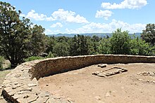
- Chimney Rock National Monument[c] near Pagosa Springs
- Colorado National Monument near Grand Junction and Fruita
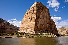
- Dinosaur National Monument[d] near Dinosaur
- Florissant Fossil Beds National Monument near Florissant
- Hovenweep National Monument[e] near Cortez
- Yucca House National Monument near Cortez
Two former National Monuments were reclassified due to their remoteness:
- Holy Cross Wilderness[c] near Minturn
- Wheeler Geologic Area[c] near Creede
National Historic Sites[]

The two National Historic Sites within Colorado are:
- Bent's Old Fort National Historic Site near La Junta
- Sand Creek Massacre National Historic Site near Chivington
proposed:
- Camp Amache near Granada
National Recreation Areas[]

The two National Recreation Areas within Colorado are::
- Arapaho National Recreation Area[c] near Granby
- Curecanti National Recreation Area near Gunnison
National Historic Trails[]

The four National Historic Trails that pass through Colorado are:
- California National Historic Trail[f] through Sedgwick County
- Old Spanish National Historic Trail[g] through southwestern Colorado
- Pony Express National Historic Trail[h] through Sedgwick County
- Santa Fe National Historic Trail[i] through southeastern Colorado
National Scenic Trail[]

The National Scenic Trail that passes through Colorado is:
- Continental Divide National Scenic Trail[j] along the Continental Divide of the Americas
National Wildernesses[]

The National Park Service also manages five of the 44 National Wildernesses within Colorado.
- Black Canyon of the Gunnison Wilderness
- Great Sand Dunes Wilderness
- Indian Peaks Wilderness[k]
- Mesa Verde Wilderness
- Rocky Mountain National Park Wilderness
See also[]
- Colorado
- Bibliography of Colorado
- Index of Colorado-related articles
- Outline of Colorado
- Colorado statistical areas
- Geography of Colorado
- History of Colorado
- List of counties in Colorado
- List of places in Colorado
- List of protected areas of Colorado
Notes[]
- ^ Jointly managed by the United States Department of the Interior, Bureau of Land Management and the United States Department of Agriculture, National Forest Service.
- ^ Managed by the United States Department of the Interior, Bureau of Land Management.
- ^ Jump up to: a b c d Managed by the United States Department of Agriculture, National Forest Service.
- ^ Dinosaur National Monument extends into the State of Utah.
- ^ Hovenweep National Monument extends into the State of Utah.
- ^ The California National Historic Trail traverses ten U.S. states: Missouri, Kansas, Nebraska, Colorado, Wyoming, Idaho, Utah, Nevada, Oregon, and California.
- ^ The Old Spanish National Historic Trail traverses six U.S. states: New Mexico, Colorado, Utah, Arizona, Nevada, and California.
- ^ The Pony Express National Historic Trail traverses eight U.S. states: Missouri, Kansas, Nebraska, Colorado, Wyoming, Utah, Nevada, and California.
- ^ The Santa Fe National Historic Trail traverses five U.S. states: Missouri, Kansas, Colorado, Oklahoma, and New Mexico.
- ^ The Continental Divide National Scenic Trail traverses five U.S. states: Montana, Idaho, Wyoming, Colorado, and New Mexico.
- ^ Jointly managed by the United States Department of the Interior, National Park Service and the United States Department of Agriculture, National Forest Service.
External links[]
 Definitions from Wiktionary
 Media from Wikimedia Commons
 News from Wikinews
 Quotations from Wikiquote
 Texts from Wikisource
 Textbooks from Wikibooks
 Resources from Wikiversity

Coordinates: 38°59′50″N 105°32′52″W / 38.9972°N 105.5478°W

- National parks in Colorado
- Colorado geography-related lists
- Colorado history-related lists
- Protected areas of Colorado
- Tourism in Colorado
- Tourist attractions in Colorado
- Lists of national parks in the United States