Hinsdale County, Colorado
Hinsdale County | |
|---|---|
U.S. county | |
 The 1877 Hinsdale County Court House in Lake City, Colorado. | |
 Location within the U.S. state of Colorado | |
 Colorado's location within the U.S. | |
| Coordinates: 37°49′N 107°17′W / 37.82°N 107.28°W | |
| Country | |
| State | |
| Founded | February 10, 1874 |
| Named for | George A. Hinsdale |
| Seat | Lake City |
| Largest town | Lake City |
| Area | |
| • Total | 1,123 sq mi (2,910 km2) |
| • Land | 1,117 sq mi (2,890 km2) |
| • Water | 5.9 sq mi (15 km2) 0.5%% |
| Population | |
| • Estimate (2020) | 788 |
| • Density | 0.7/sq mi (0.3/km2) |
| Time zone | UTC−7 (Mountain) |
| • Summer (DST) | UTC−6 (MDT) |
| Congressional district | 3rd |
| Website | www |


Hinsdale County is one of the 64 counties of the U.S. state of Colorado. As of the 2020 census, the population was 788,[1] making it the second-least populous county in Colorado. With a population density of only 0.71 inhabitants per square mile (0.27/km2), it is also the least-densely populated county in Colorado. The county seat and only incorporated municipality in the county is Lake City.[2] The county is named for George A. Hinsdale,[3] a prominent pioneer and former Lieut. Governor of Colorado Territory.
Geography[]
According to the U.S. Census Bureau, the county has a total area of 1,123 square miles (2,910 km2), of which 1,117 square miles (2,890 km2) is land and 5.9 square miles (15 km2) (0.5%) is water.[4]
Hinsdale County is one of the most remote counties in Colorado and the United States. The county is covered by mountains, including multiple fourteeners, and contains one of the most roadless areas in the country.[5] The continental divide crosses the county twice. Most of the county is divided among several different national forests and the Weminuche Wilderness area.
Adjacent counties[]
- Gunnison – north
- Saguache – northeast
- Mineral – east
- Archuleta – southeast
- La Plata – southwest
- San Juan – west
- Ouray – northwest
Major Highways[]
Demographics[]
| Historical population | |||
|---|---|---|---|
| Census | Pop. | %± | |
| 1880 | 1,487 | — | |
| 1890 | 862 | −42.0% | |
| 1900 | 1,609 | 86.7% | |
| 1910 | 646 | −59.9% | |
| 1920 | 538 | −16.7% | |
| 1930 | 449 | −16.5% | |
| 1940 | 349 | −22.3% | |
| 1950 | 263 | −24.6% | |
| 1960 | 208 | −20.9% | |
| 1970 | 202 | −2.9% | |
| 1980 | 408 | 102.0% | |
| 1990 | 467 | 14.5% | |
| 2000 | 790 | 69.2% | |
| 2010 | 843 | 6.7% | |
| 2020 | 788 | −6.5% | |
| U.S. Decennial Census[6] 1790-1960[7] 1900-1990[8] 1990-2000[9] 2010-2020[1] | |||
As of the census of 2000, there were 790 people, 359 households, and 246 families living in the county. The population density was 0.7 people per square mile (0.3/km2). There were 1,304 housing units at an average density of 1.2 per square mile (0.5/km2). The racial makeup of the county was 97.34% White, 1.52% Native American, 0.25% Asian, 0.38% from other races, and 0.51% from two or more races. 1.52% of the population were Hispanic or Latino of any race.
There were 359 households, out of which 23.4% had children under the age of 18 living with them, 61.0% were married couples living together, 4.7% had a female householder with no husband present, and 31.20% were non-families. 24.8% of all households were made up of individuals, and 3.1% had someone living alone who was 65 years of age or older. The average household size was 2.2 and the average family size was 2.6.
In the county, the population was spread out, with 19.5% under the age of 18, 4.7% from 18 to 24, 29.5% from 25 to 44, 34.7% from 45 to 64, and 11.6% who were 65 years of age or older. The median age was 44 years. For every 100 females there were 105.7 males. For every 100 females age 18 and over, there were 109.9 males.
The median income for a household in the county was $37,279, and the median income for a family was $42,159. Males had a median income of $26,210 versus $23,750 for females. The per capita income for the county was $22,360. About 4.5% of families and 7.2% of the population were below the poverty line, including none of those under age 18 and 2.2% of those age 65 or over.
Politics[]
Republican presidential nominees have carried Hinsdale County since Franklin Delano Roosevelt defeated Alf Landon by eight votes in 1936. Along with Elbert County and Washington County it was one of three Colorado counties to vote for Barry Goldwater over Lyndon Johnson in 1964. In 2020, Joe Biden received the highest vote share for a Democrat since Johnson, and became the third Democrat since 1940 to breach 40% of the vote.
The last Democrat to carry Hinsdale County in a statewide election was John Hickenlooper in the 2010 gubernatorial contest,[11] and the only other case since at least 1980 have been Democratic senator Ben “Nighthorse” Campbell, who was later to shift to the Republican Party, in 1992, alongside popular Governor Roy Romer, who carried all but three counties statewide, in 1990.[12]
2020 County Wide Election Results [13][]
| Candidates | Votes | Percentages |
|---|---|---|
| Henry E. Woods (D) | 129 | 21.15% |
| Gregory Levine (I) | 481 | 78.85% |
| Total | 610 | 100.00% |
| Candidates | Votes | Percentages |
|---|---|---|
| Robert R. Hurd (R) | 503 | 83.69% |
| Norman Ragle (I) | 98 | 16.31% |
| Total | 601 | 100.00% |
| Candidates | Votes | Percentages |
|---|---|---|
| Christopher Kambish (R) | 460 | 80.70% |
| Gabe McNeese (Write In) | 110 | 19.30% |
| Total | 570 | 100.00% |
Recreation[]
National forests[]
- Gunnison National Forest
- Rio Grande National Forest
- San Juan National Forest
- Uncompahgre National Forest
National wilderness areas[]
- La Garita Wilderness
- Powderhorn Wilderness
- Uncompahgre Wilderness
- Weminuche Wilderness
Trails[]
- Colorado Trail
- Continental Divide National Scenic Trail
Scenic byways[]
- Alpine Loop National Scenic Back Country Byway
Communities[]
Town[]
Census-designated places[]
Ghost towns[]
- Beartown
- Burrows Park
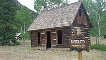
- Capitol City
- Carson
- Henson
- Old Carson
See also[]
- Outline of Colorado
- Index of Colorado-related articles
- Colorado census statistical areas
- National Register of Historic Places listings in Hinsdale County, Colorado
References[]
- ^ Jump up to: a b "State & County QuickFacts". United States Census Bureau. Retrieved September 5, 2021.
- ^ "Find a County". National Association of Counties. Archived from the original on May 31, 2011. Retrieved June 7, 2011.
- ^ Gannett, Henry (1905). The Origin of Certain Place Names in the United States. Govt. Print. Off. pp. 157.
- ^ "US Gazetteer files: 2010, 2000, and 1990". United States Census Bureau. February 12, 2011. Retrieved April 23, 2011.
- ^ Tracy Staedter (May 3, 2007). "Roadless Space Uneven Across U.S." Discovery News. Archived from the original on May 6, 2007.
- ^ "U.S. Decennial Census". United States Census Bureau. Archived from the original on April 26, 2015. Retrieved June 8, 2014.
- ^ "Historical Census Browser". University of Virginia Library. Retrieved June 8, 2014.
- ^ "Population of Counties by Decennial Census: 1900 to 1990". United States Census Bureau. Retrieved June 8, 2014.
- ^ "Census 2000 PHC-T-4. Ranking Tables for Counties: 1990 and 2000" (PDF). United States Census Bureau. Retrieved June 8, 2014.
- ^ Leip, David. "Dave Leip's Atlas of U.S. Presidential Elections". uselectionatlas.org. Retrieved May 26, 2017.
- ^ Dave Leip’s U.S. Election Atlas; 2010 Gubernatorial General Election Results – Colorado
- ^ Dave Leip’s U.S. Election Atlas; 1990 Gubernatorial General Election Results – Colorado
- ^ "Election Night Reporting". results.enr.clarityelections.com. Retrieved August 19, 2021.
- ^ "Ghost Towns of Colorado- Hinsdale County". Ghost Towns. Retrieved June 21, 2020.
External links[]
| Wikimedia Commons has media related to Hinsdale County, Colorado. |
- Hinsdale County Government website
- Official Tourism website for Lake City Hinsdale County Marketing Committee and Chamber of Commerce
- Hinsdale County and Lake City Museum[permanent dead link]
- Lake City Downtown Improvement and Revitalization Team (Official Main Street Program)
- Lake City Area Medical Center[permanent dead link]
- Colorado County Evolution by Don Stanwyck
- Colorado Historical Society
| show Places adjacent to Hinsdale County, Colorado |
|---|
| show Municipalities and communities of Hinsdale County, Colorado, United States |
|---|


Coordinates: 37°49′12″N 107°16′48″W / 37.82000°N 107.28000°W
| show Authority control |
|---|
- Colorado counties
- Hinsdale County, Colorado
- 1874 establishments in Colorado Territory
- Populated places established in 1874