Cycling in Halifax, Nova Scotia

Cycling infrastructure in the Canadian city of Halifax, Nova Scotia includes most regular streets and roads, bike lanes, protected cycle tracks, local street bikeways, and multi-use pathways.
In recent years, the municipal government has been developing an "all ages and abilities bikeway network" (commonly called the "AAA network") in the urban core with the aim of increasing the proportion of trips that are made by bicycle.
Development[]

History[]
Early bike lanes in Halifax includes those on Bell Road, Brunswick Street, and South Park Street. The 1999 addition of a third lane to the Angus L. Macdonald Bridge also included the construction of a dedicated bikeway crossing Halifax Harbour.[1]
The city's first bicycle plan, Blueprint for a Bicycle Friendly HRM, was approved by council in 2002. It was superseded in 2006 by the Active Transportation Plan, which was updated in 2014 (see below).[2]
"AAA" bikeway network[]
In 2014, the Halifax council approved the Making Connections: 2014-19 Halifax Active Transportation Priorities Plan. The plan was developed with extensive public participation. Among respondents, the most popular concept mentioned was the construction of a bicycle network in the regional centre (defined as the Halifax peninsula and the area of Dartmouth within the Circumferential Highway). The plan identified several goals including developing a connected bicycle network, doubling the modal share of bicycles by 2026, and improving bicycle infrastructure by introducing new types of facilities such as protected bike lanes.[2]
A 2016 survey found significant interest among Halifax residents in cycling more often, but respondents wished for greater separation from motor traffic. The city aims to capture this "latent demand" by improving cycling infrastructure and increasing the share of trips made by bicycle.[3]
Overall transportation improvements in Halifax are guided by the Integrated Mobility Plan (IMP), which was approved by council in December 2017. As part of the IMP, the city is currently building an "all ages and abilities bikeway network" in the regional centre, commonly called the "AAA network".[3] "All ages and ability" bicycle infrastructure is defined as facilities that are "comfortable for a wide range of cycling abilities and experience levels". Guidance on the design of this type of infrastructure is provided by organisations such as the National Association of City Transportation Officials (NACTO) and the (TAC).[3]
The AAA network comprises around 57 kilometres (35 mi) of routes intended to form a comprehensive cycling network in the regional centre.[4] About 10 kilometres (6.2 mi) of the routes already met "AAA" standard, such as the Macdonald Bridge bikeway.[3] In addition to new cycling infrastructure, the project will include the upgrading of some existing routes. For example, conventional bike lanes on Hollis, Lower Water, and South Park streets are being upgraded to protected bikeways.
In July 2019, the project received $25 million in funding from all three levels of government. It is expected to be completed by 2022.[5]
Types of cycling routes in Halifax[]
Bike lanes[]
Bike lanes are painted lanes designated for use by cyclists. In Halifax, these typically do not offer physical protection to cyclists. They are not considered "all ages and abilities" bicycle infrastructure.
Cyclist advocates have criticized the fact that conventional Halifax bike lanes tend to end before reaching intersections.[6]
Protected bikeways[]

The first protected bike lane in Halifax opened as a pilot project on Rainnie Drive in 2015, as part of the redesign of the intersection at North Park Street and Cogswell Street. At that time, most of Rainnie Drive was converted to serve one-way car traffic only. The two-way bikeway is separated from the carriageway by a painted buffer and plastic bollards.[7]
Some existing bike lanes are being upgraded to become protected bikeways. The bike lanes on South Park Street between Inglis Street and Spring Garden Road were upgraded in 2019, with plans made to extend the bikeways to Sackville Street in 2020.[6] In 2020, the bike lanes on Hollis Street and Lower Water Street were similarly being upgraded.

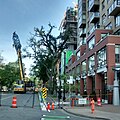
Hollis Street

Lower Water Street

Lower Water Street
South Park Street


Local street bikeways[]
Local street bikeways were introduced as part of the AAA bikeway network. These are quieter, local streets considered strategic links in the cycling network. In designating a local street bikeway, various design and regulatory changes are made to improve safety and comfort for cyclists. These include:[8]
- Pavement markings
- Wayfinding signage for cyclists
- Traffic calming treatments to reduce motor vehicle speed
- Measures to reduce motor vehicle traffic
- Treatments to facilitate the crossing of major intersections by cyclists
- Additional streetscape improvements and amenities
The region's first local street bikeway was constructed on Vernon and Seymour streets, connecting the Quinpool District to Dalhousie University, and linking planned segregated cycling facilities on Windsor Street and University Avenue. Various streetscape changes are being made, including the addition of traffic calming measures, curb extensions at intersections, and a bicycle lane at the Quinpool Road junction. New pedestrian/bicyclist-actuated traffic signals will be installed at the Vernon-Seymour-Coburg junction.[9] The first phase of this bikeway opened in 2019.[10]
Multi-use pathways[]

Multi-use pathways are routes shared by cyclists and pedestrians, separated from car traffic.

Halifax Urban Greenway

Children cycling to school on the Portland Hills Greenway

Barrington Greenway

A new "crossride" (a combined pedestrian-cycle crossing) links the Macdonald Bridge to the Barrington Greenway


Organisations[]
Halifax has several non-profit organisations which promote cycling in the city, including the Halifax Cycling Coalition, Bike Again (a DIY bike shop), and the Ecology Action Centre.[11][12]
References[]
- ^ "Implementation of the Macdonald Bridge Bikeway Connectors Project" (PDF). Halifax Regional Council. 17 May 2017. p. 2.
- ^ a b "Making Connections: 2014-19 Halifax Active Transportation Priorities Plan" (PDF). Halifax Regional Municipality. 2014.
- ^ a b c d "Integrated Mobility Plan Implementation of Regional Centre "AAA" Bikeway Network" (PDF). Halifax Regional Muncipality. 27 September 2018.
- ^ "Building an All Ages and Abilities Bikeway Network in the Regional Centre". Halifax Regional Municipality. Retrieved 27 June 2021.
- ^ Rutgers, Julia-Simone (29 July 2019). "Halifax bikeway network kicks into high gear with government funding". The Star Halifax.
- ^ a b Draus, Alicia (19 August 2019). "South Park Street protected bike lane nears completion". Global News.
- ^ "Halifax's First Protected Bike Lane Now Open on Rainnie Drive". Halifax Regional Municipality. 24 November 2015.
- ^ "Implementation of North End 'AAA' Bikeway Phase One and West End 'AAA' Bikeway (NEWEB)" (PDF). Halifax Regional Municipality. 28 July 2020. p. 3.
- ^ "Vernon-Seymour Local Street Bikeway". Halifax Regional Municipality. Retrieved 17 March 2020.
- ^ Quon, Alexander (14 June 2019). "Halifax unveils first 'local street bikeway' at Vernon Street and Jubilee Road". Global News.
- ^ "About Us". Halifax Cycling Coalition. Retrieved 1 July 2021.
- ^ Greene, Sarah (19 June 2008). "Bike tune-ups across Halifax". The Coast.
External links[]
- Cycling & walking – Halifax municipal government website
- Cycling by city
- Cycling in Canada
- Transport in Halifax, Nova Scotia