Czarnocin, Pomeranian Voivodeship
Czarnocin | |
|---|---|
Village | |
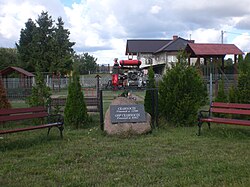 Memorial stone in Czarnocin | |
 Czarnocin | |
| Coordinates: 54°2′8″N 18°25′14″E / 54.03556°N 18.42056°E | |
| Country | |
| Voivodeship | Pomeranian |
| County | Starogard |
| Gmina | Skarszewy |
| Population | 265 |
| Time zone | UTC+1 (CET) |
| • Summer (DST) | UTC+2 (CEST) |


Czarnocin [t͡ʂarˈnɔt͡ɕin] (German: Schwarzhof, before 1874: Czarnotschin) is a village in the administrative district of Gmina Skarszewy, within Starogard County, Pomeranian Voivodeship, in northern Poland.[1] It lies approximately 4 kilometres (2 mi) south-west of Skarszewy, 11 km (7 mi) north-west of Starogard Gdański, and 40 km (25 mi) south of the regional capital Gdańsk. It is located within the ethnocultural region of Kociewie in the historic region of Pomerania.
For details of the history of the region, see History of Pomerania.
The village has a population of 265.
Czarnocin was a royal village of the Polish Crown, administratively located in the Tczew County in the Pomeranian Voivodeship.[2] It was annexed by Prussia in the First Partition of Poland in 1772, and restored to Poland, after Poland regained independence in 1918.
References[]
- ^ "Central Statistical Office (GUS) - TERYT (National Register of Territorial Land Apportionment Journal)" (in Polish). 2008-06-01.
- ^ Marian Biskup, Andrzej Tomczak, Mapy województwa pomorskiego w drugiej połowie XVI w., Toruń, 1955, p. 110-111 (in Polish)

Coordinates: 54°2′8″N 18°25′14″E / 54.03556°N 18.42056°E
This Starogard County location article is a stub. You can help Wikipedia by . |
- Villages in Starogard County
- Starogard County geography stubs