Junkrowy
Junkrowy | |
|---|---|
Village | |
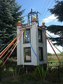 Wayside shrine in Junkrowy | |
 Junkrowy | |
| Coordinates: 54°4′25″N 18°21′43″E / 54.07361°N 18.36194°ECoordinates: 54°4′25″N 18°21′43″E / 54.07361°N 18.36194°E | |
| Country | |
| Voivodeship | Pomeranian |
| County | Starogard |
| Gmina | Skarszewy |
| Population | 135 |
| Time zone | UTC+1 (CET) |
| • Summer (DST) | UTC+2 (CEST) |
| Vehicle registration | GST |


Junkrowy [junˈkrɔvɨ] (German: Jungfernberg) is a village in the administrative district of Gmina Skarszewy, within Starogard County, Pomeranian Voivodeship, in northern Poland.[1] It lies approximately 6 kilometres (4 mi) west of Skarszewy, 17 km (11 mi) north-west of Starogard Gdański, and 38 km (24 mi) south-west of the regional capital Gdańsk. It is located within the ethnocultural region of Kociewie in the historic region of Pomerania.
The village has a population of 135.
History[]
Junkrowy dates back to the medieval Poland. In the 13th century, it was granted to the Cistercian monastery in Pelplin by Duke Sambor II. Within the Polish Crown, Junkrowy was a private church village of the Pelplin Abbey, administratively located in the Tczew County in the Pomeranian Voivodeship.[2]
During the German occupation of Poland (World War II), in 1942, the occupiers carried out expulsions of Poles, whose farms were handed over to German colonists in accordance with the Lebensraum policy.[3]
References[]
- ^ "Central Statistical Office (GUS) - TERYT (National Register of Territorial Land Apportionment Journal)" (in Polish). 2008-06-01.
- ^ Biskup, Marian; Tomczak, Andrzej (1955). Mapy województwa pomorskiego w drugiej połowie XVI w. (in Polish). Toruń. p. 120.
- ^ Wardzyńska, Maria (2017). Wysiedlenia ludności polskiej z okupowanych ziem polskich włączonych do III Rzeszy w latach 1939-1945 (in Polish). Warszawa: IPN. p. 117. ISBN 978-83-8098-174-4.

This Starogard County location article is a stub. You can help Wikipedia by . |
- Villages in Starogard County
- Starogard County geography stubs